
Jednodniowa wycieczka rowerowa z Riez do Castellane
Dostosuj własną trasę na podstawie naszego szablonu lub zobacz, jak nasza społeczność najchętniej jeździ z Riez do Castellane.
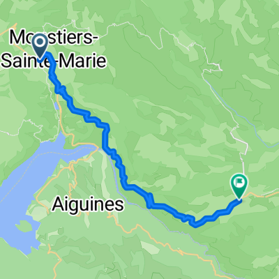
Szablon trasy
Z Riez do Castellane

- 5 h 7 min
- Czas
- 62,4 km
- Dystans
- 2609 m
- Przewyższenia
- 2291 m
- Spadek
- 12,2 km/h
- Śr. Prędkość
- 1241 m
- Maks. wysokość
Set off from the charming Provençal town of Riez, known for its ancient Roman columns and lavender fields, for a truly epic ride through the Alpes-de-Haute-Provence. This route to Castellane covers just over 62 km, winding through a mix of quiet country roads and rustic tracks, with a hefty total ascent of about 2,600 meters—perfect for those who love a good climb!
You'll pedal along a landscape that transitions from rolling lavender plains into the rugged foothills of the Verdon Regional Natural Park. The surfaces are a patchwork—expect plenty of pavement, but also long stretches of gravel and unpaved tracks, so a sturdy bike and some adventurous spirit are a must. Prepare for fantastic views as you reach elevations up to 1,241 meters, and keep an eye out for sweeping vistas over the Verdon Gorge area.
Your ride ends in Castellane, a historic village perched by the dramatic cliffs of the Verdon River, famous for its medieval charm and as a base for exploring the stunning Gorges du Verdon. Grab a well-earned coffee in the square and soak up the Alpine vibes—you’ve earned it!
Wspólnota
Najlepsi użytkownicy w tym regionie


Od naszej społeczności
Najlepsze trasy rowerowe z Riez do Castellane

5. Tag Moustiers - Trigance
Trasa rowerowa w Riez, Prowansja-Alpy-Lazurowe Wybrzeże, Francja
- 54,6 km
- Dystans
- 1482 m
- Przewyższenia
- 1347 m
- Spadek

Riez_Rougon
Trasa rowerowa w Riez, Prowansja-Alpy-Lazurowe Wybrzeże, Francja
- 45,8 km
- Dystans
- 1044 m
- Przewyższenia
- 940 m
- Spadek

Moustiers-Ste-Marie to Balcons de la Mescla
Trasa rowerowa w Riez, Prowansja-Alpy-Lazurowe Wybrzeże, Francja
- 38,7 km
- Dystans
- 1063 m
- Przewyższenia
- 839 m
- Spadek

20141015_110611.gpx
Trasa rowerowa w Riez, Prowansja-Alpy-Lazurowe Wybrzeże, Francja
- 45,5 km
- Dystans
- 1209 m
- Przewyższenia
- 919 m
- Spadek

Tacx- Col de la Madone
Trasa rowerowa w Riez, Prowansja-Alpy-Lazurowe Wybrzeże, Francja
- 19,9 km
- Dystans
- 742 m
- Przewyższenia
- 385 m
- Spadek

Gorges du Verdun
Trasa rowerowa w Riez, Prowansja-Alpy-Lazurowe Wybrzeże, Francja
- 20,3 km
- Dystans
- 685 m
- Przewyższenia
- 303 m
- Spadek

Verdon Grand canyon
Trasa rowerowa w Riez, Prowansja-Alpy-Lazurowe Wybrzeże, Francja
- 42,1 km
- Dystans
- 1551 m
- Przewyższenia
- 1216 m
- Spadek

Provence 2004 4. Tag
Trasa rowerowa w Riez, Prowansja-Alpy-Lazurowe Wybrzeże, Francja
- 43,8 km
- Dystans
- 1006 m
- Przewyższenia
- 855 m
- Spadek

gorge du verdon
Trasa rowerowa w Riez, Prowansja-Alpy-Lazurowe Wybrzeże, Francja
- 65,8 km
- Dystans
- 1825 m
- Przewyższenia
- 1389 m
- Spadek

Sainte Croix / Castellane par le Sud du Verdon
Trasa rowerowa w Riez, Prowansja-Alpy-Lazurowe Wybrzeże, Francja
- 58,2 km
- Dystans
- 1715 m
- Przewyższenia
- 1485 m
- Spadek

france 2009-10 lac de ste croix-castellane
Trasa rowerowa w Riez, Prowansja-Alpy-Lazurowe Wybrzeże, Francja
- 53,8 km
- Dystans
- 1145 m
- Przewyższenia
- 905 m
- Spadek

20141017_101124.gpx
Trasa rowerowa w Riez, Prowansja-Alpy-Lazurowe Wybrzeże, Francja
- 30,6 km
- Dystans
- 1011 m
- Przewyższenia
- 651 m
- Spadek
Odkryj więcej tras
 Tacx- Col de la Madone
- Dystans
- 19,9 km
- Przewyższenia
- 742 m
- Spadek
- 385 m
- Lokalizacja
- Riez, Prowansja-Alpy-Lazurowe Wybrzeże, Francja
 Gorges du Verdun
- Dystans
- 20,3 km
- Przewyższenia
- 685 m
- Spadek
- 303 m
- Lokalizacja
- Riez, Prowansja-Alpy-Lazurowe Wybrzeże, Francja
 Verdon Grand canyon
- Dystans
- 42,1 km
- Przewyższenia
- 1551 m
- Spadek
- 1216 m
- Lokalizacja
- Riez, Prowansja-Alpy-Lazurowe Wybrzeże, Francja
 Provence 2004 4. Tag
- Dystans
- 43,8 km
- Przewyższenia
- 1006 m
- Spadek
- 855 m
- Lokalizacja
- Riez, Prowansja-Alpy-Lazurowe Wybrzeże, Francja
 gorge du verdon
- Dystans
- 65,8 km
- Przewyższenia
- 1825 m
- Spadek
- 1389 m
- Lokalizacja
- Riez, Prowansja-Alpy-Lazurowe Wybrzeże, Francja
 Sainte Croix / Castellane par le Sud du Verdon
- Dystans
- 58,2 km
- Przewyższenia
- 1715 m
- Spadek
- 1485 m
- Lokalizacja
- Riez, Prowansja-Alpy-Lazurowe Wybrzeże, Francja
 france 2009-10 lac de ste croix-castellane
- Dystans
- 53,8 km
- Przewyższenia
- 1145 m
- Spadek
- 905 m
- Lokalizacja
- Riez, Prowansja-Alpy-Lazurowe Wybrzeże, Francja
 20141017_101124.gpx
- Dystans
- 30,6 km
- Przewyższenia
- 1011 m
- Spadek
- 651 m
- Lokalizacja
- Riez, Prowansja-Alpy-Lazurowe Wybrzeże, Francja
Trasy do Castellane
Jednodniowa wycieczka rowerowa od
Z Barcelonnette do Castellane