
Jednodniowa wycieczka rowerowa z Campan do Saint-Lary-Soulan
Dostosuj własną trasę na podstawie naszego szablonu lub zobacz, jak nasza społeczność najchętniej jeździ z Campan do Saint-Lary-Soulan.
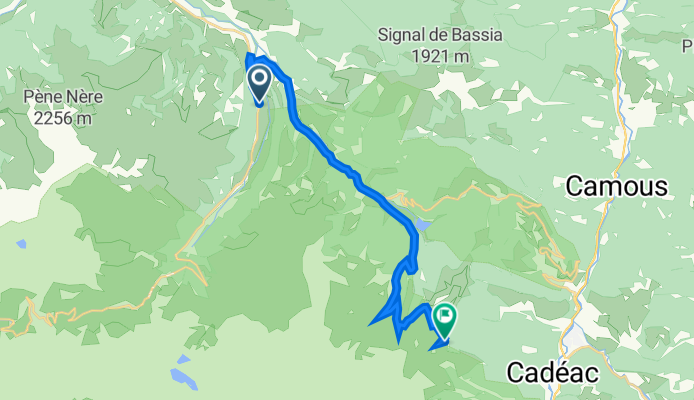
Szablon trasy
Z Campan do Saint-Lary-Soulan

- 4 h 33 min
- Czas
- 49,1 km
- Dystans
- 2073 m
- Przewyższenia
- 1917 m
- Spadek
- 10,8 km/h
- Śr. Prędkość
- 1602 m
- Maks. wysokość
Ready for a true Pyrenean adventure? This route takes you from the charming village of Campan, nestled at the foot of the mountains and famous for its quirky “Mounaques” (life-sized dolls that adorn the town in summer), to the lively alpine hub of Saint-Lary-Soulan—a favorite for both cyclists and skiers.
The journey is just under 50 km, but don’t be fooled by the distance: you’ll be climbing over 2,000 meters, with some exhilarating descents as well. Expect a real mix under your wheels—most riding is on quiet, scenic roads, but you’ll hit stretches of gravel and unpaved tracks, adding a bit of adventure to the ride.
You’ll likely pass through some iconic cols and breath-taking landscapes, with maximum elevation hitting around 1,600 meters. At the end, Saint-Lary-Soulan welcomes you with its lively village vibe and plenty of places to grab a well-earned drink. A classic mountain ride—tough, unforgettable, and perfect for anyone who loves epic climbs and gorgeous views!
Wspólnota
Najlepsi użytkownicy w tym regionie


Od naszej społeczności
Najlepsze trasy rowerowe z Campan do Saint-Lary-Soulan

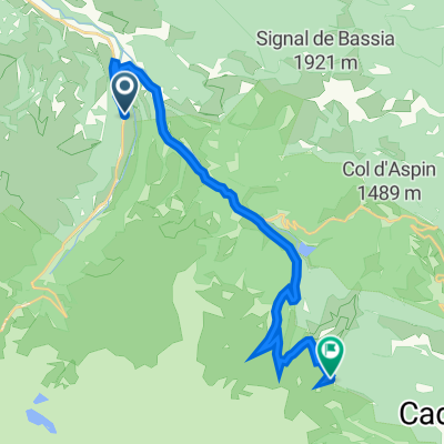
Col du Tourmalet and both sided of Col d'Aspin
Trasa rowerowa w Campan, Occitanie, Francja
- 65,4 km
- Dystans
- 2114 m
- Przewyższenia
- 2072 m
- Spadek

TDP - ETAPE 7
Trasa rowerowa w Campan, Occitanie, Francja
- 52,9 km
- Dystans
- 1917 m
- Przewyższenia
- 1612 m
- Spadek

De Route des Cols 127, Beaudean a D918 71, Aspin-Aure
Trasa rowerowa w Campan, Occitanie, Francja
- 20,5 km
- Dystans
- 1196 m
- Przewyższenia
- 324 m
- Spadek

Route reposante
Trasa rowerowa w Campan, Occitanie, Francja
- 18,7 km
- Dystans
- 734 m
- Przewyższenia
- 91 m
- Spadek

HOURQUETTE d´ANCIZAN, por Payolle
Trasa rowerowa w Campan, Occitanie, Francja
- 10,1 km
- Dystans
- 571 m
- Przewyższenia
- 88 m
- Spadek

TourmaletHAncizan
Trasa rowerowa w Campan, Occitanie, Francja
- 50,7 km
- Dystans
- 880 m
- Przewyższenia
- 2111 m
- Spadek

Day 3 - Ride 3 - Short option - Tour de France Stage 17
Trasa rowerowa w Campan, Occitanie, Francja
- 51,6 km
- Dystans
- 1524 m
- Przewyższenia
- 1618 m
- Spadek

Estersan-Tourmalet
Trasa rowerowa w Campan, Occitanie, Francja
- 79,9 km
- Dystans
- 1267 m
- Przewyższenia
- 2430 m
- Spadek

campan hourquette - aspin
Trasa rowerowa w Campan, Occitanie, Francja
- 39 km
- Dystans
- 1401 m
- Przewyższenia
- 569 m
- Spadek

Hourquette d'Arcizan par sainte-marie de campan
Trasa rowerowa w Campan, Occitanie, Francja
- 10 km
- Dystans
- 572 m
- Przewyższenia
- 101 m
- Spadek

Saint Lary Sulhan to Col de Couradabat
Trasa rowerowa w Campan, Occitanie, Francja
- 43,6 km
- Dystans
- 609 m
- Przewyższenia
- 731 m
- Spadek
Odkryj więcej tras
 Route reposante
- Dystans
- 18,7 km
- Przewyższenia
- 734 m
- Spadek
- 91 m
- Lokalizacja
- Campan, Occitanie, Francja
 HOURQUETTE d´ANCIZAN, por Payolle
- Dystans
- 10,1 km
- Przewyższenia
- 571 m
- Spadek
- 88 m
- Lokalizacja
- Campan, Occitanie, Francja
 TourmaletHAncizan
- Dystans
- 50,7 km
- Przewyższenia
- 880 m
- Spadek
- 2111 m
- Lokalizacja
- Campan, Occitanie, Francja
 Day 3 - Ride 3 - Short option - Tour de France Stage 17
- Dystans
- 51,6 km
- Przewyższenia
- 1524 m
- Spadek
- 1618 m
- Lokalizacja
- Campan, Occitanie, Francja
 Estersan-Tourmalet
- Dystans
- 79,9 km
- Przewyższenia
- 1267 m
- Spadek
- 2430 m
- Lokalizacja
- Campan, Occitanie, Francja
 campan hourquette - aspin
- Dystans
- 39 km
- Przewyższenia
- 1401 m
- Spadek
- 569 m
- Lokalizacja
- Campan, Occitanie, Francja
 Hourquette d'Arcizan par sainte-marie de campan
- Dystans
- 10 km
- Przewyższenia
- 572 m
- Spadek
- 101 m
- Lokalizacja
- Campan, Occitanie, Francja
 Saint Lary Sulhan to Col de Couradabat
- Dystans
- 43,6 km
- Przewyższenia
- 609 m
- Spadek
- 731 m
- Lokalizacja
- Campan, Occitanie, Francja
Trasy do Saint-Lary-Soulan
Jednodniowa wycieczka rowerowa od
Z Argelès-Gazost do Saint-Lary-Soulan
Jednodniowa wycieczka rowerowa od
Z Bagnères-de-Luchon do Saint-Lary-Soulan