
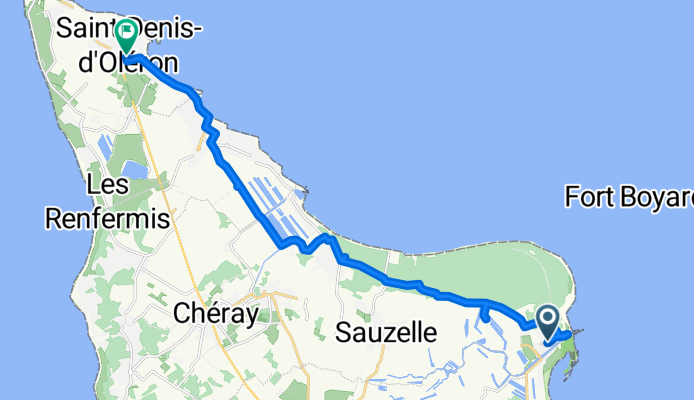
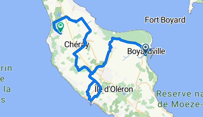
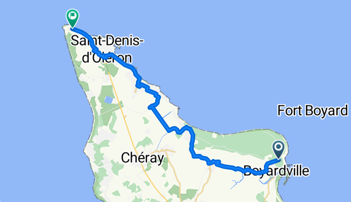
Szybka przejażdżka rowerowa z Boyard-Ville do Saint-Denis-d'Oléron
Dostosuj własną trasę na podstawie naszego szablonu lub zobacz, jak nasza społeczność najchętniej jeździ z Boyard-Ville do Saint-Denis-d'Oléron.
Szablon trasy
Z Boyard-Ville do Saint-Denis-d'Oléron
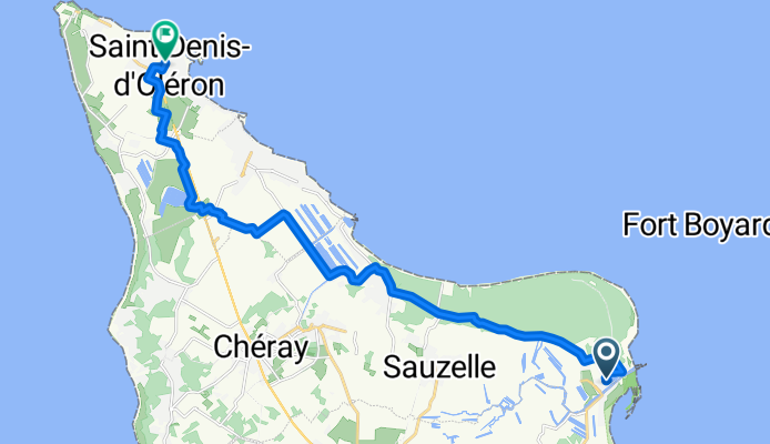
- 1 h 10 min
- Czas
- 18,5 km
- Dystans
- 17 m
- Przewyższenia
- 12 m
- Spadek
- 15,9 km/h
- Śr. Prędkość
- 12 m
- Maks. wysokość
Ready for a breezy ride? Start your cycling adventure at Boyard-Ville, a charming harbour town famous for its views toward the iconic Fort Boyard. You’ll roll out past the salty air and soon find yourself pedaling along mostly smooth cycleways and the occasional gravel path, surrounded by the relaxed vibe only Île d’Oléron can offer.
The terrain is mostly flat (max elevation just over 12 m!), making it ideal for a leisurely cruise—no big hills to worry about. Asphalt and gravel make up most surfaces, so a hybrid or gravel bike is perfect here. With most of your ride on quiet roads and car-free cycle paths, you’ll have time to soak up the landscapes—think oyster farms, wild marshes, and the Atlantic sparkling on your left.
Finish up in Saint-Denis-d'Oléron, the island’s northern hub. Here, reward yourself with some beach time or a stroll to the local lighthouse (“Phare de Chassiron”) for sweeping views. It’s a classic Oléron ride—coastal vibes, low traffic, and plenty to explore at each end!
Wspólnota
Najlepsi użytkownicy w tym regionie


Od naszej społeczności
Najlepsze trasy rowerowe z Boyard-Ville do Saint-Denis-d'Oléron
saint-pierre oleron
Trasa rowerowa w Boyard-Ville, Nouvelle-Aquitaine, Francja
- 18 km
- Dystans
- 45 m
- Przewyższenia
- 39 m
- Spadek
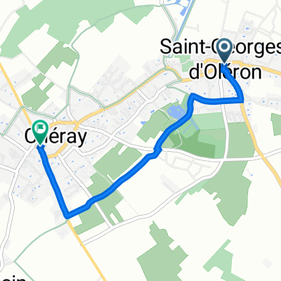
De Rue des Eglantines 11, Saint-Georges-d'Oléron à Route des Figerasses, Saint-Georges-d'Oléron
Trasa rowerowa w Boyard-Ville, Nouvelle-Aquitaine, Francja
- 7,9 km
- Dystans
- 18 m
- Przewyższenia
- 11 m
- Spadek
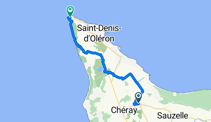
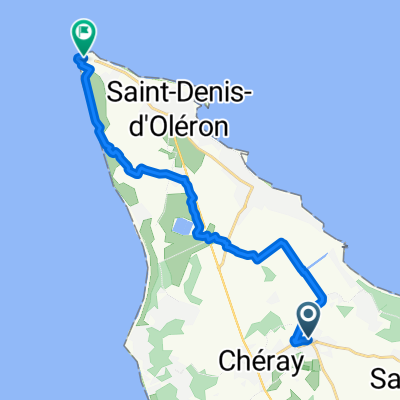
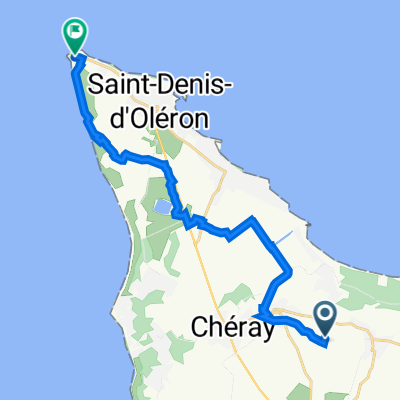
Saint-Georges-d'Oléron à 8 Rue de l'Ormeau, Saint-Denis-d'Oléron
Trasa rowerowa w Boyard-Ville, Nouvelle-Aquitaine, Francja
- 11,7 km
- Dystans
- 15 m
- Przewyższenia
- 6 m
- Spadek
De Chemin de la Prade à Les Perots de Chassiron
Trasa rowerowa w Boyard-Ville, Nouvelle-Aquitaine, Francja
- 22,1 km
- Dystans
- 118 m
- Przewyższenia
- 175 m
- Spadek
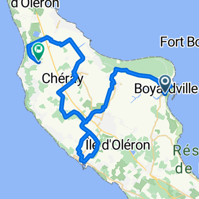
De 1 Place de Verdun, Saint-Georges-d'Oléron à La Tour de Chassiron, Saint-Denis-d'Oléron
Trasa rowerowa w Boyard-Ville, Nouvelle-Aquitaine, Francja
- 14,1 km
- Dystans
- 4 m
- Przewyższenia
- 5 m
- Spadek
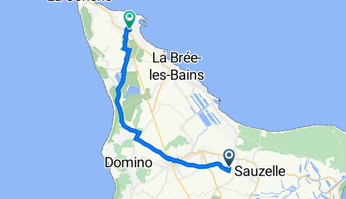
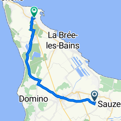
Rue du Moulin, Saint-Georges-d'Oléron à 11 Rue de la Roulette, La Brée-les-Bains
Trasa rowerowa w Boyard-Ville, Nouvelle-Aquitaine, Francja
- 9 km
- Dystans
- 4 m
- Przewyższenia
- 0 m
- Spadek
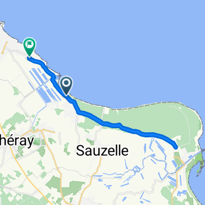
Allée du Fort Royer, Saint-Pierre-d'Oléron nach Rue du Four à Chaucre, Saint-Georges-d'Oléron
Trasa rowerowa w Boyard-Ville, Nouvelle-Aquitaine, Francja
- 37,6 km
- Dystans
- 26 m
- Przewyższenia
- 27 m
- Spadek
Saint-Georges-d'Oléron à 10 Rue de la Libération, Saint-Denis-d'Oléron
Trasa rowerowa w Boyard-Ville, Nouvelle-Aquitaine, Francja
- 12,1 km
- Dystans
- 18 m
- Przewyższenia
- 16 m
- Spadek
Avenue de la Durandière, Saint-Georges-d'Oléron à Avenue des Anciens Combattants, La Brée-les-Bains
Trasa rowerowa w Boyard-Ville, Nouvelle-Aquitaine, Francja
- 15,4 km
- Dystans
- 19 m
- Przewyższenia
- 17 m
- Spadek
De XQF6+Q7 à Saint-Denis-d'Oléron
Trasa rowerowa w Boyard-Ville, Nouvelle-Aquitaine, Francja
- 22 km
- Dystans
- 83 m
- Przewyższenia
- 74 m
- Spadek
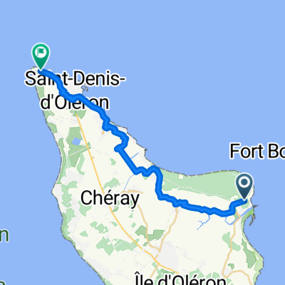
Saint-Georges-d'Oléron à Saint-Denis-d'Oléron
Trasa rowerowa w Boyard-Ville, Nouvelle-Aquitaine, Francja
- 16,1 km
- Dystans
- 20 m
- Przewyższenia
- 18 m
- Spadek
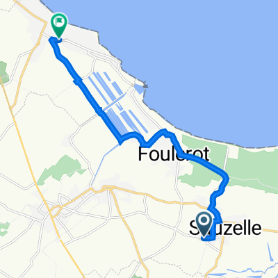
8–40 Rue de l'Église, Saint-Georges-d'Oléron à 79 Impasse Arnaud, Saint-Georges-d'Oléron
Trasa rowerowa w Boyard-Ville, Nouvelle-Aquitaine, Francja
- 2,8 km
- Dystans
- 3 m
- Przewyższenia
- 3 m
- Spadek
Odkryj więcej tras
 De 1 Place de Verdun, Saint-Georges-d'Oléron à La Tour de Chassiron, Saint-Denis-d'Oléron
- Dystans
- 14,1 km
- Przewyższenia
- 4 m
- Spadek
- 5 m
- Lokalizacja
- Boyard-Ville, Nouvelle-Aquitaine, Francja
 Rue du Moulin, Saint-Georges-d'Oléron à 11 Rue de la Roulette, La Brée-les-Bains
- Dystans
- 9 km
- Przewyższenia
- 4 m
- Spadek
- 0 m
- Lokalizacja
- Boyard-Ville, Nouvelle-Aquitaine, Francja
 Allée du Fort Royer, Saint-Pierre-d'Oléron nach Rue du Four à Chaucre, Saint-Georges-d'Oléron
- Dystans
- 37,6 km
- Przewyższenia
- 26 m
- Spadek
- 27 m
- Lokalizacja
- Boyard-Ville, Nouvelle-Aquitaine, Francja
 Saint-Georges-d'Oléron à 10 Rue de la Libération, Saint-Denis-d'Oléron
- Dystans
- 12,1 km
- Przewyższenia
- 18 m
- Spadek
- 16 m
- Lokalizacja
- Boyard-Ville, Nouvelle-Aquitaine, Francja
 Avenue de la Durandière, Saint-Georges-d'Oléron à Avenue des Anciens Combattants, La Brée-les-Bains
- Dystans
- 15,4 km
- Przewyższenia
- 19 m
- Spadek
- 17 m
- Lokalizacja
- Boyard-Ville, Nouvelle-Aquitaine, Francja
 De XQF6+Q7 à Saint-Denis-d'Oléron
- Dystans
- 22 km
- Przewyższenia
- 83 m
- Spadek
- 74 m
- Lokalizacja
- Boyard-Ville, Nouvelle-Aquitaine, Francja
 Saint-Georges-d'Oléron à Saint-Denis-d'Oléron
- Dystans
- 16,1 km
- Przewyższenia
- 20 m
- Spadek
- 18 m
- Lokalizacja
- Boyard-Ville, Nouvelle-Aquitaine, Francja
 8–40 Rue de l'Église, Saint-Georges-d'Oléron à 79 Impasse Arnaud, Saint-Georges-d'Oléron
- Dystans
- 2,8 km
- Przewyższenia
- 3 m
- Spadek
- 3 m
- Lokalizacja
- Boyard-Ville, Nouvelle-Aquitaine, Francja