
Jednodniowa wycieczka rowerowa z Bourg-Saint-Maurice do Modane
Dostosuj własną trasę na podstawie naszego szablonu lub zobacz, jak nasza społeczność najchętniej jeździ z Bourg-Saint-Maurice do Modane.
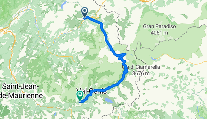
Szablon trasy
Z Bourg-Saint-Maurice do Modane

- 12 h 28 min
- Czas
- 123 km
- Dystans
- 6494 m
- Przewyższenia
- 6264 m
- Spadek
- 9,9 km/h
- Śr. Prędkość
- 2991 m
- Maks. wysokość
Get ready for a seriously epic ride from Bourg-Saint-Maurice to Modane! Your journey starts in Bourg-Saint-Maurice, a charming Alpine town known as the gateway to Les Arcs ski resort and close to the Italian border. From here, you’ll ride about 123 km through the heart of the French Alps, taking on some wild elevation—expect ascents totalling more than 6,400 meters and a max height of nearly 3,000 meters! Make sure your legs (and brakes!) are ready.
The route offers a mix of surfaces—about half might be missing info, but you’ll hit everything from smooth asphalt to loose gravel tracks and mountain paths. It’s mostly quiet roads and tracks, with a bit of cycleway sprinkled in, so you’ll get both seclusion and sweeping mountain views.
You’ll finish in Modane, a historic rail and border town perched at the entrance to the stunning Maurienne Valley—known for its dramatic scenery and as a classic Tour de France territory. This ride’s a true adventure for experienced cyclists looking for an Alpine challenge! Don’t forget to bring snacks, layers, and a hearty sense of adventure.
Wspólnota
Najlepsi użytkownicy w tym regionie


Od naszej społeczności
Najlepsze trasy rowerowe z Bourg-Saint-Maurice do Modane

RGA Tag 3
Trasa rowerowa w Bourg-Saint-Maurice, Owernia-Rodan-Alpy, Francja
- 104,8 km
- Dystans
- 2100 m
- Przewyższenia
- 1884 m
- Spadek

Francia Alpok 03 vándor
Trasa rowerowa w Bourg-Saint-Maurice, Owernia-Rodan-Alpy, Francja
- 97,4 km
- Dystans
- 2310 m
- Przewyższenia
- 1645 m
- Spadek

RDGA-03 - Bourg-Saint-Maurice - Modane
Trasa rowerowa w Bourg-Saint-Maurice, Owernia-Rodan-Alpy, Francja
- 158,6 km
- Dystans
- 4084 m
- Przewyższenia
- 3867 m
- Spadek

RdGA - Stage 3 (Var. Mont Cenis)
Trasa rowerowa w Bourg-Saint-Maurice, Owernia-Rodan-Alpy, Francja
- 120,1 km
- Dystans
- 2820 m
- Przewyższenia
- 2242 m
- Spadek

RdGA - Stage 3
Trasa rowerowa w Bourg-Saint-Maurice, Owernia-Rodan-Alpy, Francja
- 79,8 km
- Dystans
- 2056 m
- Przewyższenia
- 1475 m
- Spadek
CLemay-Alpes-Jour7-BourStMaurice-Aussois
Trasa rowerowa w Bourg-Saint-Maurice, Owernia-Rodan-Alpy, Francja
- 98 km
- Dystans
- 2366 m
- Przewyższenia
- 1682 m
- Spadek

Route des Grandes Alpes Stage 3
Trasa rowerowa w Bourg-Saint-Maurice, Owernia-Rodan-Alpy, Francja
- 79,8 km
- Dystans
- 2057 m
- Przewyższenia
- 1472 m
- Spadek

RDGA - Etape 2
Trasa rowerowa w Bourg-Saint-Maurice, Owernia-Rodan-Alpy, Francja
- 103 km
- Dystans
- 2079 m
- Przewyższenia
- 1826 m
- Spadek

Bourg-Saint-Maurice naar Lanslebourg (80km)
Trasa rowerowa w Bourg-Saint-Maurice, Owernia-Rodan-Alpy, Francja
- 80,4 km
- Dystans
- 2050 m
- Przewyższenia
- 1465 m
- Spadek

4. Bourg-St. Maurice - Val d´Isere - Col d´Iseran - Modane - Aussois (100km, 2600hm)
Trasa rowerowa w Bourg-Saint-Maurice, Owernia-Rodan-Alpy, Francja
- 97,9 km
- Dystans
- 2295 m
- Przewyższenia
- 1647 m
- Spadek

1. Etappe Route des Grand Alpes Bourg-Saint-Maurice - Lanslebourg Mont- Cenis
Trasa rowerowa w Bourg-Saint-Maurice, Owernia-Rodan-Alpy, Francja
- 81,7 km
- Dystans
- 2012 m
- Przewyższenia
- 1432 m
- Spadek

BstM-Aussois
Trasa rowerowa w Bourg-Saint-Maurice, Owernia-Rodan-Alpy, Francja
- 96,6 km
- Dystans
- 2383 m
- Przewyższenia
- 1713 m
- Spadek
Odkryj więcej tras
 RdGA - Stage 3
- Dystans
- 79,8 km
- Przewyższenia
- 2056 m
- Spadek
- 1475 m
- Lokalizacja
- Bourg-Saint-Maurice, Owernia-Rodan-Alpy, Francja
 CLemay-Alpes-Jour7-BourStMaurice-Aussois
- Dystans
- 98 km
- Przewyższenia
- 2366 m
- Spadek
- 1682 m
- Lokalizacja
- Bourg-Saint-Maurice, Owernia-Rodan-Alpy, Francja
 Route des Grandes Alpes Stage 3
- Dystans
- 79,8 km
- Przewyższenia
- 2057 m
- Spadek
- 1472 m
- Lokalizacja
- Bourg-Saint-Maurice, Owernia-Rodan-Alpy, Francja
 RDGA - Etape 2
- Dystans
- 103 km
- Przewyższenia
- 2079 m
- Spadek
- 1826 m
- Lokalizacja
- Bourg-Saint-Maurice, Owernia-Rodan-Alpy, Francja
 Bourg-Saint-Maurice naar Lanslebourg (80km)
- Dystans
- 80,4 km
- Przewyższenia
- 2050 m
- Spadek
- 1465 m
- Lokalizacja
- Bourg-Saint-Maurice, Owernia-Rodan-Alpy, Francja
 4. Bourg-St. Maurice - Val d´Isere - Col d´Iseran - Modane - Aussois (100km, 2600hm)
- Dystans
- 97,9 km
- Przewyższenia
- 2295 m
- Spadek
- 1647 m
- Lokalizacja
- Bourg-Saint-Maurice, Owernia-Rodan-Alpy, Francja
 1. Etappe Route des Grand Alpes Bourg-Saint-Maurice - Lanslebourg Mont- Cenis
- Dystans
- 81,7 km
- Przewyższenia
- 2012 m
- Spadek
- 1432 m
- Lokalizacja
- Bourg-Saint-Maurice, Owernia-Rodan-Alpy, Francja
 BstM-Aussois
- Dystans
- 96,6 km
- Przewyższenia
- 2383 m
- Spadek
- 1713 m
- Lokalizacja
- Bourg-Saint-Maurice, Owernia-Rodan-Alpy, Francja
Trasy z Bourg-Saint-Maurice
Jednodniowa wycieczka rowerowa od
Z Bourg-Saint-Maurice do Val d'Isère
Jednodniowa wycieczka rowerowa od
Z Bourg-Saint-Maurice do Saint-Michel-de-Maurienne
Szybka przejażdżka rowerowa od
Z Bourg-Saint-Maurice do Séez
Trasy do Modane
Jednodniowa wycieczka rowerowa od
Z Séez do Modane