
Rowerowa z Bayeux do Port-en-Bessin-Huppain
Dostosuj własną trasę na podstawie naszego szablonu lub zobacz, jak nasza społeczność najchętniej jeździ z Bayeux do Port-en-Bessin-Huppain.
Szablon trasy
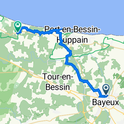
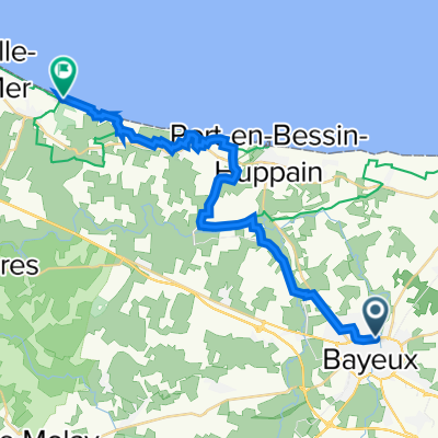
Z Bayeux do Port-en-Bessin-Huppain
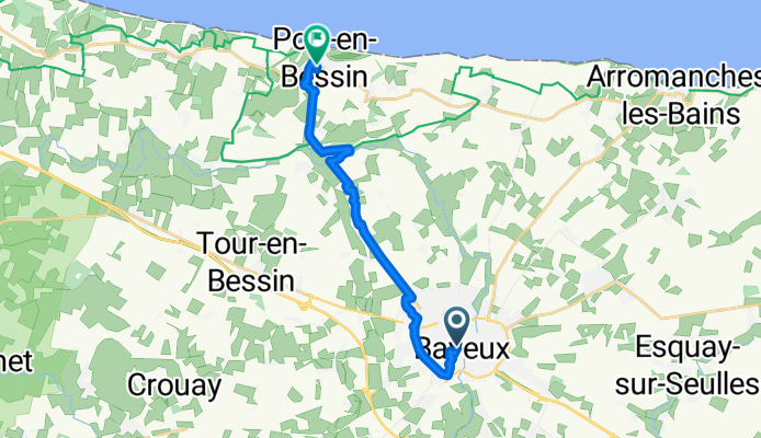
- 45 min
- Czas
- 13 km
- Dystans
- 65 m
- Przewyższenia
- 99 m
- Spadek
- 17,5 km/h
- Śr. Prędkość
- 66 m
- Maks. wysokość
This scenic ride takes you from the historic heart of Bayeux—famed for its medieval cathedral and the incredible Bayeux Tapestry—northward to the charming fishing village of Port-en-Bessin-Huppain on the Normandy coast. Clocking in at just under 13 km, the route gently leaves Bayeux’s bustling streets behind, gliding through quiet country roads, cycleways, and a few peaceful paths. You’ll get a mild workout with some gentle climbs (about 65 meters of ascent) before cruising down towards the sea.
Expect mostly smooth asphalt under your wheels, with the occasional less-defined section (nothing too wild, though). The final approach down into Port-en-Bessin gives you sweeping views of the English Channel—a well-earned treat! Once you arrive, wander the bustling port, sample fresh seafood, or simply bask in the salty sea air. This ride is perfect for a leisurely morning or afternoon, blending history, countryside, and coastline all in one trip.
Wspólnota
Najlepsi użytkownicy w tym regionie


Od naszej społeczności
Najlepsze trasy rowerowe z Bayeux do Port-en-Bessin-Huppain

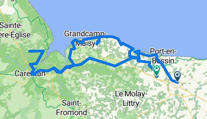
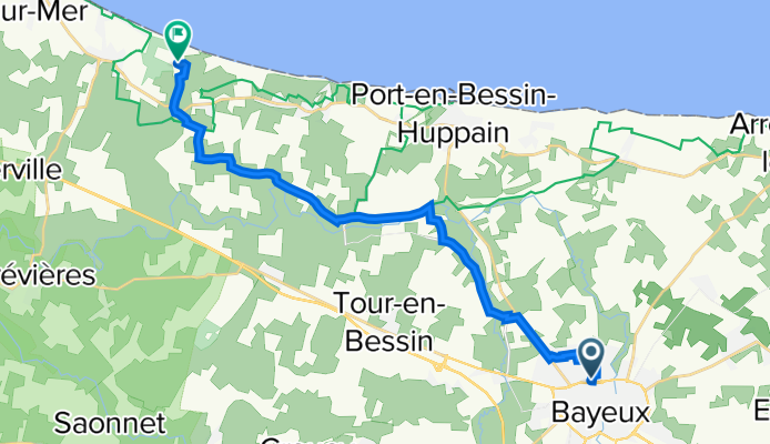
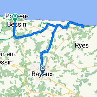
32 Boulevard d'Eindhoven, Bayeux to 5 Rue de l'Église, Saint-Laurent-sur-Mer
Trasa rowerowa w Bayeux, Normandia, Francja
- 23,6 km
- Dystans
- 130 m
- Przewyższenia
- 122 m
- Spadek
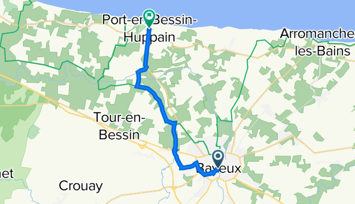
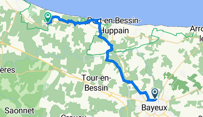
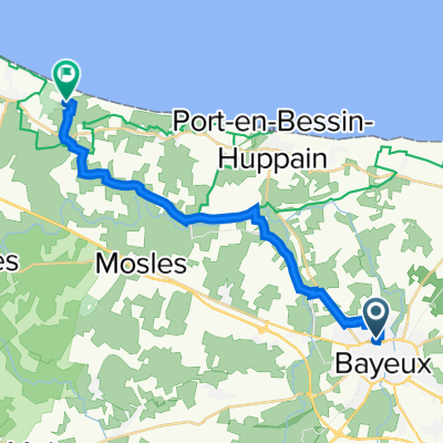
12 Rue Laitière, Bayeux à 14 Rue de Bayeux, Port-en-Bessin-Huppain
Trasa rowerowa w Bayeux, Normandia, Francja
- 12,1 km
- Dystans
- 65 m
- Przewyższenia
- 99 m
- Spadek
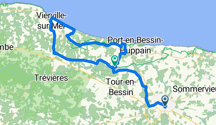
Bayeux Route 1
Trasa rowerowa w Bayeux, Normandia, Francja
- 43,5 km
- Dystans
- 191 m
- Przewyższenia
- 221 m
- Spadek
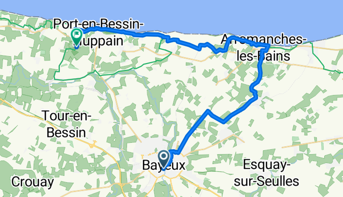
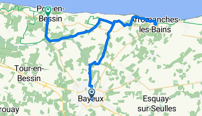
Bayeux to Port en Bessin via Arromanches
Trasa rowerowa w Bayeux, Normandia, Francja
- 26,9 km
- Dystans
- 222 m
- Przewyższenia
- 205 m
- Spadek
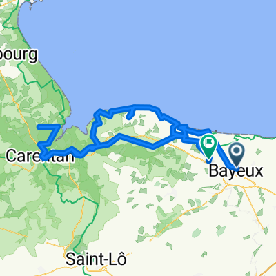
Allée du Camping, Bayeux to Route de Maisons, Tour-en-Bessin
Trasa rowerowa w Bayeux, Normandia, Francja
- 153,4 km
- Dystans
- 754 m
- Przewyższenia
- 748 m
- Spadek
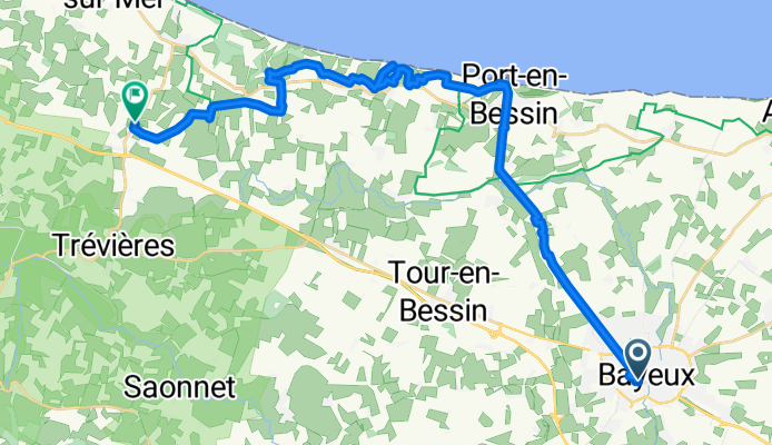
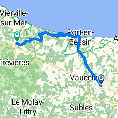
31 Boulevard d'Eindhoven, Bayeux to 598 Route d'Omaha Beach, Colleville-sur-Mer
Trasa rowerowa w Bayeux, Normandia, Francja
- 18,1 km
- Dystans
- 134 m
- Przewyższenia
- 111 m
- Spadek

Normandy D-Day Beaches
Trasa rowerowa w Bayeux, Normandia, Francja
- 36,2 km
- Dystans
- 287 m
- Przewyższenia
- 276 m
- Spadek
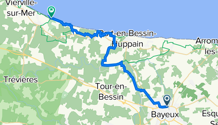
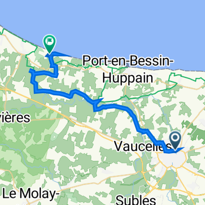
Rue Larcher, Bayeux to Avenue Maréchal de Tourville, Port-en-Bessin-Huppain
Trasa rowerowa w Bayeux, Normandia, Francja
- 28,8 km
- Dystans
- 164 m
- Przewyższenia
- 184 m
- Spadek
Route nach Rue du Connétable de Richemont
Trasa rowerowa w Bayeux, Normandia, Francja
- 27,4 km
- Dystans
- 225 m
- Przewyższenia
- 301 m
- Spadek

34 Boulevard d'Eindhoven, Bayeux nach Route du Capitaine Joe Dawson, Colleville-sur-Mer
Trasa rowerowa w Bayeux, Normandia, Francja
- 24,8 km
- Dystans
- 183 m
- Przewyższenia
- 175 m
- Spadek
32 Boulevard d'Eindhoven, Bayeux nach Saint-Laurent-sur-Mer
Trasa rowerowa w Bayeux, Normandia, Francja
- 23,2 km
- Dystans
- 199 m
- Przewyższenia
- 239 m
- Spadek
Odkryj więcej tras
 Allée du Camping, Bayeux to Route de Maisons, Tour-en-Bessin
- Dystans
- 153,4 km
- Przewyższenia
- 754 m
- Spadek
- 748 m
- Lokalizacja
- Bayeux, Normandia, Francja
 31 Boulevard d'Eindhoven, Bayeux to 598 Route d'Omaha Beach, Colleville-sur-Mer
- Dystans
- 18,1 km
- Przewyższenia
- 134 m
- Spadek
- 111 m
- Lokalizacja
- Bayeux, Normandia, Francja
 Normandy D-Day Beaches
- Dystans
- 36,2 km
- Przewyższenia
- 287 m
- Spadek
- 276 m
- Lokalizacja
- Bayeux, Normandia, Francja
 Rue Larcher, Bayeux to Avenue Maréchal de Tourville, Port-en-Bessin-Huppain
- Dystans
- 28,8 km
- Przewyższenia
- 164 m
- Spadek
- 184 m
- Lokalizacja
- Bayeux, Normandia, Francja
 Route nach Rue du Connétable de Richemont
- Dystans
- 27,4 km
- Przewyższenia
- 225 m
- Spadek
- 301 m
- Lokalizacja
- Bayeux, Normandia, Francja
 Projet IME
- Dystans
- 17,6 km
- Przewyższenia
- 98 m
- Spadek
- 91 m
- Lokalizacja
- Bayeux, Normandia, Francja
 34 Boulevard d'Eindhoven, Bayeux nach Route du Capitaine Joe Dawson, Colleville-sur-Mer
- Dystans
- 24,8 km
- Przewyższenia
- 183 m
- Spadek
- 175 m
- Lokalizacja
- Bayeux, Normandia, Francja
 32 Boulevard d'Eindhoven, Bayeux nach Saint-Laurent-sur-Mer
- Dystans
- 23,2 km
- Przewyższenia
- 199 m
- Spadek
- 239 m
- Lokalizacja
- Bayeux, Normandia, Francja