
Jednodniowa wycieczka rowerowa z Arette do Saint-Jean-Pied-de-Port
Dostosuj własną trasę na podstawie naszego szablonu lub zobacz, jak nasza społeczność najchętniej jeździ z Arette do Saint-Jean-Pied-de-Port.
Szablon trasy
Z Arette do Saint-Jean-Pied-de-Port

- 5 h 38 min
- Czas
- 80,3 km
- Dystans
- 2257 m
- Przewyższenia
- 2426 m
- Spadek
- 14,3 km/h
- Śr. Prędkość
- 490 m
- Maks. wysokość
Get ready for an epic ride in the western Pyrenees! Starting from the charming village of Arette, nestled on the edge of the Béarn region (famous for its sheep’s cheese!), you’ll roll southward on tranquil roads. This route is a proper leg-burner, clocking over 2,200 m of climbing as you zigzag through lush valleys, over forested hills, and past rolling pastures where horses and sheep graze freely.
While nearly half the surface is missing from our data (adventure awaits!), expect mostly paved roads and long, quiet stretches with little traffic—perfect for soaking in those mountain views. There’s a bit of gravel here and there to keep things interesting, but nothing too wild.
After about 80 km of Pyrenean beauty and a big dose of up-and-down, you’ll cruise into Saint-Jean-Pied-de-Port. This historic Basque town is the gateway to the Camino de Santiago and packed with medieval charm—think old stone walls, bustling cafés, and pilgrims everywhere. Treat yourself to a pastry or a pint: You’ve earned it!
Wspólnota
Najlepsi użytkownicy w tym regionie


Od naszej społeczności
Najlepsze trasy rowerowe z Arette do Saint-Jean-Pied-de-Port

2014 Ride Day 107 - Issor to St-Jean-le-Vieux
Trasa rowerowa w Arette, Nouvelle-Aquitaine, Francja
- 79,4 km
- Dystans
- 688 m
- Przewyższenia
- 834 m
- Spadek

Saint-Jean-Pied-de-Port - L`Abérouat
Trasa rowerowa w Arette, Nouvelle-Aquitaine, Francja
- 212,4 km
- Dystans
- 4981 m
- Przewyższenia
- 6274 m
- Spadek

Escot - Artaburu
Trasa rowerowa w Arette, Nouvelle-Aquitaine, Francja
- 213 km
- Dystans
- 4939 m
- Przewyższenia
- 4135 m
- Spadek

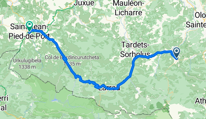
Arette - Saint Jean Pied de Port
Trasa rowerowa w Arette, Nouvelle-Aquitaine, Francja
- 55,4 km
- Dystans
- 983 m
- Przewyższenia
- 1143 m
- Spadek

Dag 6 Meerdaagse 2014
Trasa rowerowa w Arette, Nouvelle-Aquitaine, Francja
- 123,4 km
- Dystans
- 2875 m
- Przewyższenia
- 3302 m
- Spadek

2012 - OW7
Trasa rowerowa w Arette, Nouvelle-Aquitaine, Francja
- 152,4 km
- Dystans
- 2332 m
- Przewyższenia
- 3767 m
- Spadek

10-LURBE-COL BAGARGUI-BURDINKURUTXETA-SAINT JEAN PIED PORT
Trasa rowerowa w Arette, Nouvelle-Aquitaine, Francja
- 85,8 km
- Dystans
- 1442 m
- Przewyższenia
- 1588 m
- Spadek

Transpirenaica: Arette - St. Jean Pied de Port
Trasa rowerowa w Arette, Nouvelle-Aquitaine, Francja
- 69 km
- Dystans
- 734 m
- Przewyższenia
- 862 m
- Spadek

etapa8
Trasa rowerowa w Arette, Nouvelle-Aquitaine, Francja
- 79,7 km
- Dystans
- 1479 m
- Przewyższenia
- 1646 m
- Spadek

Sept 27 Optional: Arette over Col Bagargui & Col de Burdincurutcheta to St-Jean-Pied-de-Port
Trasa rowerowa w Arette, Nouvelle-Aquitaine, Francja
- 72,9 km
- Dystans
- 1350 m
- Przewyższenia
- 1512 m
- Spadek

Sept 27: Arette over Col Inharpu to St Jean Pied de Port
Trasa rowerowa w Arette, Nouvelle-Aquitaine, Francja
- 55,1 km
- Dystans
- 1023 m
- Przewyższenia
- 1168 m
- Spadek
St J Pied
Trasa rowerowa w Arette, Nouvelle-Aquitaine, Francja
- 65,6 km
- Dystans
- 1444 m
- Przewyższenia
- 1589 m
- Spadek
Odkryj więcej tras
 Dag 6 Meerdaagse 2014
- Dystans
- 123,4 km
- Przewyższenia
- 2875 m
- Spadek
- 3302 m
- Lokalizacja
- Arette, Nouvelle-Aquitaine, Francja
 2012 - OW7
- Dystans
- 152,4 km
- Przewyższenia
- 2332 m
- Spadek
- 3767 m
- Lokalizacja
- Arette, Nouvelle-Aquitaine, Francja
 10-LURBE-COL BAGARGUI-BURDINKURUTXETA-SAINT JEAN PIED PORT
- Dystans
- 85,8 km
- Przewyższenia
- 1442 m
- Spadek
- 1588 m
- Lokalizacja
- Arette, Nouvelle-Aquitaine, Francja
 Transpirenaica: Arette - St. Jean Pied de Port
- Dystans
- 69 km
- Przewyższenia
- 734 m
- Spadek
- 862 m
- Lokalizacja
- Arette, Nouvelle-Aquitaine, Francja
 etapa8
- Dystans
- 79,7 km
- Przewyższenia
- 1479 m
- Spadek
- 1646 m
- Lokalizacja
- Arette, Nouvelle-Aquitaine, Francja
 Sept 27 Optional: Arette over Col Bagargui & Col de Burdincurutcheta to St-Jean-Pied-de-Port
- Dystans
- 72,9 km
- Przewyższenia
- 1350 m
- Spadek
- 1512 m
- Lokalizacja
- Arette, Nouvelle-Aquitaine, Francja
 Sept 27: Arette over Col Inharpu to St Jean Pied de Port
- Dystans
- 55,1 km
- Przewyższenia
- 1023 m
- Spadek
- 1168 m
- Lokalizacja
- Arette, Nouvelle-Aquitaine, Francja
 St J Pied
- Dystans
- 65,6 km
- Przewyższenia
- 1444 m
- Spadek
- 1589 m
- Lokalizacja
- Arette, Nouvelle-Aquitaine, Francja
Trasy do Saint-Jean-Pied-de-Port
Jednodniowa wycieczka rowerowa od
Z Hendaye do Saint-Jean-Pied-de-Port