
Szablon trasy
Z Arès do Arcachon

- 2 h 25 min
- Czas
- 46,7 km
- Dystans
- 162 m
- Przewyższenia
- 129 m
- Spadek
- 19,4 km/h
- Śr. Prędkość
- 42 m
- Maks. wysokość
This ride takes you from the relaxed seaside village of Arès down the western edge of the Bassin d’Arcachon to the lively town of Arcachon. Most of your 47 km journey unfolds on dedicated cycleways—so expect a chilled vibe, minimal traffic, and a smooth 97% paved surface. You’ll pedal through pine forests and past oyster farms, catching peeks of the bay and maybe even glimpsing otters or herons along the way.
The route is mostly flat, with gentle climbs totaling about 160 meters of ascent, so it’s ideal for all fitness levels (or even a lazy holiday spin). Arcachon itself is famous for its belle-époque architecture, sandy beaches, and the option to indulge in fresh seafood when you park your bike at the finish.
Tip: Bring a swimsuit! There are plenty of spots en route for a quick dip. This is one of the region’s classic rides—perfect for soaking up that laid-back Atlantic Coast charm.
Wspólnota
Najlepsi użytkownicy w tym regionie


Od naszej społeczności
Najlepsze trasy rowerowe z Arès do Arcachon

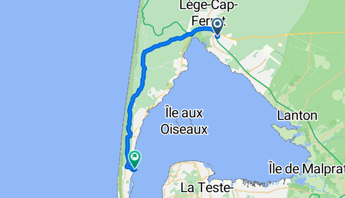
Route Forestière du Crohot, Lège-Cap-Ferret to Jetée du Moulleau, Arcachon
Trasa rowerowa w Arès, Nouvelle-Aquitaine, Francja
- 22,5 km
- Dystans
- 89 m
- Przewyższenia
- 91 m
- Spadek

Recovered Route
Trasa rowerowa w Arès, Nouvelle-Aquitaine, Francja
- 8,3 km
- Dystans
- 44 m
- Przewyższenia
- 46 m
- Spadek


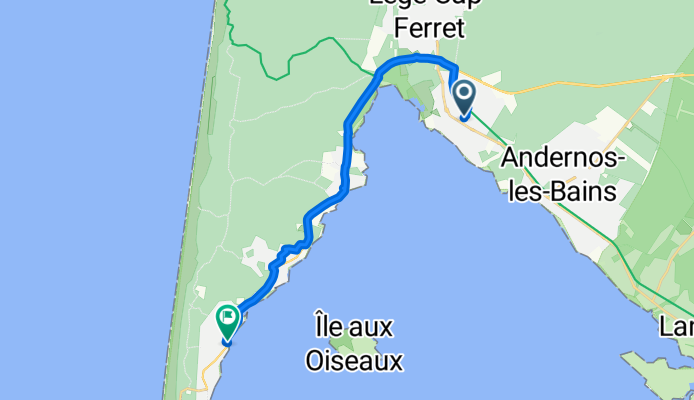
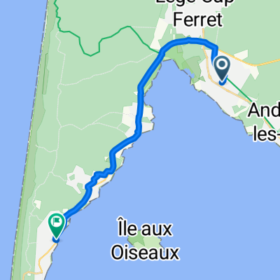
Eurovélo 1 - Atlantique Coast Route, Lège-Cap-Ferret nach 86 Avenue de l'Herbe, Lège-Cap-Ferret
Trasa rowerowa w Arès, Nouvelle-Aquitaine, Francja
- 16,4 km
- Dystans
- 115 m
- Przewyższenia
- 108 m
- Spadek

Route de Bordeaux, Lège-Cap-Ferret à 1 Impasse de la Jagude, Lège-Cap-Ferret
Trasa rowerowa w Arès, Nouvelle-Aquitaine, Francja
- 14,2 km
- Dystans
- 59 m
- Przewyższenia
- 63 m
- Spadek

12_a_Arès_Gujan-Mestras
Trasa rowerowa w Arès, Nouvelle-Aquitaine, Francja
- 22 km
- Dystans
- 57 m
- Przewyższenia
- 60 m
- Spadek

De 2bis Allée de Charenton, Arès à 11 Rue Marcel Levasseur, Arcachon
Trasa rowerowa w Arès, Nouvelle-Aquitaine, Francja
- 41,8 km
- Dystans
- 36 m
- Przewyższenia
- 40 m
- Spadek

Route de Bordeaux, Lège-Cap-Ferret à 11 Allée du Sauvignon, Lège-Cap-Ferret
Trasa rowerowa w Arès, Nouvelle-Aquitaine, Francja
- 13,5 km
- Dystans
- 173 m
- Przewyższenia
- 174 m
- Spadek

Itinéraire à partir de 8 Avenue du Général de Gaulle, Lège-Cap-Ferret
Trasa rowerowa w Arès, Nouvelle-Aquitaine, Francja
- 18,6 km
- Dystans
- 52 m
- Przewyższenia
- 53 m
- Spadek
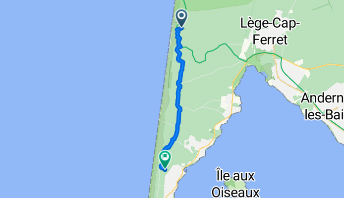
Route Forestière du Crohot, Lège-Cap-Ferret to Lège-Cap-Ferret
Trasa rowerowa w Arès, Nouvelle-Aquitaine, Francja
- 12,8 km
- Dystans
- 77 m
- Przewyższenia
- 78 m
- Spadek
Rue du Garguehos, Arès nach Rue Ste Catherine, Lège-Cap-Ferret
Trasa rowerowa w Arès, Nouvelle-Aquitaine, Francja
- 16,6 km
- Dystans
- 36 m
- Przewyższenia
- 46 m
- Spadek
Odkryj więcej tras
 Route de Bordeaux, Lège-Cap-Ferret à 1 Impasse de la Jagude, Lège-Cap-Ferret
- Dystans
- 14,2 km
- Przewyższenia
- 59 m
- Spadek
- 63 m
- Lokalizacja
- Arès, Nouvelle-Aquitaine, Francja
 3=FN
3=FN- Dystans
- 41,5 km
- Przewyższenia
- 59 m
- Spadek
- 53 m
- Lokalizacja
- Arès, Nouvelle-Aquitaine, Francja
 12_a_Arès_Gujan-Mestras
- Dystans
- 22 km
- Przewyższenia
- 57 m
- Spadek
- 60 m
- Lokalizacja
- Arès, Nouvelle-Aquitaine, Francja
 De 2bis Allée de Charenton, Arès à 11 Rue Marcel Levasseur, Arcachon
- Dystans
- 41,8 km
- Przewyższenia
- 36 m
- Spadek
- 40 m
- Lokalizacja
- Arès, Nouvelle-Aquitaine, Francja
 Route de Bordeaux, Lège-Cap-Ferret à 11 Allée du Sauvignon, Lège-Cap-Ferret
- Dystans
- 13,5 km
- Przewyższenia
- 173 m
- Spadek
- 174 m
- Lokalizacja
- Arès, Nouvelle-Aquitaine, Francja
 Itinéraire à partir de 8 Avenue du Général de Gaulle, Lège-Cap-Ferret
- Dystans
- 18,6 km
- Przewyższenia
- 52 m
- Spadek
- 53 m
- Lokalizacja
- Arès, Nouvelle-Aquitaine, Francja
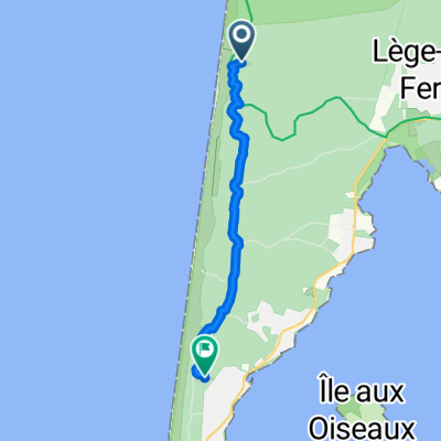 Route Forestière du Crohot, Lège-Cap-Ferret to Lège-Cap-Ferret
- Dystans
- 12,8 km
- Przewyższenia
- 77 m
- Spadek
- 78 m
- Lokalizacja
- Arès, Nouvelle-Aquitaine, Francja
 Rue du Garguehos, Arès nach Rue Ste Catherine, Lège-Cap-Ferret
- Dystans
- 16,6 km
- Przewyższenia
- 36 m
- Spadek
- 46 m
- Lokalizacja
- Arès, Nouvelle-Aquitaine, Francja
Trasy do Arcachon
Szybka przejażdżka rowerowa od
Z La Teste-de-Buch do Arcachon