
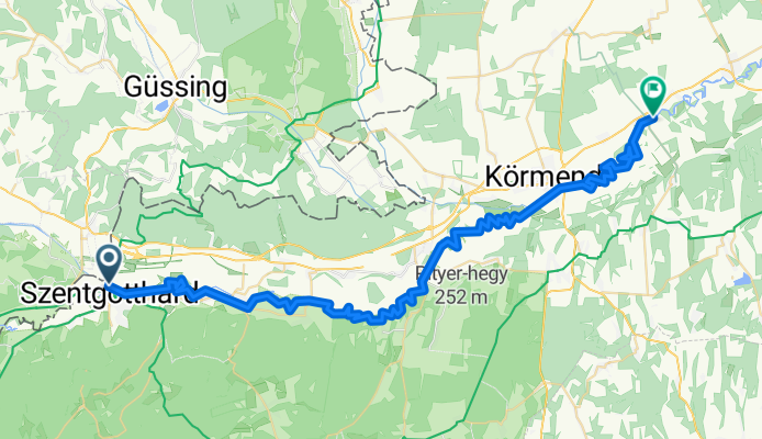
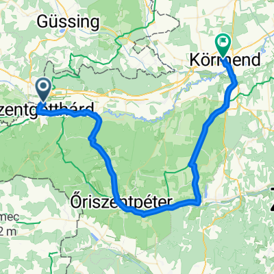
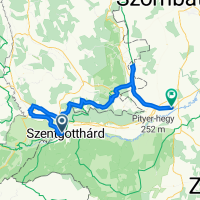
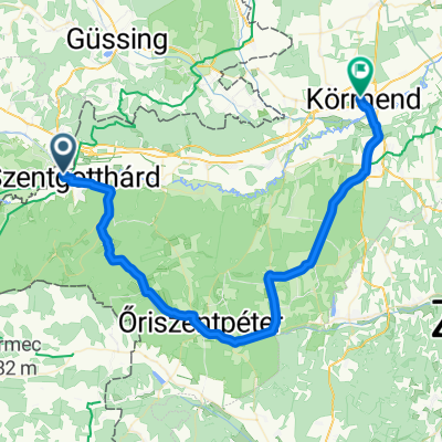
Jednodniowa wycieczka rowerowa z Szentgotthárd do Körmend
Dostosuj własną trasę na podstawie naszego szablonu lub zobacz, jak nasza społeczność najchętniej jeździ z Szentgotthárd do Körmend.
Szablon trasy
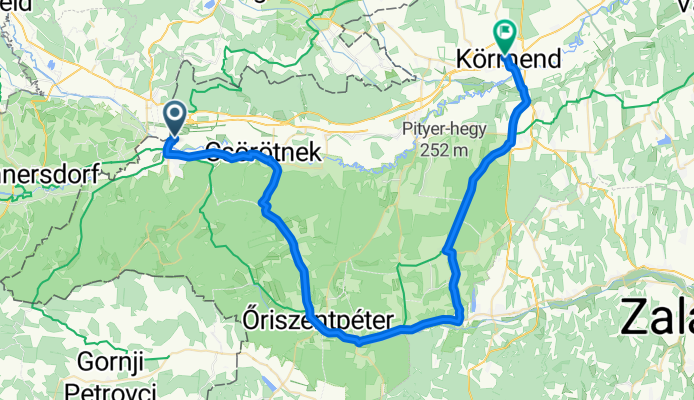
Z Szentgotthárd do Körmend
- 2 h 37 min
- Czas
- 38,8 km
- Dystans
- 298 m
- Przewyższenia
- 336 m
- Spadek
- 14,8 km/h
- Śr. Prędkość
- 274 m
- Maks. wysokość
Here’s a great ride for those who love scenic landscapes and a touch of adventure! Set out from Szentgotthárd, a charming western Hungarian town near the Austrian border—famous for its spa, Baroque monastery, and multicultural vibe. The 39 km journey to Körmend winds through peaceful countryside, rolling fields, and small villages, offering a true taste of rural Hungary.
The route has a good mix of surfaces: expect mostly natural tracks and some paved stretches, so wider tires are a smart choice. There’s a moderate amount of up and down, but nothing that’ll break your spirit—it's perfect for a leisurely pace. You’ll spend much of the ride on quiet paths and cycleways, away from traffic.
As you roll into Körmend, you’ll be greeted by its historic Batthyány Castle and lovely town center. Whether you’re after a laidback day on two wheels or just want to explore somewhere new, this ride is a relaxed, scenic treat. Don’t forget your camera!
Wspólnota
Najlepsi użytkownicy w tym regionie


Od naszej społeczności
Najlepsze trasy rowerowe z Szentgotthárd do Körmend

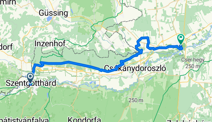
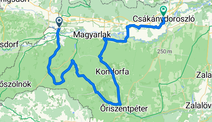
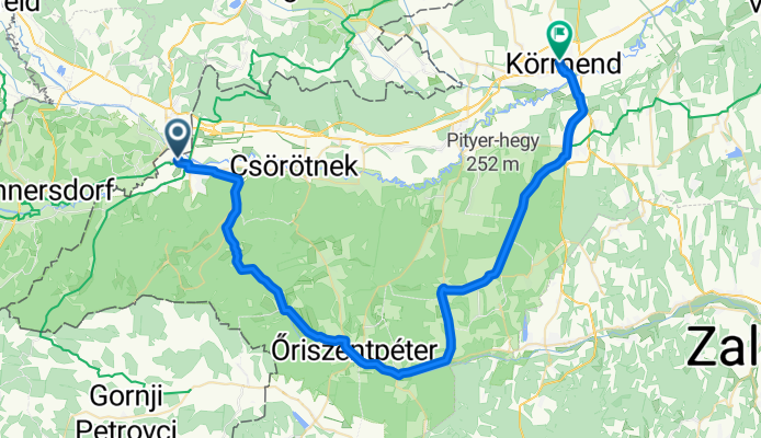
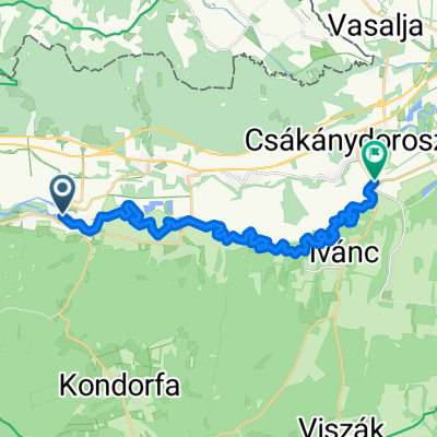
Szentgotthárd - Csákánydoroszló
Trasa rowerowa w Szentgotthárd, Komitat Vas, Węgry
- 60,4 km
- Dystans
- 341 m
- Przewyższenia
- 360 m
- Spadek
Őrségi Kerékpáros Vándortábor 5. nap
Trasa rowerowa w Szentgotthárd, Komitat Vas, Węgry
- 52,7 km
- Dystans
- 191 m
- Przewyższenia
- 195 m
- Spadek
Rába Canoe Marathon - Rába Kenu Maraton
Trasa rowerowa w Szentgotthárd, Komitat Vas, Węgry
- 62,2 km
- Dystans
- 12 m
- Przewyższenia
- 47 m
- Spadek
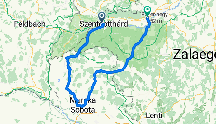
Szentgotthárd - Murska Sobota - Csákánydoroszló Tour 2009.07.25
Trasa rowerowa w Szentgotthárd, Komitat Vas, Węgry
- 105,2 km
- Dystans
- 900 m
- Przewyższenia
- 908 m
- Spadek
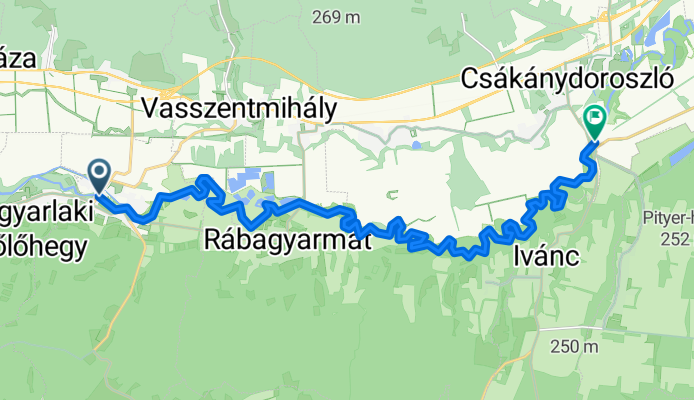
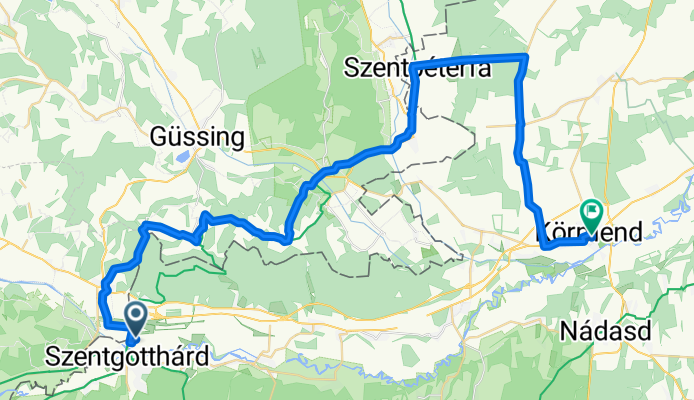
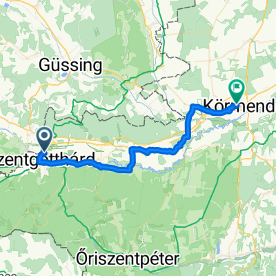
Szentgotthárd-Vadása tó-Körmend
Trasa rowerowa w Szentgotthárd, Komitat Vas, Węgry
- 57,8 km
- Dystans
- 279 m
- Przewyższenia
- 307 m
- Spadek
ssllllllllllll
Trasa rowerowa w Szentgotthárd, Komitat Vas, Węgry
- 55,8 km
- Dystans
- 273 m
- Przewyższenia
- 292 m
- Spadek
Csörötnek - Csákánydoroszló kenu útvonal
Trasa rowerowa w Szentgotthárd, Komitat Vas, Węgry
- 22,7 km
- Dystans
- 17 m
- Przewyższenia
- 30 m
- Spadek
Hunyadi utca 36, Szentgotthárd - Rákóczi utca 49a, Körmend
Trasa rowerowa w Szentgotthárd, Komitat Vas, Węgry
- 66,8 km
- Dystans
- 383 m
- Przewyższenia
- 464 m
- Spadek
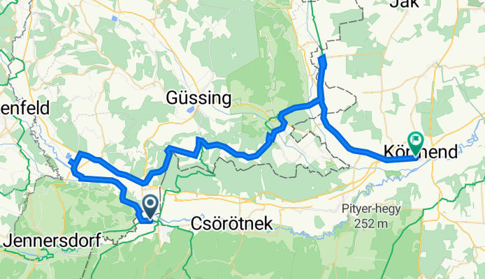
Plant-Moschendorf (fröccs)-Körmend
Trasa rowerowa w Szentgotthárd, Komitat Vas, Węgry
- 53,1 km
- Dystans
- 367 m
- Przewyższenia
- 396 m
- Spadek

Őkvt 2018. 5. nap
Trasa rowerowa w Szentgotthárd, Komitat Vas, Węgry
- 45,4 km
- Dystans
- 199 m
- Przewyższenia
- 207 m
- Spadek
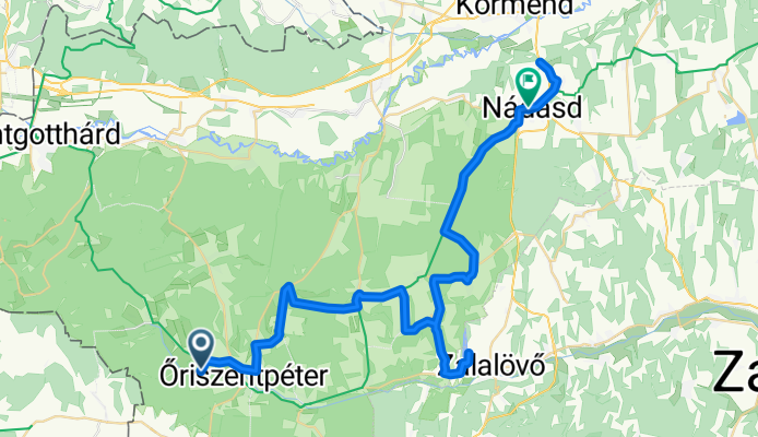
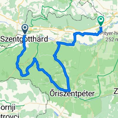
Szentgotthárd-Oriszentpéter-
Trasa rowerowa w Szentgotthárd, Komitat Vas, Węgry
- 54,5 km
- Dystans
- 281 m
- Przewyższenia
- 311 m
- Spadek
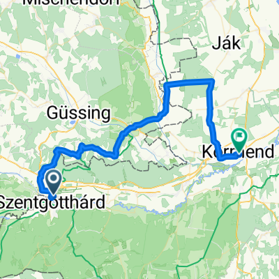
Sztg-Körmend
Trasa rowerowa w Szentgotthárd, Komitat Vas, Węgry
- 35,5 km
- Dystans
- 61 m
- Przewyższenia
- 87 m
- Spadek
Odkryj więcej tras
 Szentgotthárd-Vadása tó-Körmend
- Dystans
- 57,8 km
- Przewyższenia
- 279 m
- Spadek
- 307 m
- Lokalizacja
- Szentgotthárd, Komitat Vas, Węgry
 ssllllllllllll
- Dystans
- 55,8 km
- Przewyższenia
- 273 m
- Spadek
- 292 m
- Lokalizacja
- Szentgotthárd, Komitat Vas, Węgry
 Csörötnek - Csákánydoroszló kenu útvonal
- Dystans
- 22,7 km
- Przewyższenia
- 17 m
- Spadek
- 30 m
- Lokalizacja
- Szentgotthárd, Komitat Vas, Węgry
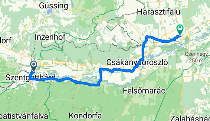
 Hunyadi utca 36, Szentgotthárd - Rákóczi utca 49a, Körmend
- Dystans
- 66,8 km
- Przewyższenia
- 383 m
- Spadek
- 464 m
- Lokalizacja
- Szentgotthárd, Komitat Vas, Węgry
 Plant-Moschendorf (fröccs)-Körmend
- Dystans
- 53,1 km
- Przewyższenia
- 367 m
- Spadek
- 396 m
- Lokalizacja
- Szentgotthárd, Komitat Vas, Węgry
 Őkvt 2018. 5. nap
- Dystans
- 45,4 km
- Przewyższenia
- 199 m
- Spadek
- 207 m
- Lokalizacja
- Szentgotthárd, Komitat Vas, Węgry
 Szentgotthárd-Oriszentpéter-
- Dystans
- 54,5 km
- Przewyższenia
- 281 m
- Spadek
- 311 m
- Lokalizacja
- Szentgotthárd, Komitat Vas, Węgry
 Sztg-Körmend
- Dystans
- 35,5 km
- Przewyższenia
- 61 m
- Spadek
- 87 m
- Lokalizacja
- Szentgotthárd, Komitat Vas, Węgry
Trasy z Szentgotthárd
Jednodniowa wycieczka rowerowa od
Z Szentgotthárd do Zalalövő