
Rowerowa z Sarajewo do Kobilja Glava
Dostosuj własną trasę na podstawie naszego szablonu lub zobacz, jak nasza społeczność najchętniej jeździ z Sarajewo do Kobilja Glava.
Szablon trasy
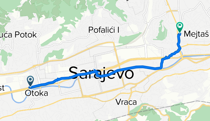
Z Sarajewo do Kobilja Glava
Kick off your ride in the heart of Sarajevo, the bustling capital of Bosnia and Herzegovina, famous for its vibrant old town and mix of Ottoman, Austro-Hungarian, and Yugoslav-era architecture. From there, you’ll wind your way north towards Kobilja Glava—a peaceful little suburb perched on the hills, offering sweeping views back towards the city.
This route’s just over 7.4 km, so it won’t take all day, but be ready for some climbing; you’ll gain about 250 meters in elevation! The roads are mostly quiet, with a good mix of asphalt and paved surfaces, though a small stretch is missing data—so a sense of adventure helps. As you approach Kobilja Glava, keep an eye out: the higher elevation means gorgeous overlooks, especially at sunset.
It’s a perfect ride if you want to escape Sarajevo’s city center for some fresh air, with a mix of urban energy and hillside calm. Don’t forget to snap a picture—once you see the view, you’ll know why.
Wspólnota
Najlepsi użytkownicy w tym regionie
Od naszej społeczności
Najlepsze trasy rowerowe z Sarajewo do Kobilja Glava
Alipasino - Barice (hardway)
Trasa rowerowa w Sarajewo, Federation of Bosnia and Herzegovina, Bośnia i Hercegowina
- 12,1 km
- Dystans
- 545 m
- Przewyższenia
- 63 m
- Spadek
Sarajevo-Bijambare-Misoca-ilijas-Sa
Trasa rowerowa w Sarajewo, Federation of Bosnia and Herzegovina, Bośnia i Hercegowina
- 116,9 km
- Dystans
- 1318 m
- Przewyższenia
- 1309 m
- Spadek
12 Giro di Sarajevo
Trasa rowerowa w Sarajewo, Federation of Bosnia and Herzegovina, Bośnia i Hercegowina
- 13,3 km
- Dystans
- 56 m
- Przewyższenia
- 39 m
- Spadek
Cavljak preko Radave
Trasa rowerowa w Sarajewo, Federation of Bosnia and Herzegovina, Bośnia i Hercegowina
- 17,5 km
- Dystans
- 781 m
- Przewyższenia
- 57 m
- Spadek
test 2
Trasa rowerowa w Sarajewo, Federation of Bosnia and Herzegovina, Bośnia i Hercegowina
- 14,6 km
- Dystans
- 428 m
- Przewyższenia
- 414 m
- Spadek
Sarajevo VLuka Izvor Miljacke Ozren Crepoljsko
Trasa rowerowa w Sarajewo, Federation of Bosnia and Herzegovina, Bośnia i Hercegowina
- 65,5 km
- Dystans
- 1521 m
- Przewyższenia
- 1518 m
- Spadek
Vukova Luka
Trasa rowerowa w Sarajewo, Federation of Bosnia and Herzegovina, Bośnia i Hercegowina
- 21,5 km
- Dystans
- 904 m
- Przewyższenia
- 139 m
- Spadek
Sarajevo History Hillers
Trasa rowerowa w Sarajewo, Federation of Bosnia and Herzegovina, Bośnia i Hercegowina
- 103 km
- Dystans
- 1626 m
- Przewyższenia
- 1629 m
- Spadek
Do Zicare
Trasa rowerowa w Sarajewo, Federation of Bosnia and Herzegovina, Bośnia i Hercegowina
- 11,2 km
- Dystans
- 103 m
- Przewyższenia
- 61 m
- Spadek
Cengic Vila - Ciglane
Trasa rowerowa w Sarajewo, Federation of Bosnia and Herzegovina, Bośnia i Hercegowina
- 4,7 km
- Dystans
- 58 m
- Przewyższenia
- 9 m
- Spadek
jedan krug
Trasa rowerowa w Sarajewo, Federation of Bosnia and Herzegovina, Bośnia i Hercegowina
- 47,9 km
- Dystans
- 237 m
- Przewyższenia
- 305 m
- Spadek
Steady ride
Trasa rowerowa w Sarajewo, Federation of Bosnia and Herzegovina, Bośnia i Hercegowina
- 5,1 km
- Dystans
- 105 m
- Przewyższenia
- 62 m
- Spadek
Odkryj więcej tras
 test 2
- Dystans
- 14,6 km
- Przewyższenia
- 428 m
- Spadek
- 414 m
- Lokalizacja
- Sarajewo, Federation of Bosnia and Herzegovina, Bośnia i Hercegowina
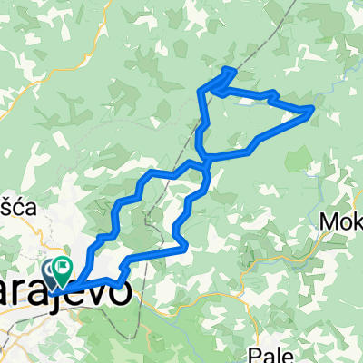 Sarajevo VLuka Izvor Miljacke Ozren Crepoljsko
- Dystans
- 65,5 km
- Przewyższenia
- 1521 m
- Spadek
- 1518 m
- Lokalizacja
- Sarajewo, Federation of Bosnia and Herzegovina, Bośnia i Hercegowina
 Vukova Luka
- Dystans
- 21,5 km
- Przewyższenia
- 904 m
- Spadek
- 139 m
- Lokalizacja
- Sarajewo, Federation of Bosnia and Herzegovina, Bośnia i Hercegowina
 Sarajevo History Hillers
- Dystans
- 103 km
- Przewyższenia
- 1626 m
- Spadek
- 1629 m
- Lokalizacja
- Sarajewo, Federation of Bosnia and Herzegovina, Bośnia i Hercegowina
 Do Zicare
- Dystans
- 11,2 km
- Przewyższenia
- 103 m
- Spadek
- 61 m
- Lokalizacja
- Sarajewo, Federation of Bosnia and Herzegovina, Bośnia i Hercegowina
 Cengic Vila - Ciglane
- Dystans
- 4,7 km
- Przewyższenia
- 58 m
- Spadek
- 9 m
- Lokalizacja
- Sarajewo, Federation of Bosnia and Herzegovina, Bośnia i Hercegowina
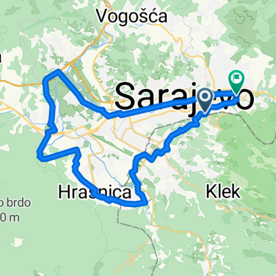 jedan krug
- Dystans
- 47,9 km
- Przewyższenia
- 237 m
- Spadek
- 305 m
- Lokalizacja
- Sarajewo, Federation of Bosnia and Herzegovina, Bośnia i Hercegowina
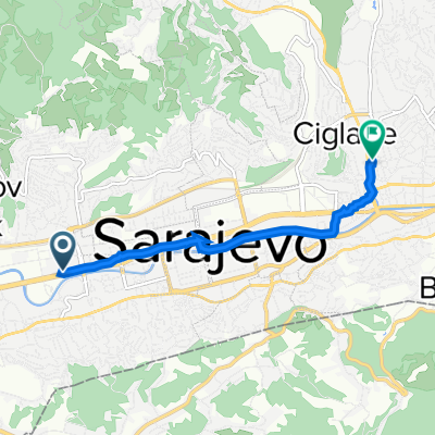 Steady ride
- Dystans
- 5,1 km
- Przewyższenia
- 105 m
- Spadek
- 62 m
- Lokalizacja
- Sarajewo, Federation of Bosnia and Herzegovina, Bośnia i Hercegowina
Trasy z Sarajewo
Jednodniowa wycieczka rowerowa od
Z Sarajewo do Gračanica

