
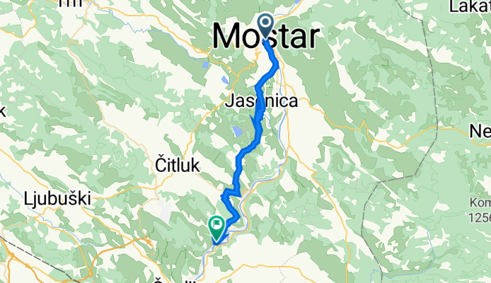
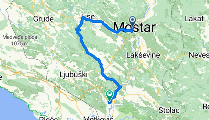
Szablon trasy
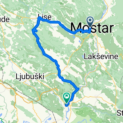
Z Mostar do Tasovčići
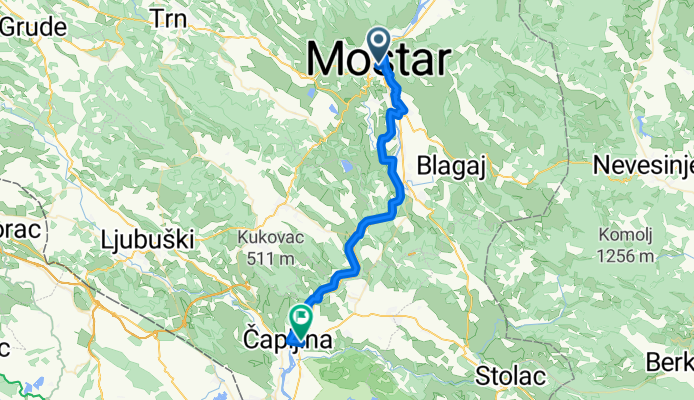
- 2 h 41 min
- Czas
- 42 km
- Dystans
- 531 m
- Przewyższenia
- 589 m
- Spadek
- 15,7 km/h
- Śr. Prędkość
- 114 m
- Maks. wysokość
Roll out from Mostar’s iconic Stari Most (a UNESCO World Heritage bridge) and cruise south along the Neretva. This is a roughly 42 km, fully paved ride that sticks mostly to quiet roads, with just brief touches of busier sections. It’s gently rolling—about 530 m of climbing overall—but trends downhill as you follow the river through vineyards, orchards, and limestone cliffs.
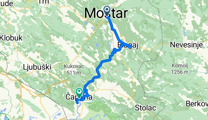
Nice detours if you’ve got time: Blagaj’s Buna spring and Dervish monastery, and the hillside village of Počitelj with its fortress and stone lanes—both classic Herzegovina views.
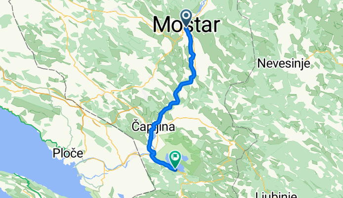
You’ll finish in Tasovčići, a riverside village next to Čapljina. From here, it’s an easy spin to the Roman villa at Mogorjelo or the bird-rich wetlands of Hutovo Blato Nature Park.
Tips: summer heat can be fierce in the Neretva valley—carry plenty of water. Expect a few short, narrow farm-road sections despite the smooth surface overall.
Wspólnota
Najlepsi użytkownicy w tym regionie


Od naszej społeczności
Najlepsze trasy rowerowe z Mostar do Tasovčići
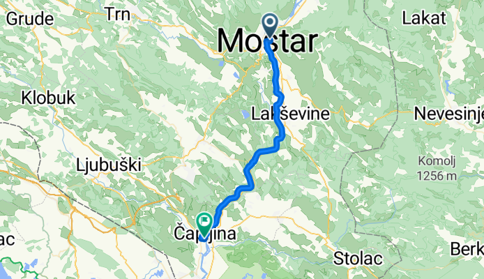
Mostar - Tasovčići
Trasa rowerowa w Mostar, Federation of Bosnia and Herzegovina, Bośnia i Hercegowina
- 51 km
- Dystans
- 57 m
- Przewyższenia
- 118 m
- Spadek
Ćirina Pruga 1.dio: Mostar - Čapljina
Trasa rowerowa w Mostar, Federation of Bosnia and Herzegovina, Bośnia i Hercegowina
- 64,5 km
- Dystans
- 258 m
- Przewyższenia
- 312 m
- Spadek
Mostar to Čapljina - 35 - 470D+
Trasa rowerowa w Mostar, Federation of Bosnia and Herzegovina, Bośnia i Hercegowina
- 34,5 km
- Dystans
- 474 m
- Przewyższenia
- 530 m
- Spadek

Mostar-Čapljina
Trasa rowerowa w Mostar, Federation of Bosnia and Herzegovina, Bośnia i Hercegowina
- 35,7 km
- Dystans
- 257 m
- Przewyższenia
- 314 m
- Spadek

Ćirina Pruga 1.dio: Mostar - Čapljina - Ćirina Pruga 1.dio: Mostar - Čapljina
Trasa rowerowa w Mostar, Federation of Bosnia and Herzegovina, Bośnia i Hercegowina
- 64,4 km
- Dystans
- 745 m
- Przewyższenia
- 801 m
- Spadek

CILJ Čapljina - Trasa utrke Hercegovina Classic za kategoriju Juniori.
Trasa rowerowa w Mostar, Federation of Bosnia and Herzegovina, Bośnia i Hercegowina
- 109 km
- Dystans
- 1081 m
- Przewyższenia
- 1145 m
- Spadek
Mostar Šurmanci brdom
Trasa rowerowa w Mostar, Federation of Bosnia and Herzegovina, Bośnia i Hercegowina
- 29,6 km
- Dystans
- 355 m
- Przewyższenia
- 394 m
- Spadek
Mostar-Čapljina- Mostar 72 km (preko Bacevica i Krucevica)
Trasa rowerowa w Mostar, Federation of Bosnia and Herzegovina, Bośnia i Hercegowina
- 36,9 km
- Dystans
- 201 m
- Przewyższenia
- 255 m
- Spadek

Ćirina Pruga 1.dio: Mostar - Čapljina
Trasa rowerowa w Mostar, Federation of Bosnia and Herzegovina, Bośnia i Hercegowina
- 64,6 km
- Dystans
- 258 m
- Przewyższenia
- 312 m
- Spadek
Cirinom prugom - Mostar Pocitelj
Trasa rowerowa w Mostar, Federation of Bosnia and Herzegovina, Bośnia i Hercegowina
- 67,3 km
- Dystans
- 765 m
- Przewyższenia
- 826 m
- Spadek
Mostar - Capljina (BBK Mostar)
Trasa rowerowa w Mostar, Federation of Bosnia and Herzegovina, Bośnia i Hercegowina
- 35,7 km
- Dystans
- 99 m
- Przewyższenia
- 154 m
- Spadek
Janje Trebizat
Trasa rowerowa w Mostar, Federation of Bosnia and Herzegovina, Bośnia i Hercegowina
- 67,9 km
- Dystans
- 645 m
- Przewyższenia
- 704 m
- Spadek
Odkryj więcej tras
 Ćirina Pruga 1.dio: Mostar - Čapljina - Ćirina Pruga 1.dio: Mostar - Čapljina
- Dystans
- 64,4 km
- Przewyższenia
- 745 m
- Spadek
- 801 m
- Lokalizacja
- Mostar, Federation of Bosnia and Herzegovina, Bośnia i Hercegowina
 CILJ Čapljina - Trasa utrke Hercegovina Classic za kategoriju Juniori.
- Dystans
- 109 km
- Przewyższenia
- 1081 m
- Spadek
- 1145 m
- Lokalizacja
- Mostar, Federation of Bosnia and Herzegovina, Bośnia i Hercegowina
 Mostar Šurmanci brdom
- Dystans
- 29,6 km
- Przewyższenia
- 355 m
- Spadek
- 394 m
- Lokalizacja
- Mostar, Federation of Bosnia and Herzegovina, Bośnia i Hercegowina
 Mostar-Čapljina- Mostar 72 km (preko Bacevica i Krucevica)
- Dystans
- 36,9 km
- Przewyższenia
- 201 m
- Spadek
- 255 m
- Lokalizacja
- Mostar, Federation of Bosnia and Herzegovina, Bośnia i Hercegowina
 Ćirina Pruga 1.dio: Mostar - Čapljina
- Dystans
- 64,6 km
- Przewyższenia
- 258 m
- Spadek
- 312 m
- Lokalizacja
- Mostar, Federation of Bosnia and Herzegovina, Bośnia i Hercegowina
 Cirinom prugom - Mostar Pocitelj
- Dystans
- 67,3 km
- Przewyższenia
- 765 m
- Spadek
- 826 m
- Lokalizacja
- Mostar, Federation of Bosnia and Herzegovina, Bośnia i Hercegowina
 Mostar - Capljina (BBK Mostar)
- Dystans
- 35,7 km
- Przewyższenia
- 99 m
- Spadek
- 154 m
- Lokalizacja
- Mostar, Federation of Bosnia and Herzegovina, Bośnia i Hercegowina
 Janje Trebizat
- Dystans
- 67,9 km
- Przewyższenia
- 645 m
- Spadek
- 704 m
- Lokalizacja
- Mostar, Federation of Bosnia and Herzegovina, Bośnia i Hercegowina