
Jednodniowa wycieczka rowerowa z Puente Alto do Villa Presidente Frei
Dostosuj własną trasę na podstawie naszego szablonu lub zobacz, jak nasza społeczność najchętniej jeździ z Puente Alto do Villa Presidente Frei.
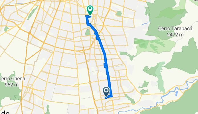
Szablon trasy
Z Puente Alto do Villa Presidente Frei

- 1 h 27 min
- Czas
- 25,9 km
- Dystans
- 38 m
- Przewyższenia
- 137 m
- Spadek
- 17,9 km/h
- Śr. Prędkość
- 700 m
- Maks. wysokość
Set out from bustling Puente Alto, one of Santiago’s largest and liveliest communes, and head north toward the residential tranquility of Villa Presidente Frei. This 26 km route is mostly flat (with just a gentle 38 meters of ascent and a longer, easy descent), making it friendly for most riders.
You’ll pedal mainly on paved roads—expect a smooth ride—with over 40% of the journey along dedicated cycleways, perfect for zoning out and soaking in the sights. Much of the rest winds through quiet backstreets, with very little time spent on busier roads. Along the way, you’ll witness the transition from urban energy to the leafy neighborhoods closer to your destination.
Villa Presidente Frei is a peaceful spot, known for its parks and community vibe. It’s a great place to catch your breath at the end of your ride. Whether it’s your daily commute or a weekend adventure, this route offers a snapshot of Santiago’s diverse neighborhoods without too many hills to slow you down. Happy cycling!
Wspólnota
Najlepsi użytkownicy w tym regionie


Od naszej społeczności
Najlepsze trasy rowerowe z Puente Alto do Villa Presidente Frei

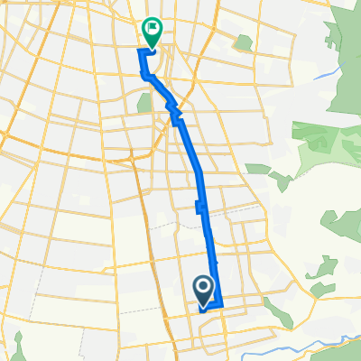
De San Mauricio 3123, Puente Alto a Pasaje 35 1505, Ñuñoa
Trasa rowerowa w Puente Alto, Region Metropolitalny, Chile
- 14,8 km
- Dystans
- 15 m
- Przewyższenia
- 118 m
- Spadek

Alcalde Luis Osorio 652, Puente Alto a Avenida Ricardo Lyon 1458, Providencia
Trasa rowerowa w Puente Alto, Region Metropolitalny, Chile
- 24,3 km
- Dystans
- 67 m
- Przewyższenia
- 127 m
- Spadek

A Z O T E
Trasa rowerowa w Puente Alto, Region Metropolitalny, Chile
- 27,7 km
- Dystans
- 96 m
- Przewyższenia
- 131 m
- Spadek

José Miguel Carrera 1256–1390, La Florida a Canal las Perdices, La Florida
Trasa rowerowa w Puente Alto, Region Metropolitalny, Chile
- 5,7 km
- Dystans
- 231 m
- Przewyższenia
- 33 m
- Spadek

Mariano Sánchez Fontecilla 3701–3729, La Florida a Las Tinajas 6000, La Florida
Trasa rowerowa w Puente Alto, Region Metropolitalny, Chile
- 2 km
- Dystans
- 152 m
- Przewyższenia
- 32 m
- Spadek

De Apóstol Matías 2973, Puente Alto a Paseo Las Mandarinas 3702, La Florida
Trasa rowerowa w Puente Alto, Region Metropolitalny, Chile
- 11,7 km
- Dystans
- 88 m
- Przewyższenia
- 129 m
- Spadek
PUC Rugby
Trasa rowerowa w Puente Alto, Region Metropolitalny, Chile
- 14,6 km
- Dystans
- 14 m
- Przewyższenia
- 123 m
- Spadek

templo bahai 😊
Trasa rowerowa w Puente Alto, Region Metropolitalny, Chile
- 16,9 km
- Dystans
- 384 m
- Przewyższenia
- 87 m
- Spadek

Recovered Route
Trasa rowerowa w Puente Alto, Region Metropolitalny, Chile
- 12,2 km
- Dystans
- 31 m
- Przewyższenia
- 152 m
- Spadek

puente alto Vitacura
Trasa rowerowa w Puente Alto, Region Metropolitalny, Chile
- 27,7 km
- Dystans
- 546 m
- Przewyższenia
- 510 m
- Spadek

De Lago Condor 1348, Cordillera a Alonso de Ercilla 1270, La Florida
Trasa rowerowa w Puente Alto, Region Metropolitalny, Chile
- 10,9 km
- Dystans
- 6 m
- Przewyższenia
- 82 m
- Spadek

panul mirador
Trasa rowerowa w Puente Alto, Region Metropolitalny, Chile
- 0,6 km
- Dystans
- 0 m
- Przewyższenia
- 51 m
- Spadek
Odkryj więcej tras
 Mariano Sánchez Fontecilla 3701–3729, La Florida a Las Tinajas 6000, La Florida
- Dystans
- 2 km
- Przewyższenia
- 152 m
- Spadek
- 32 m
- Lokalizacja
- Puente Alto, Region Metropolitalny, Chile
 De Apóstol Matías 2973, Puente Alto a Paseo Las Mandarinas 3702, La Florida
- Dystans
- 11,7 km
- Przewyższenia
- 88 m
- Spadek
- 129 m
- Lokalizacja
- Puente Alto, Region Metropolitalny, Chile
 PUC Rugby
- Dystans
- 14,6 km
- Przewyższenia
- 14 m
- Spadek
- 123 m
- Lokalizacja
- Puente Alto, Region Metropolitalny, Chile
 templo bahai 😊
- Dystans
- 16,9 km
- Przewyższenia
- 384 m
- Spadek
- 87 m
- Lokalizacja
- Puente Alto, Region Metropolitalny, Chile
 Recovered Route
- Dystans
- 12,2 km
- Przewyższenia
- 31 m
- Spadek
- 152 m
- Lokalizacja
- Puente Alto, Region Metropolitalny, Chile
 puente alto Vitacura
- Dystans
- 27,7 km
- Przewyższenia
- 546 m
- Spadek
- 510 m
- Lokalizacja
- Puente Alto, Region Metropolitalny, Chile
 De Lago Condor 1348, Cordillera a Alonso de Ercilla 1270, La Florida
- Dystans
- 10,9 km
- Przewyższenia
- 6 m
- Spadek
- 82 m
- Lokalizacja
- Puente Alto, Region Metropolitalny, Chile
 panul mirador
- Dystans
- 0,6 km
- Przewyższenia
- 0 m
- Spadek
- 51 m
- Lokalizacja
- Puente Alto, Region Metropolitalny, Chile
Trasy z Puente Alto
Jednodniowa wycieczka rowerowa od
Z Puente Alto do Santiago de Chile
Rowerowa od
Z Puente Alto do La Pintana
Trasy do Villa Presidente Frei
Jednodniowa wycieczka rowerowa od
Z Chicureo do Villa Presidente Frei
Jednodniowa wycieczka rowerowa od
Z La Pintana do Villa Presidente Frei
Rowerowa od
Z Santiago de Chile do Villa Presidente Frei