
Jednodniowa wycieczka rowerowa z Minneapolis do Mendota Heights
Dostosuj własną trasę na podstawie naszego szablonu lub zobacz, jak nasza społeczność najchętniej jeździ z Minneapolis do Mendota Heights.
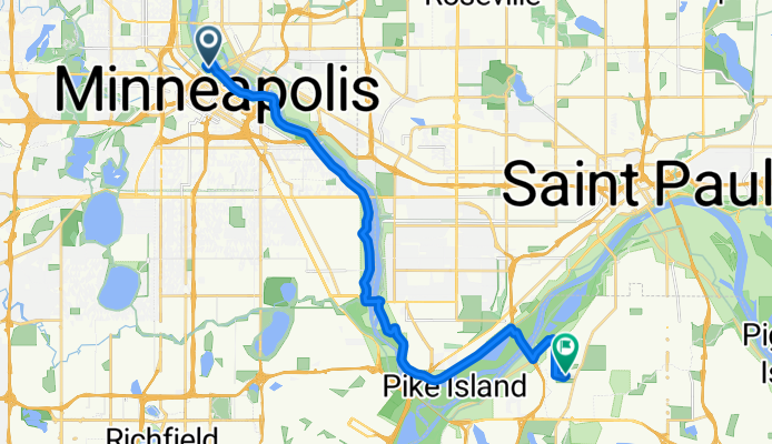
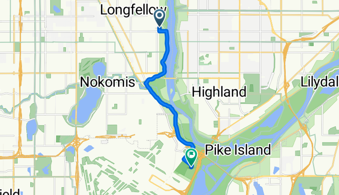
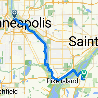
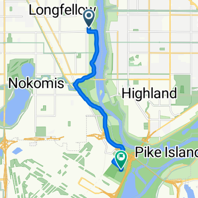
Szablon trasy
Z Minneapolis do Mendota Heights
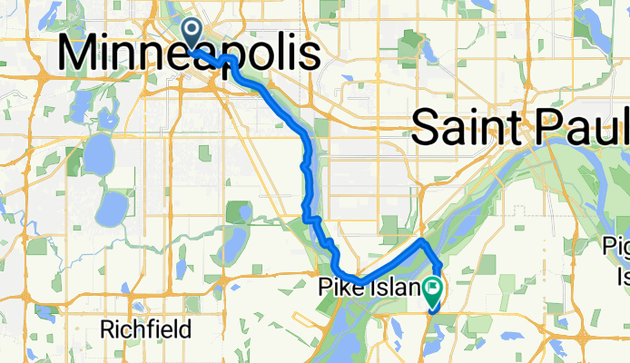
- 1 h 12 min
- Czas
- 21,4 km
- Dystans
- 194 m
- Przewyższenia
- 179 m
- Spadek
- 17,9 km/h
- Śr. Prędkość
- 275 m
- Maks. wysokość
Wspólnota
Najlepsi użytkownicy w tym regionie


Od naszej społeczności
Najlepsze trasy rowerowe z Minneapolis do Mendota Heights

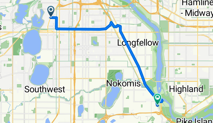
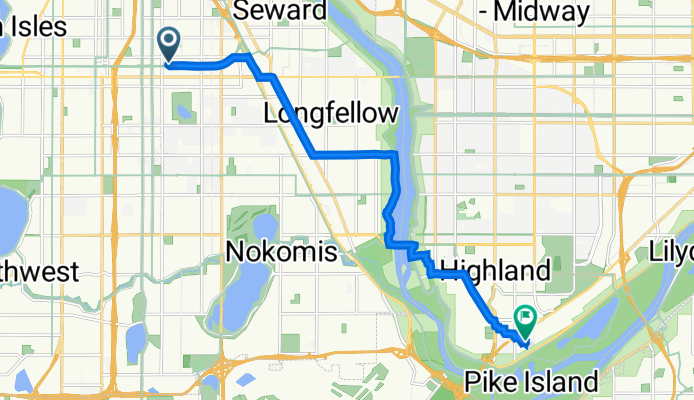
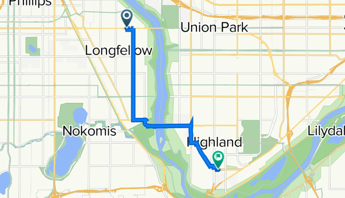
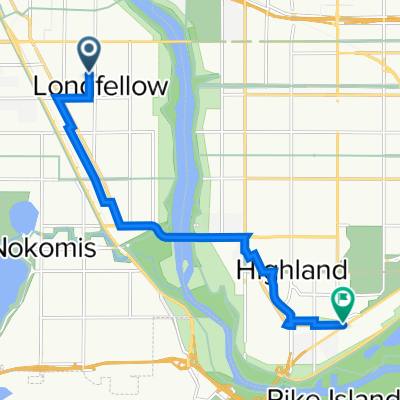
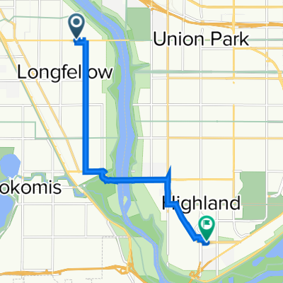
B2B00534 55407>55121 via Hiawatha Trl, Big Rivers Trl, Pilot Knob Rd
Trasa rowerowa w Minneapolis, Minnesota, USA
Because of one-ways will have to go around the parking lot at Ft. Snelling to get back to the path to head toward Minnehaha Park.
The path on Pilot Knob switches sides so use caution when crossing the street near Northland Dr.
- 14,7 km
- Dystans
- 83 m
- Przewyższenia
- 79 m
- Spadek

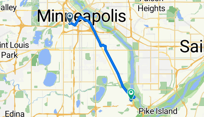
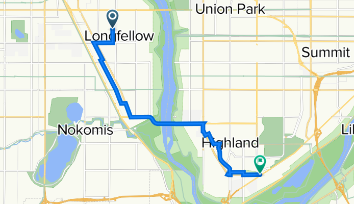
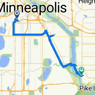
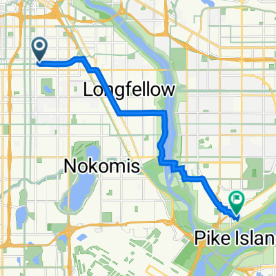
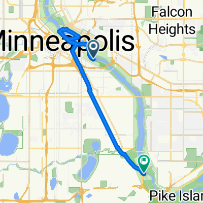
B2B00475 55406>55121 via 46th Ave S, Mendota Bridge, Pilot Knob, Lone Oak Rd
Trasa rowerowa w Minneapolis, Minnesota, USA
Pilot Knob and Lone Oak both have bike paths alongside the road but use caution as sometimes the path switches sides of the road and you will have to cross at marked intersections.
- 18,2 km
- Dystans
- 114 m
- Przewyższenia
- 97 m
- Spadek
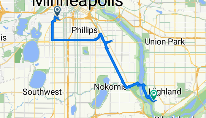
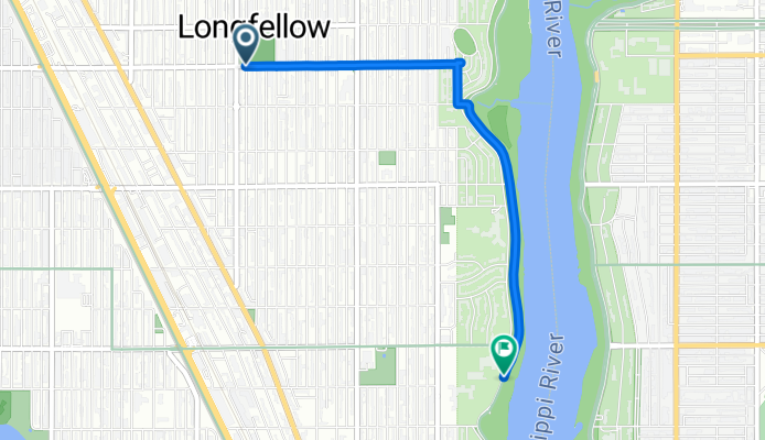
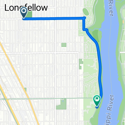
B2B00845 55405>55417 via Greenway, Minnehaha
Trasa rowerowa w Minneapolis, Minnesota, USA
Take 25th east to Bryant. (Note: if you want to cross Hennepin at a light, go to 24th).
Take a right onto Bryant and head south to the Greenway entrance.
Take a left onto the Greenway entrance (between 28th St and 29th St).
Head east on the Greenway until you get to Hiawatha.
Go over the Hiawatha bridge.
Once you're over the bridge, take a gentle left to continue heading east.
You will quickly see Minnehaha.
Take a right onto Minnehaha Avenue which has a bike lane.
Follow Minnehaha Avenue for awhile in the road. At 46th, you can get onto a bike trail on the east side of the street.
Follow that in the bike path until just before you reach the
roundabout, and take a left to head south east on Minnehaha Avenue in
the bike path.Continue on Minnehaha Avenue until your reach 54th St E (note: along the way Minnehaha turns into River pkwy)Take a right on 54th St. to cross Hiawatha.Continue on 54th about 2 blocks and take a left onto Minnehaha Avenue.Continue on Minnehaha to your destination.
- 12,7 km
- Dystans
- 0 m
- Przewyższenia
- 17 m
- Spadek
B2B00442 55403 > 55417 via DT Mpls, LRT Trail, Minnehaha
Trasa rowerowa w Minneapolis, Minnesota, USA
Take Yale to 12th St
Take a right onto 12th St which has a bike lane.
Continue on 12th St in the bike lane to 2nd Ave S.
Take a left onto 2nd Ave S into the bike lane. Note: the bike lane on second is in the opposite direction of traffic.
Continue on 2nd Ave until you reach 4th St.
Take a right onto 4th St into the bike lane in the middle of the street. Note: buses go in opposite direction, but you go in the same direction as the cars.
Continue on 4th St to 11th Avenue.
Take a left onto 11th Avenue into the bike lane. Note: the bike lane on 4th street unfortunately ends at Chicago, but you only have to go about 1 more block to reach 11th Ave.
You'll quickly reach the Light Rail tracks - look for the entrance to a bike path to your right.
Take a right onto the LRT trail and take that all the way to 26th St.
Carefully cross 26th Street. You will see a bike bridge going over Hiawatha - do not go over it, rather follow the bike trail as it curves left to Minnehaha Ave.
Take a right onto Minnehaha Avenue which has a bike lane.
Follow Minnehaha Avenue for awhile in the road. At 46th, you can get onto a bike trail on the east side of the street.
Follow that in the bike path until just before you reach the
roundabout, and take a left to head south east on Minnehaha Avenue in
the bike path.<br /><br />Continue on Minnehaha Avenue until your reach 54th St E (note: along the way Minnehaha turns into River pkwy)<br /><br />Take a right on 54th St. to cross Hiawatha.<br /><br />Continue on 54th about 2 blocks and take a left onto Minnehaha Avenue.<br /><br />Continue on Minnehaha to your destination.
- 12,7 km
- Dystans
- 77 m
- Przewyższenia
- 74 m
- Spadek
Clifton Avenue 416, Minneapolis to Itasca Avenue 2086, Saint Paul
Trasa rowerowa w Minneapolis, Minnesota, USA
- 15,7 km
- Dystans
- 35 m
- Przewyższenia
- 29 m
- Spadek
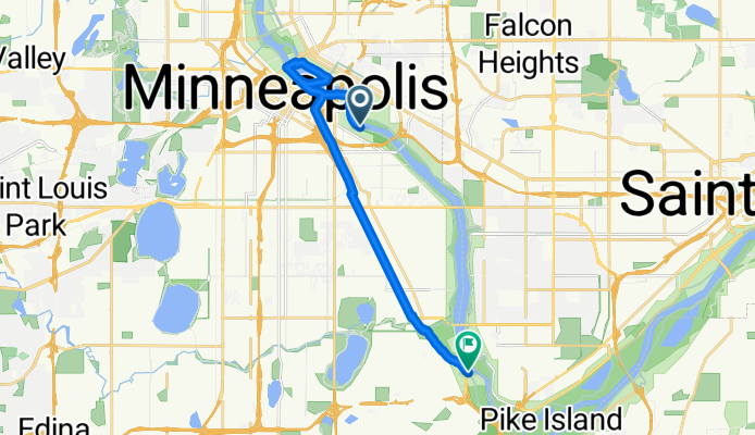
N First St, Minneapolis to Evergreen Knolls, Mendota Heights
Trasa rowerowa w Minneapolis, Minnesota, USA
- 22,5 km
- Dystans
- 144 m
- Przewyższenia
- 118 m
- Spadek
10th Avenue South 2830, Minneapolis to West Maynard Drive 1357W, Saint Paul
Trasa rowerowa w Minneapolis, Minnesota, USA
- 12,2 km
- Dystans
- 47 m
- Przewyższenia
- 33 m
- Spadek
longfellow to bluff
Trasa rowerowa w Minneapolis, Minnesota, USA
- 3,2 km
- Dystans
- 7 m
- Przewyższenia
- 13 m
- Spadek
Mpls - W River & 4th to Stone Arch Bridge and back to Minnehaha
Trasa rowerowa w Minneapolis, Minnesota, USA
- 15,9 km
- Dystans
- 105 m
- Przewyższenia
- 96 m
- Spadek
Odkryj więcej tras
 Clifton Avenue 416, Minneapolis to Itasca Avenue 2086, Saint Paul
- Dystans
- 15,7 km
- Przewyższenia
- 35 m
- Spadek
- 29 m
- Lokalizacja
- Minneapolis, Minnesota, USA
 N First St, Minneapolis to Evergreen Knolls, Mendota Heights
- Dystans
- 22,5 km
- Przewyższenia
- 144 m
- Spadek
- 118 m
- Lokalizacja
- Minneapolis, Minnesota, USA
 testt
testt- Dystans
- 9,1 km
- Przewyższenia
- 59 m
- Spadek
- 65 m
- Lokalizacja
- Minneapolis, Minnesota, USA
 10th Avenue South 2830, Minneapolis to West Maynard Drive 1357W, Saint Paul
- Dystans
- 12,2 km
- Przewyższenia
- 47 m
- Spadek
- 33 m
- Lokalizacja
- Minneapolis, Minnesota, USA
 longfellow to bluff
- Dystans
- 3,2 km
- Przewyższenia
- 7 m
- Spadek
- 13 m
- Lokalizacja
- Minneapolis, Minnesota, USA
 Fort Snelling
- Dystans
- 7,4 km
- Przewyższenia
- 50 m
- Spadek
- 52 m
- Lokalizacja
- Minneapolis, Minnesota, USA
 test2
test2- Dystans
- 8,7 km
- Przewyższenia
- 59 m
- Spadek
- 64 m
- Lokalizacja
- Minneapolis, Minnesota, USA
 Mpls - W River & 4th to Stone Arch Bridge and back to Minnehaha
- Dystans
- 15,9 km
- Przewyższenia
- 105 m
- Spadek
- 96 m
- Lokalizacja
- Minneapolis, Minnesota, USA
Trasy z Minneapolis
Jednodniowa wycieczka rowerowa od
Z Minneapolis do Saint Paul
Jednodniowa wycieczka rowerowa od
Z Minneapolis do Richfield
Szybka przejażdżka rowerowa od
Z Minneapolis do Saint Louis Park
Szybka przejażdżka rowerowa od
Z Minneapolis do Saint Anthony