


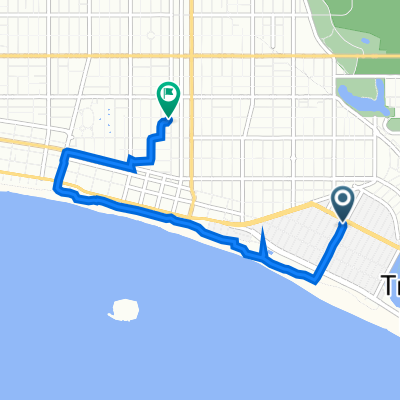
5030 E Second St, Long Beach to 341 N Winnipeg Pl, Long Beach
- 5,4 km
- 19 m
- 6 m
- Seal Beach, Kalifornia, USA

Dostosuj własną trasę na podstawie naszego szablonu lub zobacz, jak nasza społeczność najchętniej jeździ z Seal Beach do Long Beach.
Szablon trasy

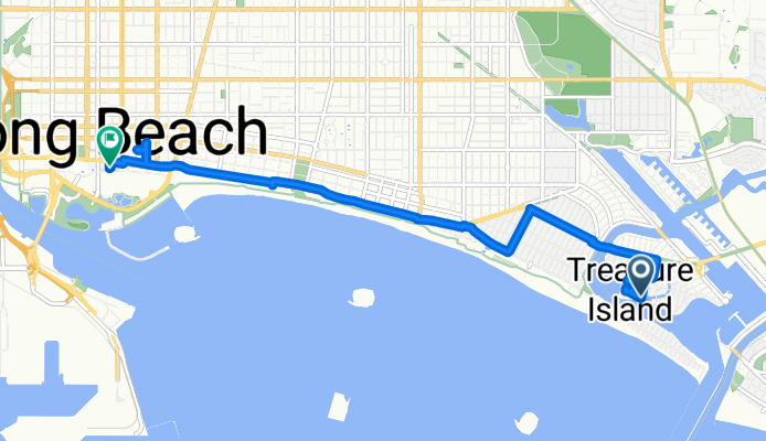
Ready for a classic SoCal ride? Roll out from the laid-back vibe of Seal Beach—a sweet surf town with a charming Main Street and one of California’s longest wooden piers. From here, the route comes in at just over 21 kilometers, mostly along paved cycleways, making this a relaxed yet scenic cruise north toward Long Beach.
You’ll pedal past coastal wetlands and marinas, with the occasional rise (total ascent about 174 meters, so nothing too intense) before dropping gently into Long Beach. Expect a mix of surfaces—while most of the path is paved, there are some stretches where the surface is unlisted, so keep your eyes peeled. The majority of the route is on bike paths and quiet roads, so you can enjoy the salty air and ocean views without much traffic.
Finish in Long Beach, known for its bustling waterfront, the Aquarium of the Pacific, and the famous Queen Mary. If you’ve got time, grab a coffee by the Shoreline or stroll the lively Pike Outlets before heading home!
Wspólnota
Od naszej społeczności
Trasa rowerowa w Seal Beach, Kalifornia, USA
Trasa rowerowa w Seal Beach, Kalifornia, USA
Trasa rowerowa w Seal Beach, Kalifornia, USA
Trasa rowerowa w Seal Beach, Kalifornia, USA
Trasa rowerowa w Seal Beach, Kalifornia, USA
Trasa rowerowa w Seal Beach, Kalifornia, USA
Trasa rowerowa w Seal Beach, Kalifornia, USA
Trasa rowerowa w Seal Beach, Kalifornia, USA
Trasa rowerowa w Seal Beach, Kalifornia, USA
Trasa rowerowa w Seal Beach, Kalifornia, USA


