

Rowerowa z Seattle do Clyde Hill
Dostosuj własną trasę na podstawie naszego szablonu lub zobacz, jak nasza społeczność najchętniej jeździ z Seattle do Clyde Hill.
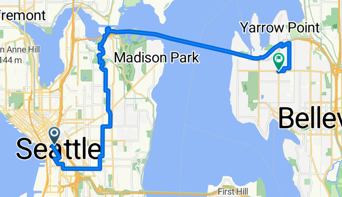
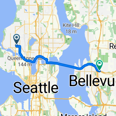
Szablon trasy
Z Seattle do Clyde Hill
- 1 h 5 min
- Czas
- 18,7 km
- Dystans
- 291 m
- Przewyższenia
- 267 m
- Spadek
- 17,3 km/h
- Śr. Prędkość
- 118 m
- Maks. wysokość
Roll out from downtown Seattle and head northeast toward the U District, picking up the Burke-Gilman Trail through Montlake. From there, hop on the SR 520 Trail and glide over Lake Washington—the Evergreen Point Floating Bridge you’ll cross is the longest floating bridge in the world. Expect great views of the skyline and, on a clear day, Mount Rainier.
On the Eastside, exit near Medina and weave through quiet, tree-lined streets to Clyde Hill. The finish packs a punch: you’ll rack up roughly 300 m of climbing overall, with a few short, steep ramps as you crest the hill.
It’s about 19 km, with roughly half on dedicated cycleways and most of the rest on calm neighborhood roads—almost entirely paved. Seattle’s a perfect launchpad with coffee and waterfront vibes; Clyde Hill is a serene, residential hilltop known for big views of Lake Washington and the Olympics. Bring lights for tunnel sections and enjoy the bridge breeze.
Wspólnota
Najlepsi użytkownicy w tym regionie


Od naszej społeczności
Najlepsze trasy rowerowe z Seattle do Clyde Hill

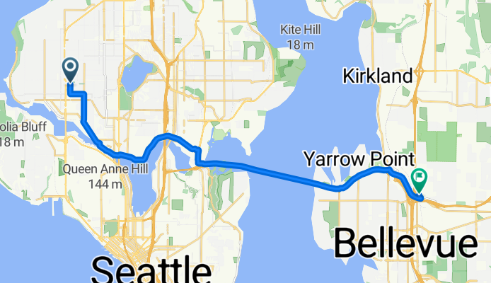
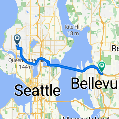
NW 64th St, Seattle to 116th Ave NE, Bellevue
Trasa rowerowa w Seattle, Waszyngton, USA
- 19,3 km
- Dystans
- 151 m
- Przewyższenia
- 140 m
- Spadek
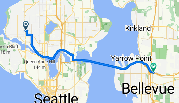
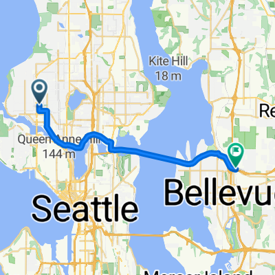
NW 64th St, Seattle to 116th Ave NE, Bellevue
Trasa rowerowa w Seattle, Waszyngton, USA
- 19,4 km
- Dystans
- 162 m
- Przewyższenia
- 152 m
- Spadek
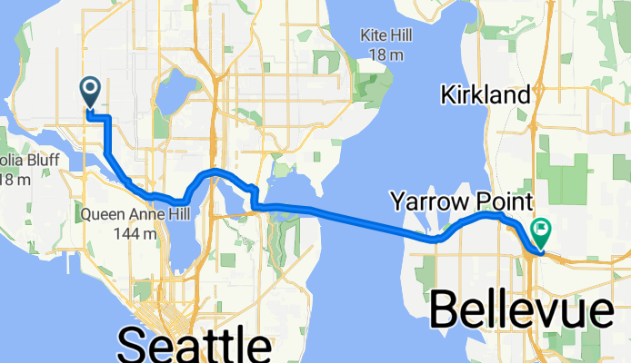
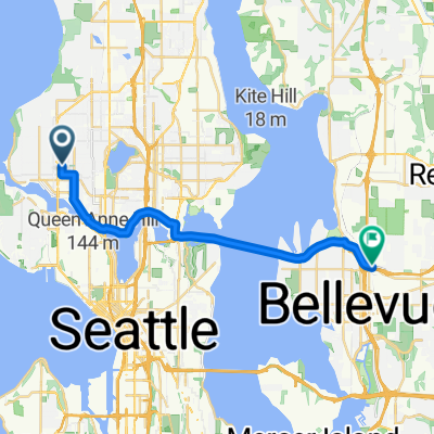
NW 64th St, Seattle to 116th Ave NE, Bellevue
Trasa rowerowa w Seattle, Waszyngton, USA
- 19,5 km
- Dystans
- 162 m
- Przewyższenia
- 157 m
- Spadek

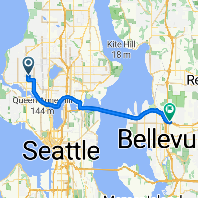
NW 64th St, Seattle to 116th Ave NE, Bellevue
Trasa rowerowa w Seattle, Waszyngton, USA
- 19,3 km
- Dystans
- 156 m
- Przewyższenia
- 146 m
- Spadek

NW 64th St, Seattle to 116th Ave NE, Bellevue
Trasa rowerowa w Seattle, Waszyngton, USA
- 19,8 km
- Dystans
- 178 m
- Przewyższenia
- 169 m
- Spadek

NW 64th St, Seattle to 116th Ave NE, Bellevue
Trasa rowerowa w Seattle, Waszyngton, USA
- 19,2 km
- Dystans
- 148 m
- Przewyższenia
- 140 m
- Spadek

NW 64th St, Seattle to 116th Ave NE, Bellevue
Trasa rowerowa w Seattle, Waszyngton, USA
- 19,2 km
- Dystans
- 142 m
- Przewyższenia
- 131 m
- Spadek

NW 64th St, Seattle to 116th Ave NE, Bellevue
Trasa rowerowa w Seattle, Waszyngton, USA
- 19,2 km
- Dystans
- 147 m
- Przewyższenia
- 140 m
- Spadek

NW 64th St, Seattle to 116th Ave NE, Bellevue
Trasa rowerowa w Seattle, Waszyngton, USA
- 19,2 km
- Dystans
- 150 m
- Przewyższenia
- 141 m
- Spadek

NW 64th St, Seattle to 116th Ave NE, Bellevue
Trasa rowerowa w Seattle, Waszyngton, USA
- 19,3 km
- Dystans
- 142 m
- Przewyższenia
- 131 m
- Spadek

15th Ave NW, Seattle to 116th Ave NE, Bellevue
Trasa rowerowa w Seattle, Waszyngton, USA
- 19,3 km
- Dystans
- 143 m
- Przewyższenia
- 135 m
- Spadek
NW 64th St, Seattle to 116th Ave NE, Bellevue
Trasa rowerowa w Seattle, Waszyngton, USA
- 19,2 km
- Dystans
- 139 m
- Przewyższenia
- 128 m
- Spadek
Odkryj więcej tras
 NW 64th St, Seattle to 116th Ave NE, Bellevue
- Dystans
- 19,8 km
- Przewyższenia
- 178 m
- Spadek
- 169 m
- Lokalizacja
- Seattle, Waszyngton, USA
 NW 64th St, Seattle to 116th Ave NE, Bellevue
- Dystans
- 19,2 km
- Przewyższenia
- 148 m
- Spadek
- 140 m
- Lokalizacja
- Seattle, Waszyngton, USA
 NW 64th St, Seattle to 116th Ave NE, Bellevue
- Dystans
- 19,2 km
- Przewyższenia
- 142 m
- Spadek
- 131 m
- Lokalizacja
- Seattle, Waszyngton, USA
 NW 64th St, Seattle to 116th Ave NE, Bellevue
- Dystans
- 19,2 km
- Przewyższenia
- 147 m
- Spadek
- 140 m
- Lokalizacja
- Seattle, Waszyngton, USA
 NW 64th St, Seattle to 116th Ave NE, Bellevue
- Dystans
- 19,2 km
- Przewyższenia
- 150 m
- Spadek
- 141 m
- Lokalizacja
- Seattle, Waszyngton, USA
 NW 64th St, Seattle to 116th Ave NE, Bellevue
- Dystans
- 19,3 km
- Przewyższenia
- 142 m
- Spadek
- 131 m
- Lokalizacja
- Seattle, Waszyngton, USA
 15th Ave NW, Seattle to 116th Ave NE, Bellevue
- Dystans
- 19,3 km
- Przewyższenia
- 143 m
- Spadek
- 135 m
- Lokalizacja
- Seattle, Waszyngton, USA
 NW 64th St, Seattle to 116th Ave NE, Bellevue
- Dystans
- 19,2 km
- Przewyższenia
- 139 m
- Spadek
- 128 m
- Lokalizacja
- Seattle, Waszyngton, USA
Trasy z Seattle
Jednodniowa wycieczka rowerowa od
Z Seattle do Shoreline
Rowerowa od
Z Seattle do Yarrow Point
Rowerowa od
Z Seattle do Mercer Island