

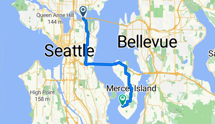
Rowerowa z Seattle do Mercer Island
Dostosuj własną trasę na podstawie naszego szablonu lub zobacz, jak nasza społeczność najchętniej jeździ z Seattle do Mercer Island.
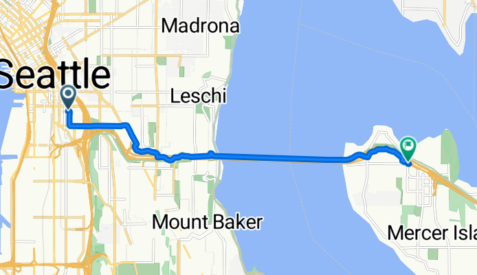
Szablon trasy
Z Seattle do Mercer Island

- 43 min
- Czas
- 12,8 km
- Dystans
- 201 m
- Przewyższenia
- 173 m
- Spadek
- 17,8 km/h
- Śr. Prędkość
- 105 m
- Maks. wysokość
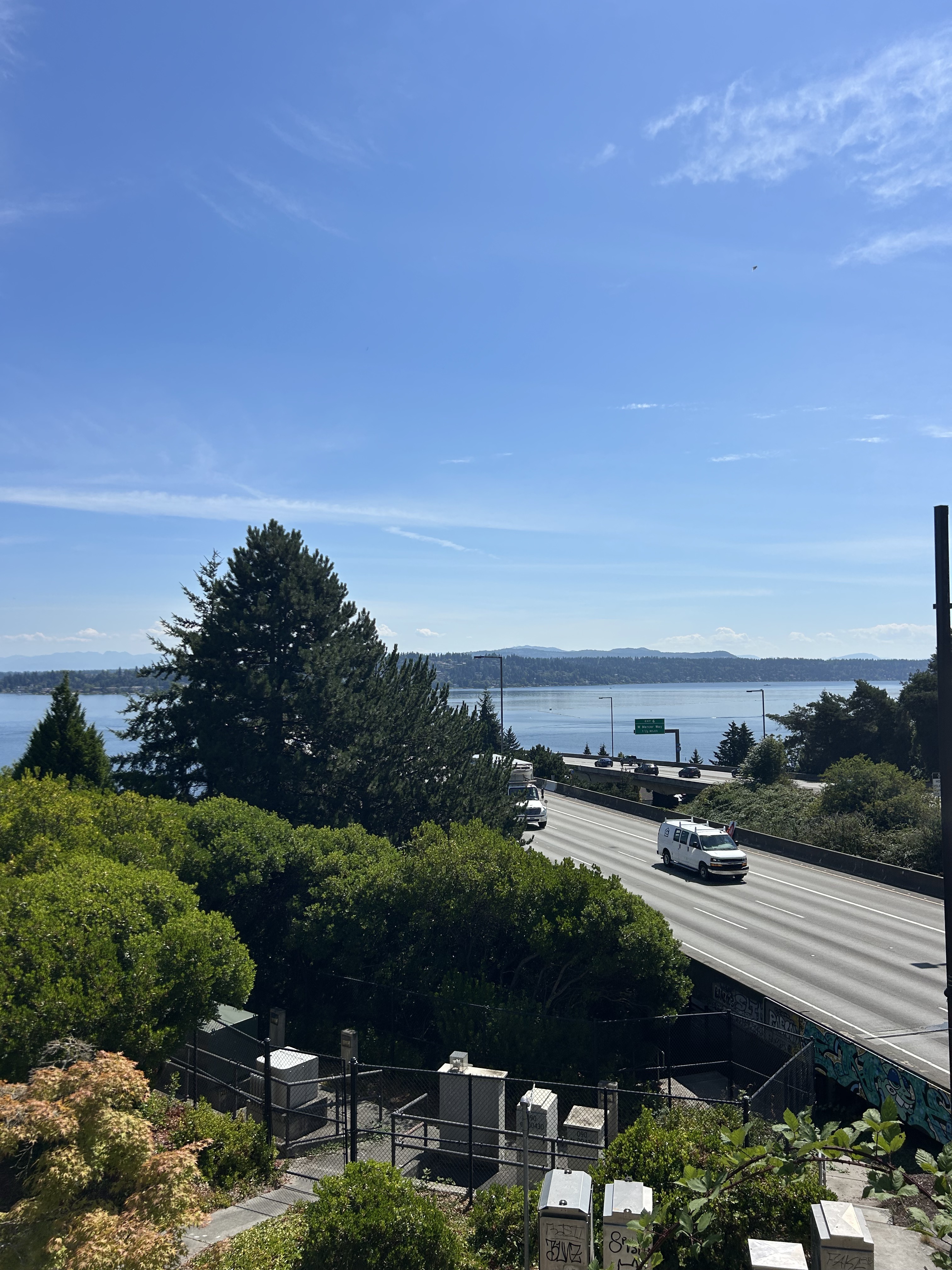
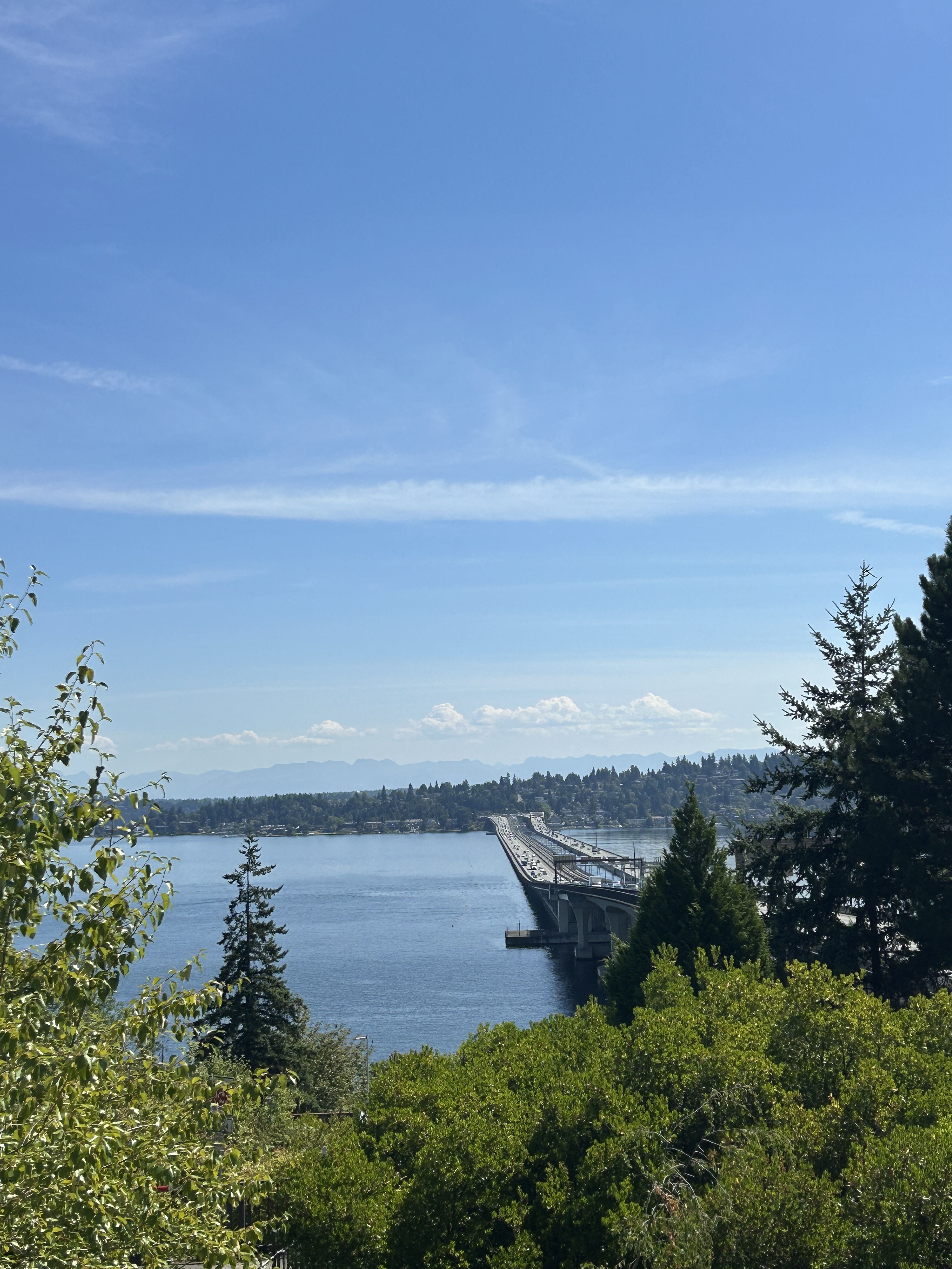
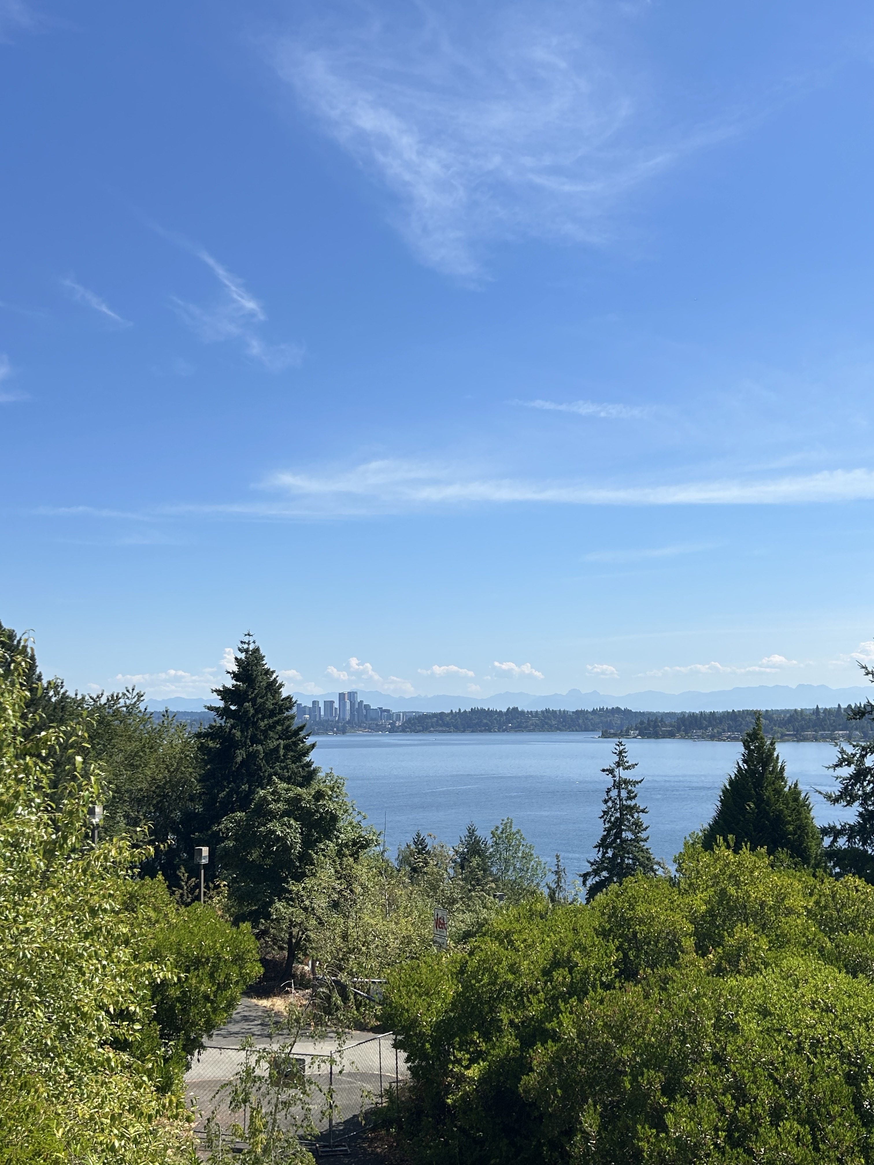
Ready for a unique ride? Start in the heart of Seattle, then head east, weaving through city streets until you reach the car-free I-90 Trail that stretches out across Lake Washington. Riding across the iconic floating bridge is a one-of-a-kind Northwest experience—you’ll have amazing views of Mt. Rainier if it’s clear, and the Seattle skyline behind you is unforgettable.
You’ll cross over to Mercer Island, a leafy and upscale residential island with tranquil parks and waterfront paths. The route is mostly flat with a few gentle climbs, and almost three-quarters is solid cycleway, so you can relax and enjoy the scenery. The surface is a mix, mostly paved, and there’s practically no busy road traffic.
Once you reach Mercer Island, check out Luther Burbank Park or grab a coffee at a local café before heading back, or keep exploring—there are lots of routes here for a longer ride. All in all, it’s a classic Seattle-area ride: urban buzz, incredible water views, and peaceful green spaces.
Wspólnota
Najlepsi użytkownicy w tym regionie

Od naszej społeczności
Najlepsze trasy rowerowe z Seattle do Mercer Island
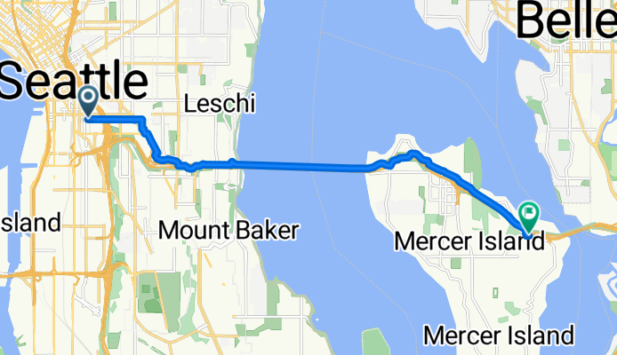
E Hamlin St, Seattle to W Mercer Way, Mercer Island
Trasa rowerowa w Seattle, Waszyngton, USA
- 20,8 km
- Dystans
- 298 m
- Przewyższenia
- 256 m
- Spadek
5th Ave S, Seattle to 76th Ave SE, Mercer Island
Trasa rowerowa w Seattle, Waszyngton, USA
- 8,3 km
- Dystans
- 98 m
- Przewyższenia
- 81 m
- Spadek

BEACON HILL - MERCER ISLAND
Trasa rowerowa w Seattle, Waszyngton, USA
- 26,5 km
- Dystans
- 225 m
- Przewyższenia
- 243 m
- Spadek

305 Harrison St, Seattle to Seattle
Trasa rowerowa w Seattle, Waszyngton, USA
- 15,1 km
- Dystans
- 259 m
- Przewyższenia
- 261 m
- Spadek

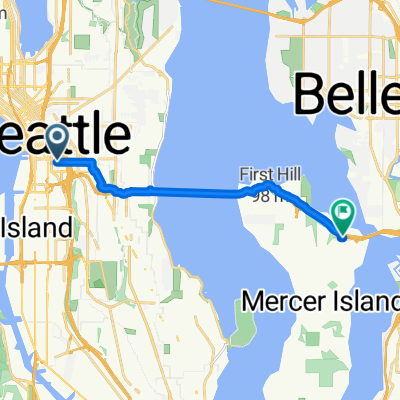
213 21st Ave, Seattle to I-90 Trail, Mercer Island
Trasa rowerowa w Seattle, Waszyngton, USA
- 7 km
- Dystans
- 62 m
- Przewyższenia
- 124 m
- Spadek

1120 Spring St, Seattle to 6523 43rd Ave S, Seattle
Trasa rowerowa w Seattle, Waszyngton, USA
- 10,4 km
- Dystans
- 148 m
- Przewyższenia
- 218 m
- Spadek

1050 S Jackson St, Seattle to Mount Baker, Seattle
Trasa rowerowa w Seattle, Waszyngton, USA
- 9,5 km
- Dystans
- 168 m
- Przewyższenia
- 210 m
- Spadek

University Street 1100, Seattle to 82nd Avenue Southeast 1980, Mercer Island
Trasa rowerowa w Seattle, Waszyngton, USA
- 10,8 km
- Dystans
- 103 m
- Przewyższenia
- 168 m
- Spadek

1101–1193 Spring St, Seattle to 6523 43rd Ave S, Seattle
Trasa rowerowa w Seattle, Waszyngton, USA
- 9,7 km
- Dystans
- 118 m
- Przewyższenia
- 187 m
- Spadek

UW - Lake Washington Blvd - Seward Park
Trasa rowerowa w Seattle, Waszyngton, USA
- 18,1 km
- Dystans
- 106 m
- Przewyższenia
- 112 m
- Spadek

9th Avenue 1800, Seattle to Courtland Place South 3638B, Seattle
Trasa rowerowa w Seattle, Waszyngton, USA
- 10,4 km
- Dystans
- 127 m
- Przewyższenia
- 138 m
- Spadek
Chinatown to Mercer Island
Trasa rowerowa w Seattle, Waszyngton, USA
- 10,5 km
- Dystans
- 140 m
- Przewyższenia
- 127 m
- Spadek
Odkryj więcej tras
 213 21st Ave, Seattle to I-90 Trail, Mercer Island
- Dystans
- 7 km
- Przewyższenia
- 62 m
- Spadek
- 124 m
- Lokalizacja
- Seattle, Waszyngton, USA
 1120 Spring St, Seattle to 6523 43rd Ave S, Seattle
- Dystans
- 10,4 km
- Przewyższenia
- 148 m
- Spadek
- 218 m
- Lokalizacja
- Seattle, Waszyngton, USA
 1050 S Jackson St, Seattle to Mount Baker, Seattle
- Dystans
- 9,5 km
- Przewyższenia
- 168 m
- Spadek
- 210 m
- Lokalizacja
- Seattle, Waszyngton, USA
 University Street 1100, Seattle to 82nd Avenue Southeast 1980, Mercer Island
- Dystans
- 10,8 km
- Przewyższenia
- 103 m
- Spadek
- 168 m
- Lokalizacja
- Seattle, Waszyngton, USA
 1101–1193 Spring St, Seattle to 6523 43rd Ave S, Seattle
- Dystans
- 9,7 km
- Przewyższenia
- 118 m
- Spadek
- 187 m
- Lokalizacja
- Seattle, Waszyngton, USA
 UW - Lake Washington Blvd - Seward Park
- Dystans
- 18,1 km
- Przewyższenia
- 106 m
- Spadek
- 112 m
- Lokalizacja
- Seattle, Waszyngton, USA
 9th Avenue 1800, Seattle to Courtland Place South 3638B, Seattle
- Dystans
- 10,4 km
- Przewyższenia
- 127 m
- Spadek
- 138 m
- Lokalizacja
- Seattle, Waszyngton, USA
 Chinatown to Mercer Island
- Dystans
- 10,5 km
- Przewyższenia
- 140 m
- Spadek
- 127 m
- Lokalizacja
- Seattle, Waszyngton, USA
Trasy z Seattle
Jednodniowa wycieczka rowerowa od
Z Seattle do Shoreline
Rowerowa od
Z Seattle do White Center
Rowerowa od
Z Seattle do Yarrow Point