

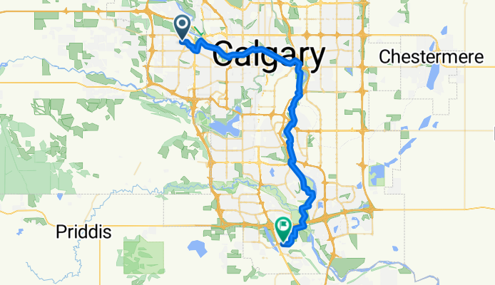
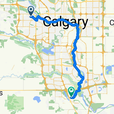
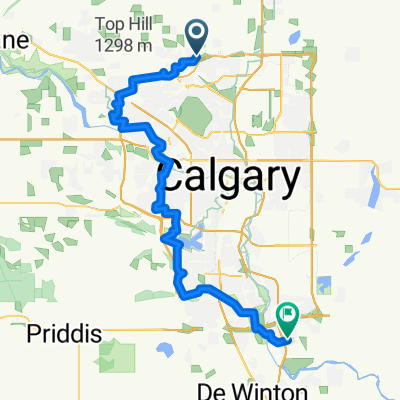
Szablon trasy
Z Calgary do Okotoks

- 3 h 55 min
- Czas
- 66,4 km
- Dystans
- 353 m
- Przewyższenia
- 328 m
- Spadek
- 16,9 km/h
- Śr. Prędkość
- 1158 m
- Maks. wysokość
Looking for a ride that takes you from city vibes to small-town charm? This one’s for you! Start your adventure in Calgary, the heart of Alberta—famous for its downtown skyline, bustling neighborhoods, and as the gateway to the Rocky Mountains. From here, head south out of the city on a mostly paved route with a gentle mix of cycle paths and quiet rural roads.
You’ll cruise past sprawling fields and classic prairie scenery, catching glimpses of the Rockies on a clear day. While there are a few rolling hills (about 350 meters of climbing in total), nothing too daunting—just enough to keep things interesting!
After roughly 66 km, you’ll roll into Okotoks, a friendly town known for its huge glacial erratic rock and relaxed pace. Grab a coffee, stretch your legs, and explore the local shops before your journey back or onward.
With mostly paved surfaces and bike-friendly paths (over half the route is on dedicated cycleways), it’s a relaxing ride for anyone looking to escape the city and enjoy some small-town atmosphere. Just be sure to check your route for those few unpaved bits before you roll!
Wspólnota
Najlepsi użytkownicy w tym regionie


Od naszej społeczności
Najlepsze trasy rowerowe z Calgary do Okotoks

Bridlewood - Okotoks
Trasa rowerowa w Calgary, Alberta, Kanada
- 27,4 km
- Dystans
- 220 m
- Przewyższenia
- 254 m
- Spadek


Somerset Station to Okotoks
Trasa rowerowa w Calgary, Alberta, Kanada
- 29,9 km
- Dystans
- 278 m
- Przewyższenia
- 255 m
- Spadek

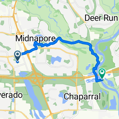
Coachway Gdns SW, Calgary to Walden Gate SE, Calgary
Trasa rowerowa w Calgary, Alberta, Kanada
- 41,7 km
- Dystans
- 177 m
- Przewyższenia
- 355 m
- Spadek
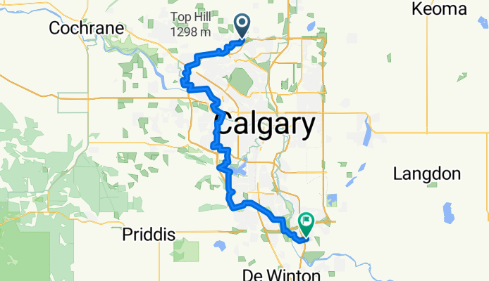
Calgary - Okotoks
Trasa rowerowa w Calgary, Alberta, Kanada
- 74,1 km
- Dystans
- 364 m
- Przewyższenia
- 447 m
- Spadek

15915 MacLeod Trail SE, Calgary to 35 Silverado Plains Manor SW, Calgary
Trasa rowerowa w Calgary, Alberta, Kanada
- 4,7 km
- Dystans
- 31 m
- Przewyższenia
- 4 m
- Spadek
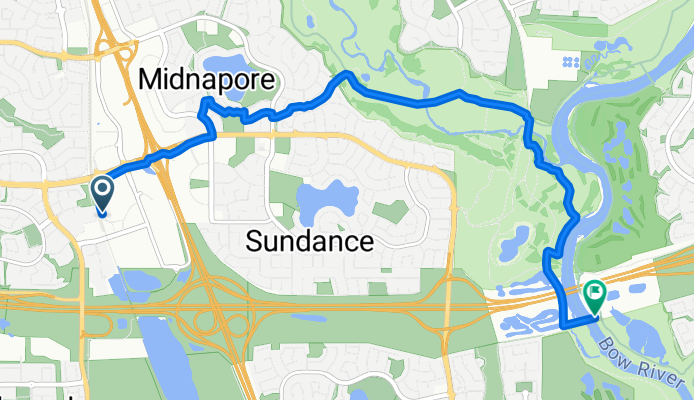
Shawville Blvd SE, Calgary to Fish Creek Park, Calgary
Trasa rowerowa w Calgary, Alberta, Kanada
- 8,2 km
- Dystans
- 6 m
- Przewyższenia
- 55 m
- Spadek

252 Evermeadow Ave SW, Calgary to 411 Legacy Village Way SE, Calgary
Trasa rowerowa w Calgary, Alberta, Kanada
- 22,7 km
- Dystans
- 98 m
- Przewyższenia
- 167 m
- Spadek

McKenzie Meadows Dr SE, Calgary to Fish Creek Park, Calgary
Trasa rowerowa w Calgary, Alberta, Kanada
- 0,6 km
- Dystans
- 0 m
- Przewyższenia
- 0 m
- Spadek

Route to 16 Chaparral Cove SE, Calgary
Trasa rowerowa w Calgary, Alberta, Kanada
- 9,4 km
- Dystans
- 80 m
- Przewyższenia
- 35 m
- Spadek

Home to Seton (ibk)
Trasa rowerowa w Calgary, Alberta, Kanada
- 44,3 km
- Dystans
- 49 m
- Przewyższenia
- 113 m
- Spadek
Odkryj więcej tras
 Coachway Gdns SW, Calgary to Walden Gate SE, Calgary
- Dystans
- 41,7 km
- Przewyższenia
- 177 m
- Spadek
- 355 m
- Lokalizacja
- Calgary, Alberta, Kanada
 Calgary - Okotoks
- Dystans
- 74,1 km
- Przewyższenia
- 364 m
- Spadek
- 447 m
- Lokalizacja
- Calgary, Alberta, Kanada
 15915 MacLeod Trail SE, Calgary to 35 Silverado Plains Manor SW, Calgary
- Dystans
- 4,7 km
- Przewyższenia
- 31 m
- Spadek
- 4 m
- Lokalizacja
- Calgary, Alberta, Kanada
 Shawville Blvd SE, Calgary to Fish Creek Park, Calgary
- Dystans
- 8,2 km
- Przewyższenia
- 6 m
- Spadek
- 55 m
- Lokalizacja
- Calgary, Alberta, Kanada
 252 Evermeadow Ave SW, Calgary to 411 Legacy Village Way SE, Calgary
- Dystans
- 22,7 km
- Przewyższenia
- 98 m
- Spadek
- 167 m
- Lokalizacja
- Calgary, Alberta, Kanada
 McKenzie Meadows Dr SE, Calgary to Fish Creek Park, Calgary
- Dystans
- 0,6 km
- Przewyższenia
- 0 m
- Spadek
- 0 m
- Lokalizacja
- Calgary, Alberta, Kanada
 Route to 16 Chaparral Cove SE, Calgary
- Dystans
- 9,4 km
- Przewyższenia
- 80 m
- Spadek
- 35 m
- Lokalizacja
- Calgary, Alberta, Kanada
 Home to Seton (ibk)
- Dystans
- 44,3 km
- Przewyższenia
- 49 m
- Spadek
- 113 m
- Lokalizacja
- Calgary, Alberta, Kanada
Trasy z Calgary
Jednodniowa wycieczka rowerowa od
Z Calgary do Chestermere