
Jednodniowa wycieczka rowerowa z West End do West Vancouver
Dostosuj własną trasę na podstawie naszego szablonu lub zobacz, jak nasza społeczność najchętniej jeździ z West End do West Vancouver.
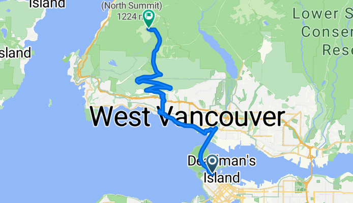
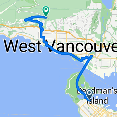
Szablon trasy
Z West End do West Vancouver

- 2 h 49 min
- Czas
- 24,9 km
- Dystans
- 1229 m
- Przewyższenia
- 489 m
- Spadek
- 8,8 km/h
- Śr. Prędkość
- 820 m
- Maks. wysokość
Starting off in Vancouver’s lively West End, you’ll trace an epic 25 km ride all the way to the scenic neighborhoods of West Vancouver. Prepare for some strong climbing (with over 1200 meters of elevation gain!) as you leave the city’s buzz behind for some beautiful North Shore hills.
The route mixes things up between paved roads and gravel sections, linking cycleways, quiet side roads, and a few tracks. Expect about half the ride on smooth tarmac, but keep your tires ready for some adventurous bits—especially as you ascend towards the highest elevations at more than 800 meters.
West End is known for its beach vibes, vibrant bars, and easy access to Stanley Park—so don’t forget to fuel up at a café before setting out. When you finish in West Vancouver, you’ll be greeted by stunning sea views and laid-back suburban streets, perfect for a post-ride cool down. It’s a challenging ride, but with city skylines, forested paths, and that sense of achievement at every turn, it’ll be worth every pedal stroke!
Wspólnota
Najlepsi użytkownicy w tym regionie


Od naszej społeczności
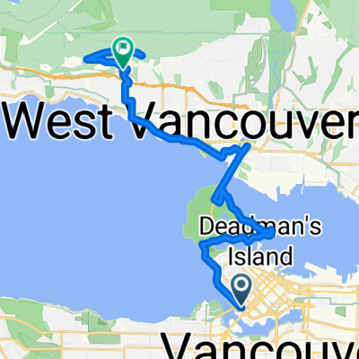
Najlepsze trasy rowerowe z West End do West Vancouver

Cypress Mountain
Trasa rowerowa w West End, Kolumbia Brytyjska, Kanada
- 27,9 km
- Dystans
- 1011 m
- Przewyższenia
- 106 m
- Spadek

Taylor Way, Capilano 5 to 3640 Mathers Ave, West Vancouver
Trasa rowerowa w West End, Kolumbia Brytyjska, Kanada
- 6,8 km
- Dystans
- 197 m
- Przewyższenia
- 125 m
- Spadek

cypress first level
Trasa rowerowa w West End, Kolumbia Brytyjska, Kanada
- 31,7 km
- Dystans
- 1062 m
- Przewyższenia
- 182 m
- Spadek

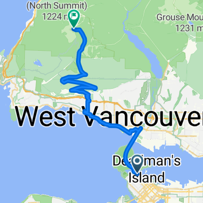
0 Cypress Mt 1h30min
Trasa rowerowa w West End, Kolumbia Brytyjska, Kanada
- 25,1 km
- Dystans
- 1084 m
- Przewyższenia
- 210 m
- Spadek

Cypress Lookout
Trasa rowerowa w West End, Kolumbia Brytyjska, Kanada
- 16,5 km
- Dystans
- 607 m
- Przewyższenia
- 202 m
- Spadek

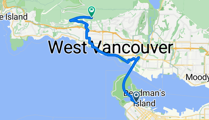
Stanley to West Van
Trasa rowerowa w West End, Kolumbia Brytyjska, Kanada
- 14 km
- Dystans
- 245 m
- Przewyższenia
- 287 m
- Spadek

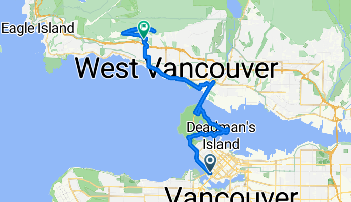
downtown cypress
Trasa rowerowa w West End, Kolumbia Brytyjska, Kanada
- 18,8 km
- Dystans
- 755 m
- Przewyższenia
- 331 m
- Spadek
Menchions Mews, Vancouver to Cypress Bowl Rd, West Vancouver
Trasa rowerowa w West End, Kolumbia Brytyjska, Kanada
- 25 km
- Dystans
- 1007 m
- Przewyższenia
- 96 m
- Spadek
Bayshore Dr, Vancouver to Cypress Bowl Rd, West Vancouver
Trasa rowerowa w West End, Kolumbia Brytyjska, Kanada
- 15,1 km
- Dystans
- 551 m
- Przewyższenia
- 151 m
- Spadek
Howe St, Vancouver to Chairlift Rd, West Vancouver
Trasa rowerowa w West End, Kolumbia Brytyjska, Kanada
- 25,3 km
- Dystans
- 530 m
- Przewyższenia
- 355 m
- Spadek

295–299 Tomahawk Ave, Capilano 5 to 1381 27th St, West Vancouver
Trasa rowerowa w West End, Kolumbia Brytyjska, Kanada
- 4,8 km
- Dystans
- 31 m
- Przewyższenia
- 22 m
- Spadek

Stovold Ln, Vancouver to 1548 Argyle Ave, West Vancouver
Trasa rowerowa w West End, Kolumbia Brytyjska, Kanada
- 30,2 km
- Dystans
- 768 m
- Przewyższenia
- 795 m
- Spadek
Odkryj więcej tras
 Cypress Lookout
- Dystans
- 16,5 km
- Przewyższenia
- 607 m
- Spadek
- 202 m
- Lokalizacja
- West End, Kolumbia Brytyjska, Kanada
 Stanley to West Van
- Dystans
- 14 km
- Przewyższenia
- 245 m
- Spadek
- 287 m
- Lokalizacja
- West End, Kolumbia Brytyjska, Kanada
 downtown cypress
- Dystans
- 18,8 km
- Przewyższenia
- 755 m
- Spadek
- 331 m
- Lokalizacja
- West End, Kolumbia Brytyjska, Kanada
 Menchions Mews, Vancouver to Cypress Bowl Rd, West Vancouver
- Dystans
- 25 km
- Przewyższenia
- 1007 m
- Spadek
- 96 m
- Lokalizacja
- West End, Kolumbia Brytyjska, Kanada
 Bayshore Dr, Vancouver to Cypress Bowl Rd, West Vancouver
- Dystans
- 15,1 km
- Przewyższenia
- 551 m
- Spadek
- 151 m
- Lokalizacja
- West End, Kolumbia Brytyjska, Kanada
 Howe St, Vancouver to Chairlift Rd, West Vancouver
- Dystans
- 25,3 km
- Przewyższenia
- 530 m
- Spadek
- 355 m
- Lokalizacja
- West End, Kolumbia Brytyjska, Kanada
 295–299 Tomahawk Ave, Capilano 5 to 1381 27th St, West Vancouver
- Dystans
- 4,8 km
- Przewyższenia
- 31 m
- Spadek
- 22 m
- Lokalizacja
- West End, Kolumbia Brytyjska, Kanada
 Stovold Ln, Vancouver to 1548 Argyle Ave, West Vancouver
- Dystans
- 30,2 km
- Przewyższenia
- 768 m
- Spadek
- 795 m
- Lokalizacja
- West End, Kolumbia Brytyjska, Kanada
Trasy z West End
Jednodniowa wycieczka rowerowa od
Z West End do New Westminster
Jednodniowa wycieczka rowerowa od
Z West End do Port Moody
Szybka przejażdżka rowerowa od
Z West End do Vancouver
Szybka przejażdżka rowerowa od
Z West End do North Vancouver
Trasy do West Vancouver
Jednodniowa wycieczka rowerowa od
Z North Vancouver do West Vancouver