
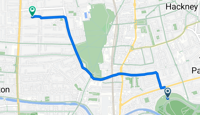
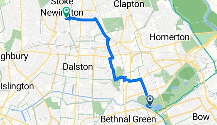
Szybka przejażdżka rowerowa z Bethnal Green do Hackney
Dostosuj własną trasę na podstawie naszego szablonu lub zobacz, jak nasza społeczność najchętniej jeździ z Bethnal Green do Hackney.
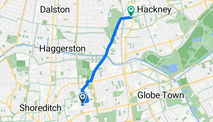
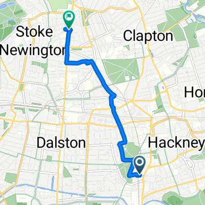
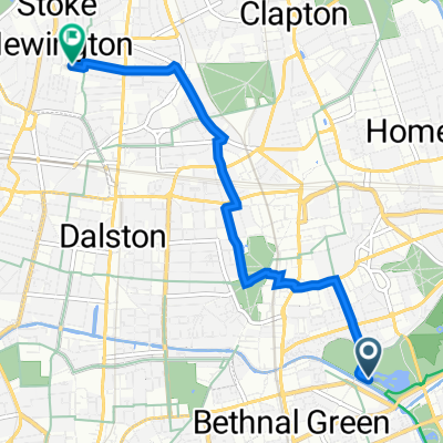
Szablon trasy
Z Bethnal Green do Hackney
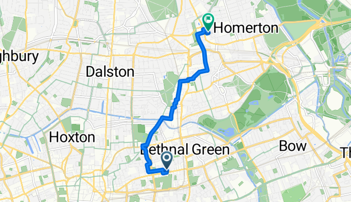
- 14 min
- Czas
- 4,2 km
- Dystans
- 7 m
- Przewyższenia
- 9 m
- Spadek
- 17,8 km/h
- Śr. Prędkość
- 23 m
- Maks. wysokość
This cycling route takes you from the vibrant streets of Bethnal Green up to the creative hub of Hackney—a journey of just over 4 km, perfect for a relaxed ride. You’ll mostly roll along quiet roads and cycleways, so expect a stress-free cruise with very little elevation—just enough to keep it interesting!
Bethnal Green is known for its lively markets and historic architecture, and you'll notice the blend of East London’s old and new as you pedal northward. The path gently weaves through leafy residential areas, with about 90% of it paved and only a few short stretches on paving stones—your tires will thank you.
On arrival in Hackney, you’ll find yourself surrounded by indie cafes, street art, and green spaces like London Fields. Whether you’re a local exploring your boroughs or a visitor hopping between London’s coolest neighborhoods, this route gives you a real taste of East End character with minimal hassle. Happy cycling!
Wspólnota
Najlepsi użytkownicy w tym regionie


Od naszej społeczności
Najlepsze trasy rowerowe z Bethnal Green do Hackney
12/07
Trasa rowerowa w Bethnal Green, Anglia, Zjednoczone Królestwo Wielkiej Brytanii
- 54,4 km
- Dystans
- 252 m
- Przewyższenia
- 258 m
- Spadek
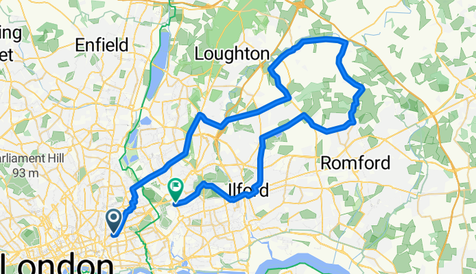
Essex Lanes - The Autumn Edition
Trasa rowerowa w Bethnal Green, Anglia, Zjednoczone Królestwo Wielkiej Brytanii
- 82,2 km
- Dystans
- 571 m
- Przewyższenia
- 568 m
- Spadek
19 Warburton Road, London to 21 Oldfield Road, London
Trasa rowerowa w Bethnal Green, Anglia, Zjednoczone Królestwo Wielkiej Brytanii
- 3,7 km
- Dystans
- 39 m
- Przewyższenia
- 35 m
- Spadek
Bethnal Green Road, London to Pilgrims Lodge, London
Trasa rowerowa w Bethnal Green, Anglia, Zjednoczone Królestwo Wielkiej Brytanii
- 2,5 km
- Dystans
- 22 m
- Przewyższenia
- 21 m
- Spadek
51.537, -0.057 to 51.552, -0.044
Trasa rowerowa w Bethnal Green, Anglia, Zjednoczone Królestwo Wielkiej Brytanii
- 2,7 km
- Dystans
- 20 m
- Przewyższenia
- 56 m
- Spadek
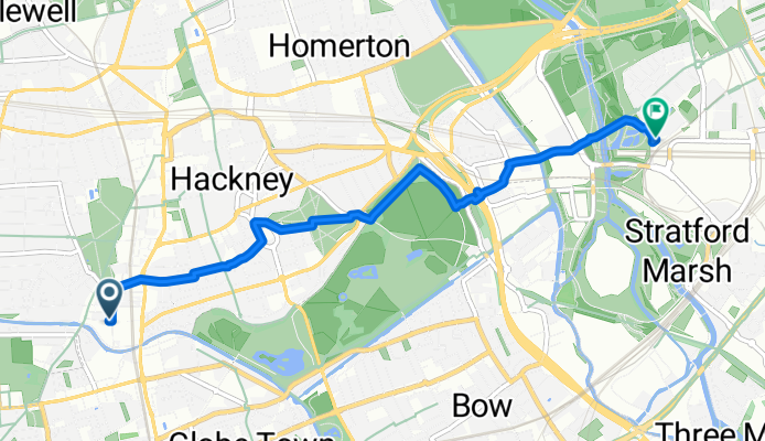
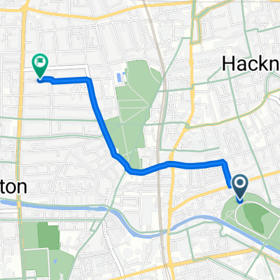
Hollybush Place, London to Navigators Walk, London
Trasa rowerowa w Bethnal Green, Anglia, Zjednoczone Królestwo Wielkiej Brytanii
- 3,4 km
- Dystans
- 0 m
- Przewyższenia
- 9 m
- Spadek
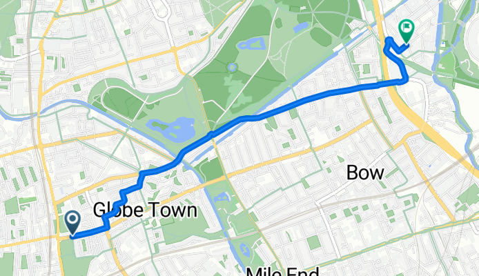
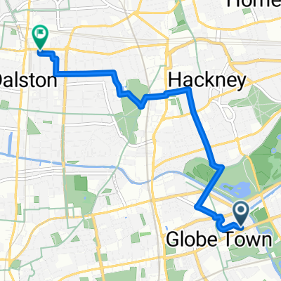
Pritchard's Road, London to Glade Walk, London
Trasa rowerowa w Bethnal Green, Anglia, Zjednoczone Królestwo Wielkiej Brytanii
- 4,8 km
- Dystans
- 13 m
- Przewyższenia
- 23 m
- Spadek
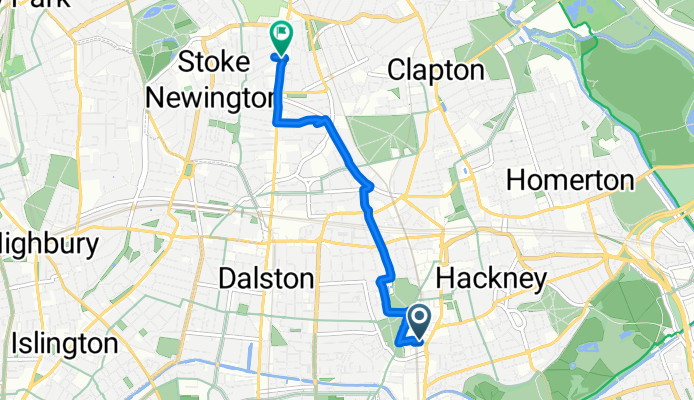
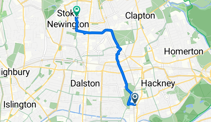
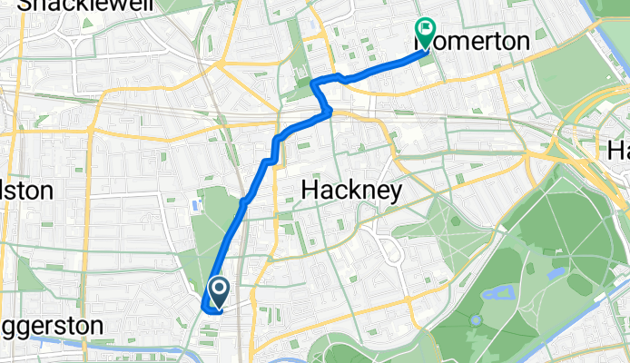
2-18 Warburton Road, London to 99A Stoke Newington High Street, London
Trasa rowerowa w Bethnal Green, Anglia, Zjednoczone Królestwo Wielkiej Brytanii
- 3,9 km
- Dystans
- 107 m
- Przewyższenia
- 100 m
- Spadek
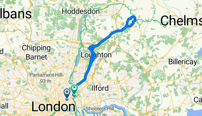
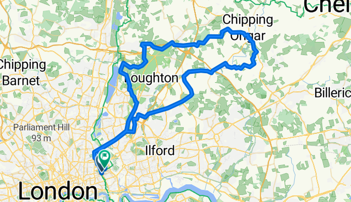
The Only Way is Epping (forest) Long version
Trasa rowerowa w Bethnal Green, Anglia, Zjednoczone Królestwo Wielkiej Brytanii
- 72,4 km
- Dystans
- 331 m
- Przewyższenia
- 332 m
- Spadek
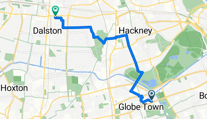
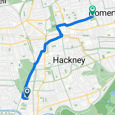
6–10 Gore Road, London to 92 Lenthall Road, London
Trasa rowerowa w Bethnal Green, Anglia, Zjednoczone Królestwo Wielkiej Brytanii
- 1,8 km
- Dystans
- 0 m
- Przewyższenia
- 3 m
- Spadek
Mace Street to Dalston Lane
Trasa rowerowa w Bethnal Green, Anglia, Zjednoczone Królestwo Wielkiej Brytanii
- 4,2 km
- Dystans
- 6 m
- Przewyższenia
- 3 m
- Spadek
Tower Hamlets, London to 33 Allen Road, London
Trasa rowerowa w Bethnal Green, Anglia, Zjednoczone Królestwo Wielkiej Brytanii
- 4,6 km
- Dystans
- 49 m
- Przewyższenia
- 40 m
- Spadek
Odkryj więcej tras
 51.537, -0.057 to 51.552, -0.044
- Dystans
- 2,7 km
- Przewyższenia
- 20 m
- Spadek
- 56 m
- Lokalizacja
- Bethnal Green, Anglia, Zjednoczone Królestwo Wielkiej Brytanii
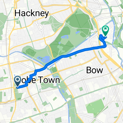 Hollybush Place, London to Navigators Walk, London
- Dystans
- 3,4 km
- Przewyższenia
- 0 m
- Spadek
- 9 m
- Lokalizacja
- Bethnal Green, Anglia, Zjednoczone Królestwo Wielkiej Brytanii
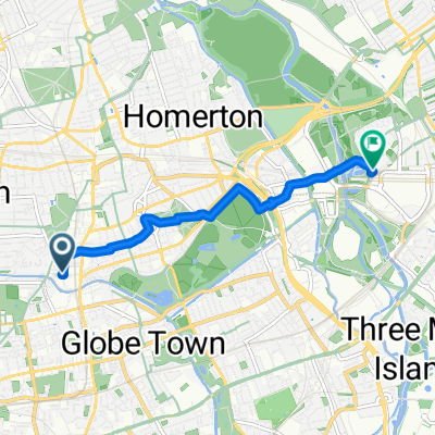 Pritchard's Road, London to Glade Walk, London
- Dystans
- 4,8 km
- Przewyższenia
- 13 m
- Spadek
- 23 m
- Lokalizacja
- Bethnal Green, Anglia, Zjednoczone Królestwo Wielkiej Brytanii
 2-18 Warburton Road, London to 99A Stoke Newington High Street, London
- Dystans
- 3,9 km
- Przewyższenia
- 107 m
- Spadek
- 100 m
- Lokalizacja
- Bethnal Green, Anglia, Zjednoczone Królestwo Wielkiej Brytanii
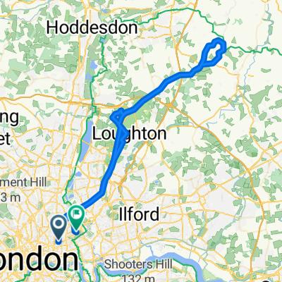 The Only Way is Epping (forest) Long version
- Dystans
- 72,4 km
- Przewyższenia
- 331 m
- Spadek
- 332 m
- Lokalizacja
- Bethnal Green, Anglia, Zjednoczone Królestwo Wielkiej Brytanii
 6–10 Gore Road, London to 92 Lenthall Road, London
- Dystans
- 1,8 km
- Przewyższenia
- 0 m
- Spadek
- 3 m
- Lokalizacja
- Bethnal Green, Anglia, Zjednoczone Królestwo Wielkiej Brytanii
 Mace Street to Dalston Lane
- Dystans
- 4,2 km
- Przewyższenia
- 6 m
- Spadek
- 3 m
- Lokalizacja
- Bethnal Green, Anglia, Zjednoczone Królestwo Wielkiej Brytanii
 Tower Hamlets, London to 33 Allen Road, London
- Dystans
- 4,6 km
- Przewyższenia
- 49 m
- Spadek
- 40 m
- Lokalizacja
- Bethnal Green, Anglia, Zjednoczone Królestwo Wielkiej Brytanii
Trasy z Bethnal Green
Szybka przejażdżka rowerowa od
Z Bethnal Green do Islington
Szybka przejażdżka rowerowa od
Z Bethnal Green do Londyn
Trasy do Hackney
Szybka przejażdżka rowerowa od
Z City of London do Hackney
Szybka przejażdżka rowerowa od
Z West End of London do Hackney