

CYCLING THE RHINE: Route 07A
Trasa rowerowa rozpoczynająca się w Wesel, Nadrenia Północna-Westfalia, Niemcy.
Przegląd
O tej trasie
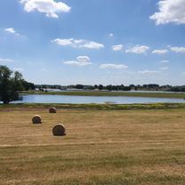
Stacja kolejowa Wesel do stacji kolejowej Ruhrort (Duisburg), przez Rheinberg i Orsoy, wzdłuż Renu.
Mapa Google i zdjęcie nie zgadzają się w miejscu, gdzie droga B58 przecina Ren. Mam szkic nowego punktu przeprawy (zobacz znacznik). Trasa i GPS powinny być poprawne (jeszcze nie testowane w terenie). Zignoruj zdjęcie satelitarne Google, ponieważ jest nieaktualne (czerwiec 2011).
- -:--
- Czas
- 40 km
- Dystans
- 47 m
- Przewyższenia
- 44 m
- Spadek
- ---
- Śr. Prędkość
- ---
- Maks. wysokość
Najważniejsze punkty trasy
Punkty zainteresowania na trasie
Interesujące miejsce po 1,1 km
Information Centre
Interesujące miejsce po 1,8 km
Cycle in the right hand side cycle path across the bridge, take the first turnoff right, turn back towards the Rhine, at T-junction, turn right into the B58 road underpass and immediately left. Take the right hand path to reach the Rhine-side cycle path, then turn right.
Interesujące miejsce po 15,6 km
Dismount in the car park area. Walk through the shrubbery to the nearby road. Turn right and immediate first left.
Interesujące miejsce po 23,4 km
Alternative route: keep right and take the lower, paved road.
Interesujące miejsce po 38,4 km
Take ramp up to left hand side bike path and cross bridge on the left side.
Nocleg po 40 km
YOUTH HOSTEL: DJH Duisburg - Meiderich 133 Losorter Strasse Duisburg
Kontynuuj z Bikemap
Użyj, edytuj lub pobierz tę trasę rowerową
Chcesz przejechać trasę CYCLING THE RHINE: Route 07A lub dostosować ją do swojej wycieczki? Oto, co możesz zrobić z tą trasą na Bikemap:
Darmowe funkcje
- Zapisz tę trasę jako ulubioną lub w kolekcji
- Skopiuj i zaplanuj swoją wersję tej trasy
- Synchronizuj swoją trasę z Garminem lub Wahoo
Funkcje Premium
3 dni bezpłatnej wersji próbnej lub jednorazowa opłata. Dowiedz się więcej o Bikemap Premium.
- Nawiguj po tej trasie na iOS i Androidzie
- Eksportuj plik GPX / KML tej trasy
- Stwórz swój własny wydruk (wypróbuj za darmo)
- Pobierz tę trasę do nawigacji offline
Odkryj więcej funkcji Premium.
Uzyskaj Bikemap PremiumOd naszej społeczności
Wesel: Inne popularne trasy rozpoczynające się tutaj
 CYCLING THE RHINE: Route 07A
- Dystans
- 40 km
- Przewyższenia
- 47 m
- Spadek
- 44 m
- Lokalizacja
- Wesel, Nadrenia Północna-Westfalia, Niemcy
 Rundweg Wesel - Rees - Xanten
- Dystans
- 55,8 km
- Przewyższenia
- 495 m
- Spadek
- 489 m
- Lokalizacja
- Wesel, Nadrenia Północna-Westfalia, Niemcy
 Wesel-Hohe Mark
- Dystans
- 109,8 km
- Przewyższenia
- 177 m
- Spadek
- 181 m
- Lokalizacja
- Wesel, Nadrenia Północna-Westfalia, Niemcy
 Wesel 2 Tag Rundtour
- Dystans
- 47,8 km
- Przewyższenia
- 63 m
- Spadek
- 62 m
- Lokalizacja
- Wesel, Nadrenia Północna-Westfalia, Niemcy
 Emmericher Straße, Wesel nach Konrad-Duden-Straße, Wesel
- Dystans
- 36,5 km
- Przewyższenia
- 106 m
- Spadek
- 106 m
- Lokalizacja
- Wesel, Nadrenia Północna-Westfalia, Niemcy
 От Fischertorstraße до Hansaring
- Dystans
- 14,3 km
- Przewyższenia
- 34 m
- Spadek
- 83 m
- Lokalizacja
- Wesel, Nadrenia Północna-Westfalia, Niemcy
 Reeser Landstraße 11, Wesel do Landen
- Dystans
- 234,3 km
- Przewyższenia
- 1099 m
- Spadek
- 1002 m
- Lokalizacja
- Wesel, Nadrenia Północna-Westfalia, Niemcy
 pfingsttour
- Dystans
- 63,6 km
- Przewyższenia
- 102 m
- Spadek
- 105 m
- Lokalizacja
- Wesel, Nadrenia Północna-Westfalia, Niemcy
Otwórz ją w aplikacji