Day 5, 42 wet and windy miles from Newtonmore to Pitlockry
Trasa rowerowa rozpoczynająca się w Kingussie, Szkocja, Zjednoczone Królestwo Wielkiej Brytanii.
Przegląd
O tej trasie
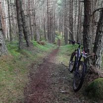
September 5, 2006. This was our first really wet day. We left Newtonmore in light drizzle at 11 degrees to climb the 1513 foot Drummochter Pass into a SW wind. After a few hours in heavy rain and persistent wind with the temperature dropping to 8 degrees, those of us without rain booties had less than warm feet. Much of the ride was on the not terribly well maintained cycle path that follows the old highway beside the A9 and the rail lines. We stopped for coffee at the New Inn in Dalwhinney and reluctantly passed on the opportinity to visit "Scotland's highest distillery" because it was obvious that we were going to be making poor time in these conditions. Although we could not enjoy the distant views of the mountains and heather, we were impressed with the variety of road kill - several pheasants, hares, and frogs, a mink and a sheep. There were many grand houses as we got farther south and at Blair Athol we marvelled at the 4-miles of 5-foot stone wall along the road on one side of Blair Castle. After 5 hours and 42 miles of this, we arrived at the very pretty town of Pitlochry near 2 pm in time to get our bikes tuned up by the very competent Kevin at the Escape Route cycle shop and repaired to the Moulin Inn (est. 1695) for their real ale brewed on the premises (we all had the 5.2 percent "The Remediator") and excellent lunch (our selections included venison platter, steak and ale pie, game pudding, scotchman's hat - a large Yorkshire pudding with meat and mushroom filling).
- -:--
- Czas
- 67,9 km
- Dystans
- 423 m
- Przewyższenia
- 570 m
- Spadek
- ---
- Śr. Prędkość
- 458 m
- Maks. wysokość
Zdjęcia trasy
Jakość trasy
Typy dróg i nawierzchnie na trasie
Typy dróg
Droga rowerowa
25,1 km
(37 %)
Spokojna droga
12,2 km
(18 %)
Powierzchnie
Utwardzona
38,7 km
(57 %)
Nieutwardzona
0,7 km
(1 %)
Asfalt
38,7 km
(57 %)
Żwir
0,7 km
(1 %)
Niezdefiniowany
28,5 km
(42 %)
Kontynuuj z Bikemap
Użyj, edytuj lub pobierz tę trasę rowerową
Chcesz przejechać trasę Day 5, 42 wet and windy miles from Newtonmore to Pitlockry lub dostosować ją do swojej wycieczki? Oto, co możesz zrobić z tą trasą na Bikemap:
Darmowe funkcje
- Zapisz tę trasę jako ulubioną lub w kolekcji
- Skopiuj i zaplanuj swoją wersję tej trasy
- Synchronizuj swoją trasę z Garminem lub Wahoo
Funkcje Premium
3 dni bezpłatnej wersji próbnej lub jednorazowa opłata. Dowiedz się więcej o Bikemap Premium.
- Nawiguj po tej trasie na iOS i Androidzie
- Eksportuj plik GPX / KML tej trasy
- Stwórz swój własny wydruk (wypróbuj za darmo)
- Pobierz tę trasę do nawigacji offline
Odkryj więcej funkcji Premium.
Uzyskaj Bikemap PremiumOd naszej społeczności
Kingussie: Inne popularne trasy rozpoczynające się tutaj
 Kingussie, Glen Tromie and Gaick
- Dystans
- 26,5 km
- Przewyższenia
- 313 m
- Spadek
- 57 m
- Lokalizacja
- Kingussie, Szkocja, Zjednoczone Królestwo Wielkiej Brytanii
 Scotsman - T10
- Dystans
- 110,1 km
- Przewyższenia
- 905 m
- Spadek
- 1106 m
- Lokalizacja
- Kingussie, Szkocja, Zjednoczone Królestwo Wielkiej Brytanii
 KOS Speyside 2019 Day 1
- Dystans
- 66,7 km
- Przewyższenia
- 243 m
- Spadek
- 273 m
- Lokalizacja
- Kingussie, Szkocja, Zjednoczone Królestwo Wielkiej Brytanii
 Kingussie, Newtonmore Wild Cat trail and Loch Gynack
- Dystans
- 16 km
- Przewyższenia
- 219 m
- Spadek
- 219 m
- Lokalizacja
- Kingussie, Szkocja, Zjednoczone Królestwo Wielkiej Brytanii
 Day 5, 42 wet and windy miles from Newtonmore to Pitlockry
- Dystans
- 67,9 km
- Przewyższenia
- 423 m
- Spadek
- 570 m
- Lokalizacja
- Kingussie, Szkocja, Zjednoczone Królestwo Wielkiej Brytanii
 May 16th Scotland
- Dystans
- 87,7 km
- Przewyższenia
- 629 m
- Spadek
- 546 m
- Lokalizacja
- Kingussie, Szkocja, Zjednoczone Królestwo Wielkiej Brytanii
 Kingussie to FeshieBridge 2
- Dystans
- 27,6 km
- Przewyższenia
- 235 m
- Spadek
- 235 m
- Lokalizacja
- Kingussie, Szkocja, Zjednoczone Królestwo Wielkiej Brytanii
 Inshriachs Best 3 Descents
- Dystans
- 19,6 km
- Przewyższenia
- 419 m
- Spadek
- 421 m
- Lokalizacja
- Kingussie, Szkocja, Zjednoczone Królestwo Wielkiej Brytanii
Otwórz ją w aplikacji


