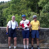
Day 6, 70 miles from Peebles to Carlisle
Trasa rowerowa rozpoczynająca się w Peebles, Szkocja, Zjednoczone Królestwo Wielkiej Brytanii.
Przegląd
O tej trasie
6 września 2006. Dziś pogoda była niemal idealna do jazdy na rowerze. Zaczęliśmy z Peebles, bardzo pięknego małego miasteczka, w szkockiej mgle i przy około 16 stopniach, co nagrzewało się do niskich dwudziestek z jedynie bardzo sporadycznymi opadami deszczu w ciągu dnia. Silny północno-zachodni wiatr osłabł i przesunął się bardziej na zachód i północ, aby nam pomóc. Trasa z Peebles do Carlisle przez Kraj Graniczny (Szkocja) i Cumbria (Anglia) jest bardzo wiejska i wzięliśmy wystarczająco dużo batoników owocowych, aby przetrwać, jeśli nie znajdziemy miejsca na lunch. W rzeczywistości dotarliśmy do buddyjskiego klasztoru tuż po tym, jak ich herbaciarnia się zamknęła, ale na czas, aby zjeść z zwolennikami za datkę 5 £. Bez mięsa, ale bardzo pożywne jedzenie, w tym sałatka z awokado. Postanowiliśmy zatrzymać się po 67 milach i zostać przewiezieni ostatnie 4 mile przez godziny szczytu w Carlisle. Zatrzymujemy się w niegdyś wspaniałym wiktoriańskim hotelu kolejowym, Crown and Mitre. Super bonusem jest to, że pokoje mają długie wanny, z których wszyscy skorzystaliśmy po wszystkich dzisiejszych wzgórzach. Podzieliliśmy ogromną jadalnię na pierwszym (tj. drugim) piętrze z 50 kobietami grającymi w bowling, o przeciętnym wieku społeczności bowlingowej.
- -:--
- Czas
- 112 km
- Dystans
- 1237 m
- Przewyższenia
- 1374 m
- Spadek
- ---
- Śr. Prędkość
- 380 m
- Maks. wysokość
Zdjęcia trasy
Jakość trasy
Typy dróg i nawierzchnie na trasie
Typy dróg
Droga
23,5 km
(21 %)
Spokojna droga
7,8 km
(7 %)
Powierzchnie
Utwardzona
33,6 km
(30 %)
Asfalt
33,6 km
(30 %)
Niezdefiniowany
78,4 km
(70 %)
Kontynuuj z Bikemap
Użyj, edytuj lub pobierz tę trasę rowerową
Chcesz przejechać trasę Day 6, 70 miles from Peebles to Carlisle lub dostosować ją do swojej wycieczki? Oto, co możesz zrobić z tą trasą na Bikemap:
Darmowe funkcje
- Zapisz tę trasę jako ulubioną lub w kolekcji
- Skopiuj i zaplanuj swoją wersję tej trasy
- Podziel trasę na etapy, aby utworzyć kilkudniową wycieczkę
- Synchronizuj swoją trasę z Garminem lub Wahoo
Funkcje Premium
3 dni bezpłatnej wersji próbnej lub jednorazowa opłata. Dowiedz się więcej o Bikemap Premium.
- Nawiguj po tej trasie na iOS i Androidzie
- Eksportuj plik GPX / KML tej trasy
- Stwórz swój własny wydruk (wypróbuj za darmo)
- Pobierz tę trasę do nawigacji offline
Odkryj więcej funkcji Premium.
Uzyskaj Bikemap PremiumOd naszej społeczności
Peebles: Inne popularne trasy rozpoczynające się tutaj
 Tour of the Borders 2015
- Dystans
- 118,5 km
- Przewyższenia
- 852 m
- Spadek
- 852 m
- Lokalizacja
- Peebles, Szkocja, Zjednoczone Królestwo Wielkiej Brytanii
 Day 6, 70 miles from Peebles to Carlisle
- Dystans
- 112 km
- Przewyższenia
- 1237 m
- Spadek
- 1374 m
- Lokalizacja
- Peebles, Szkocja, Zjednoczone Królestwo Wielkiej Brytanii
 Tour o' the Borders 2014
- Dystans
- 125,8 km
- Przewyższenia
- 873 m
- Spadek
- 876 m
- Lokalizacja
- Peebles, Szkocja, Zjednoczone Królestwo Wielkiej Brytanii
 Peebles - Romano Bridge - Leadburn Circular
- Dystans
- 44,7 km
- Przewyższenia
- 199 m
- Spadek
- 200 m
- Lokalizacja
- Peebles, Szkocja, Zjednoczone Królestwo Wielkiej Brytanii
 Peebles circular route
- Dystans
- 44,5 km
- Przewyższenia
- 408 m
- Spadek
- 407 m
- Lokalizacja
- Peebles, Szkocja, Zjednoczone Królestwo Wielkiej Brytanii
 Peebles - Traquair - Caddenfoot - Innerleithen - Peebles Loop
- Dystans
- 49,6 km
- Przewyższenia
- 188 m
- Spadek
- 191 m
- Lokalizacja
- Peebles, Szkocja, Zjednoczone Królestwo Wielkiej Brytanii
 Peebles - Broughton - Drumelzier - Dawyk
- Dystans
- 54,6 km
- Przewyższenia
- 348 m
- Spadek
- 348 m
- Lokalizacja
- Peebles, Szkocja, Zjednoczone Królestwo Wielkiej Brytanii
 Cademuir
- Dystans
- 13,9 km
- Przewyższenia
- 255 m
- Spadek
- 258 m
- Lokalizacja
- Peebles, Szkocja, Zjednoczone Królestwo Wielkiej Brytanii
Otwórz ją w aplikacji


