

Day 10, 72 miles from Monmouth to Huntspill
Trasa rowerowa rozpoczynająca się w Monmouth, Walia, Zjednoczone Królestwo Wielkiej Brytanii.
Przegląd
O tej trasie
10 września 2006. Wyruszyliśmy wcześnie i dotarliśmy do opactwa Tintern około godziny 10, gdy poranna mgła nad rzeką Wey nadal się unosiła. Przejechaliśmy 3 kilometry przez most Severn, a po pagórkowatej jeździe przez zachodnią część Bristolu przekroczyliśmy rzekę Avon mostem wiszącym w Clifton, zbudowanym przez Josiaha Brunela w latach 30. XIX wieku. Musieliśmy sobie przypomnieć, że ta rzeka Avon to jedna z czterech w Anglii i dwóch w Szkocji, i znajduje się 80 km na południowy zachód od miejsca, gdzie inna rzeka Avon łączy się z rzeką Severn w Tewksbury, po przepłynięciu obok Stratford-upon-Avon. Po drodze zapewniliśmy pomoc przy pompce powietrza dla atletycznego Johna z Bristolu (jonaird@tiscali.co.uk), który miał przebitą dętkę, ale nie miał pompki. Podziękował nam wtedy i ponownie pół godziny później, gdy przejechał obok nas z podwójną prędkością. Przejechaliśmy bocznymi drogami i szlakami rowerowymi do ośrodka Chew Valley Lake na lunch około godziny 15. Następnie nastąpił 230-metrowy podjazd na szczyt Cheddar Gorge – w temperaturze sięgającej 30 stopni Celsjusza – a potem równie długi zjazd przez wąwóz, z okazjonalnymi przystankami, aby podziwiać odwagę wspinaczy skałkowych wspinających się pionowo nad nami. Właściciel Laburnam Lodge House, gdzie nocowaliśmy w West Huntspill, ma córkę, która jest mistrzynią świata w triathlonie, więc miał pewne zrozumienie dla trudów przejechania 122 kilometrów w siodle w ciągu dnia.
- -:--
- Czas
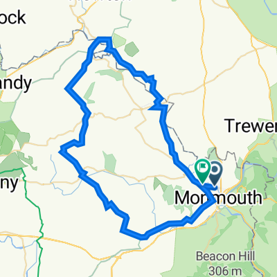
- 115,3 km
- Dystans
- 1291 m
- Przewyższenia
- 1311 m
- Spadek
- ---
- Śr. Prędkość
- 269 m
- Maks. wysokość

Zdjęcia trasy


Jakość trasy
Typy dróg i nawierzchnie na trasie
Typy dróg
Spokojna droga
46,1 km
(40 %)
Droga
12,7 km
(11 %)
Powierzchnie
Utwardzona
62,3 km
(54 %)
Asfalt
56,5 km
(49 %)
Nawierzchnia (nieokreślona)
5,8 km
(5 %)
Niezdefiniowany
53 km
(46 %)
Kontynuuj z Bikemap
Użyj, edytuj lub pobierz tę trasę rowerową
Chcesz przejechać trasę Day 10, 72 miles from Monmouth to Huntspill lub dostosować ją do swojej wycieczki? Oto, co możesz zrobić z tą trasą na Bikemap:
Darmowe funkcje
- Zapisz tę trasę jako ulubioną lub w kolekcji
- Skopiuj i zaplanuj swoją wersję tej trasy
- Podziel trasę na etapy, aby utworzyć kilkudniową wycieczkę
- Synchronizuj swoją trasę z Garminem lub Wahoo
Funkcje Premium
3 dni bezpłatnej wersji próbnej lub jednorazowa opłata. Dowiedz się więcej o Bikemap Premium.
- Nawiguj po tej trasie na iOS i Androidzie
- Eksportuj plik GPX / KML tej trasy
- Stwórz swój własny wydruk (wypróbuj za darmo)
- Pobierz tę trasę do nawigacji offline
Odkryj więcej funkcji Premium.
Uzyskaj Bikemap PremiumOd naszej społeczności
Monmouth: Inne popularne trasy rozpoczynające się tutaj
 Monmouth to Redbrook circular
- Dystans
- 10,1 km
- Przewyższenia
- 283 m
- Spadek
- 283 m
- Lokalizacja
- Monmouth, Walia, Zjednoczone Królestwo Wielkiej Brytanii
 2690m 167km
- Dystans
- 167,1 km
- Przewyższenia
- 1695 m
- Spadek
- 1695 m
- Lokalizacja
- Monmouth, Walia, Zjednoczone Królestwo Wielkiej Brytanii
 1807 A Round of Wales v2
- Dystans
- 915,1 km
- Przewyższenia
- 2428 m
- Spadek
- 2405 m
- Lokalizacja
- Monmouth, Walia, Zjednoczone Królestwo Wielkiej Brytanii
 Monmouth to Hagley
- Dystans
- 97,6 km
- Przewyższenia
- 442 m
- Spadek
- 372 m
- Lokalizacja
- Monmouth, Walia, Zjednoczone Królestwo Wielkiej Brytanii
 Day 10, 72 miles from Monmouth to Huntspill
- Dystans
- 115,3 km
- Przewyższenia
- 1291 m
- Spadek
- 1311 m
- Lokalizacja
- Monmouth, Walia, Zjednoczone Królestwo Wielkiej Brytanii
 16 Kemble Road, Monmouth to Hadnock Road, Monmouth
- Dystans
- 3680 km
- Przewyższenia
- 0 m
- Spadek
- 19 m
- Lokalizacja
- Monmouth, Walia, Zjednoczone Królestwo Wielkiej Brytanii
 Salts Lodge, Ancrehill Lane, Monmouth to Ancrehill Lane, Monmouth
- Dystans
- 52 km
- Przewyższenia
- 936 m
- Spadek
- 920 m
- Lokalizacja
- Monmouth, Walia, Zjednoczone Królestwo Wielkiej Brytanii
 Training ride_Wye Valley_21.04.14
- Dystans
- 47,7 km
- Przewyższenia
- 696 m
- Spadek
- 692 m
- Lokalizacja
- Monmouth, Walia, Zjednoczone Królestwo Wielkiej Brytanii
Otwórz ją w aplikacji