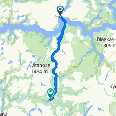
83. Dragsvik / Balestrand to Høyheimsvik
Trasa rowerowa rozpoczynająca się w Balestrand, Sogn og Fjordane Fylke, Norwegia.
Przegląd
O tej trasie
- -:--
- Czas
- 74,9 km
- Dystans
- 2093 m
- Przewyższenia
- 2061 m
- Spadek
- ---
- Śr. Prędkość
- 321 m
- Maks. wysokość
Jakość trasy
Typy dróg i nawierzchnie na trasie
Typy dróg
Droga rowerowa
39 km
(52 %)
Spokojna droga
5,2 km
(7 %)
Powierzchnie
Utwardzona
65,2 km
(87 %)
Nieutwardzona
3,7 km
(5 %)
Asfalt
65,2 km
(87 %)
Żwir
2,2 km
(3 %)
Najważniejsze punkty trasy
Punkty zainteresowania na trasie
Nocleg po 0 km
Kviknes Hotel
Interesujące miejsce po 0,1 km
Kræklingentunnelen Length: 337m Lighting: Yes Comments : I live here, and I've never been cycling through this tunnel due to the beautiful alternative route. Alternative route : There is a beautiful alternative at the narrow old road Villaveien.
Nocleg po 0,1 km
Midtnes Hotel
Interesujące miejsce po 0,1 km
St. Olaf's Church - The English Church
Nocleg po 0,1 km
Kringsjå Hotell
Nocleg po 0,1 km
Balestrand Hotel
Interesujące miejsce po 0,5 km
Ferry to Hella via Dragsvik 30 min M-F 0720 only
Nocleg po 1,9 km
Dragsvik Fjordhotel ? 2 night minimum
Nocleg po 2 km
Veganeset Camping cabins
Interesujące miejsce po 2,4 km
Dragsvik to Hella ferry 10 min 0605 0655 0740 0810 0900 0930 1000 1025 1100 then 1/2 hourly
Interesujące miejsce po 23,9 km
Bjørgahaug

Interesujące miejsce po 24,8 km
Fatlatunnelen Length: 2200m Lighting: Comments : Alternative route : Go via the old road around the tunnel on National Cycle route 6.

Interesujące miejsce po 35,7 km
Stedjebergtunnelen Length: 2100m Lighting: Yes Comments : Alternative route : Follow the National cycle route 6 signed cycle path that goes along the fjord shore.
Woda pitna po 42,7 km
Dampskipskaien Cafe , Bar Restaurant
Interesujące miejsce po 49,4 km
Årøytunnelen Length: 430m Lighting: Yes Comments : It is possible but not fun. Little space. Alternative route : Use the small road east of 55.
Interesujące miejsce po 52,5 km
Stupshølentunnelen Length: 77m Lighting: None. Comments : Short easy tunnel.
Woda pitna po 55,9 km
Lustraporten AS Restaurant
Interesujące miejsce po 57,3 km
Solvorn kyrkje
Woda pitna po 57,3 km
Kvitabui Matnaust og Galleri Restaurant
Nocleg po 58,3 km
Hafslo Guesthouse
Nocleg po 59 km
BesteBakken
Interesujące miejsce po 64,1 km
Fet kyrkje
Woda pitna po 64,8 km
Livdtun cafe
Interesujące miejsce po 67,3 km
Røneidtunnelen Length: 657m Lighting: Yes Comments : This tunnel is totally upgraded in 2018/2019. New lights, it even got these buttons on the outside where you can push to warn cars about cyclists the in tunnel. The old road by the fjord is also fully upgraded, with asphalt, and absolutely NO cars. Watch out for falling ice and rocks in the spring, it is not recommended to ride outside the tunnel from december to april. Alternative route : The old road by the fjord. Upgraded i 2017.
Interesujące miejsce po 70,9 km
Råumtunnelen Length: 514m Lighting: Yes Comments : This tunnel is fully upgraded in 2019. New and very good lightning. You can see through the entire tunnel. New signs, Syklist i tunnel, press the button and use them. Alternative route : The old road is in poor condition. It is rideable on MTB, gravel or CX. The scenery is nice though.
Interesujące miejsce po 74,9 km
Nes kyrkje
Nocleg po 74,9 km
Nes Gard
Kontynuuj z Bikemap
Użyj, edytuj lub pobierz tę trasę rowerową
Chcesz przejechać trasę 83. Dragsvik / Balestrand to Høyheimsvik lub dostosować ją do swojej wycieczki? Oto, co możesz zrobić z tą trasą na Bikemap:
Darmowe funkcje
- Zapisz tę trasę jako ulubioną lub w kolekcji
- Skopiuj i zaplanuj swoją wersję tej trasy
- Synchronizuj swoją trasę z Garminem lub Wahoo
Funkcje Premium
3 dni bezpłatnej wersji próbnej lub jednorazowa opłata. Dowiedz się więcej o Bikemap Premium.
- Nawiguj po tej trasie na iOS i Androidzie
- Eksportuj plik GPX / KML tej trasy
- Stwórz swój własny wydruk (wypróbuj za darmo)
- Pobierz tę trasę do nawigacji offline
Odkryj więcej funkcji Premium.
Uzyskaj Bikemap PremiumOd naszej społeczności
Balestrand: Inne popularne trasy rozpoczynające się tutaj
 1c Bernestand- forde
- Dystans
- 101,3 km
- Przewyższenia
- 1560 m
- Spadek
- 1557 m
- Lokalizacja
- Balestrand, Sogn og Fjordane Fylke, Norwegia
 Balestrand - Hol
- Dystans
- 233,6 km
- Przewyższenia
- 4756 m
- Spadek
- 4221 m
- Lokalizacja
- Balestrand, Sogn og Fjordane Fylke, Norwegia
 Balestrand - Kvamsøy
- Dystans
- 12 km
- Przewyższenia
- 130 m
- Spadek
- 117 m
- Lokalizacja
- Balestrand, Sogn og Fjordane Fylke, Norwegia
 8 . Hella - Vågåmo (route options)
- Dystans
- 205,6 km
- Przewyższenia
- 0 m
- Spadek
- 0 m
- Lokalizacja
- Balestrand, Sogn og Fjordane Fylke, Norwegia
 1b flam fjoird tagesausflug?
- Dystans
- 35 km
- Przewyższenia
- 996 m
- Spadek
- 1034 m
- Lokalizacja
- Balestrand, Sogn og Fjordane Fylke, Norwegia
 NOR 051: Dragsvik - Balestrand - Dragsvik
- Dystans
- 21,5 km
- Przewyższenia
- 0 m
- Spadek
- 0 m
- Lokalizacja
- Balestrand, Sogn og Fjordane Fylke, Norwegia
 Balestrand - Menes
- Dystans
- 30,1 km
- Przewyższenia
- 316 m
- Spadek
- 287 m
- Lokalizacja
- Balestrand, Sogn og Fjordane Fylke, Norwegia
 RNK 33
- Dystans
- 89,1 km
- Przewyższenia
- 1226 m
- Spadek
- 1166 m
- Lokalizacja
- Balestrand, Sogn og Fjordane Fylke, Norwegia
Otwórz ją w aplikacji


