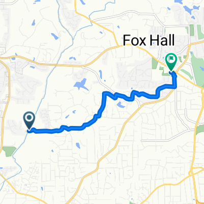
MAC Flying Turkey Trot
Trasa rowerowa rozpoczynająca się w Lewisville, Karolina Północna, USA.
Przegląd
O tej trasie
Flying Turkey Trot to wspaniała pętla pełna łagodnych wzniesień i długich, łagodnych podjazdów. Może to być bardzo szybkie sto mil metryczne, jeśli chcesz, lub może być przyjemną, luźną przejażdżką przez wieś. To wspaniała trasa w miesiącach jesiennych. Zrób to do tyłu lub do przodu - obie wersje są znakomite!
• Start Lewisville Square • Lewo Belnette Rd • Prawo Shallowford Rd • Lewo Hauser Rd. • Prawo Williams Rd • Lewo Shallowford Rd (zmienia się w Courtney-Huntsville Rd) • Prawo Brawley Rd • Lewo Old Stage Rd • Przejdź przez Hwy 601 • Prosto Lone Hickory Rd • Lewo Sandy Springs Rd (zmienia się w Bear Creek Rd) • Prawo Liberty Church Rd • Lewo Angel Rd • Przerwa przy stoisku z produktami po prawej stronie • Przejdź przez Hwy 601 • Prawo Angel Rd • Lewo Cana Rd • Prawo Pudding Ridge Rd • Lewo Cedar Creek Rd • Prawo Hwy 801 • Lewo Wyo Rd • Lewo Davie-Wyo Rd (na stopie) • Prawo Courtney-Huntsville Rd (zmienia się w Shallowford Rd) • Prawo Williams Rd • Lewo Hauser Rd • Prawo Shallowford Rd • Lewo Belnette Rd • Prawo W Lewisville Square • Koniec Lewisville Square.
- -:--
- Czas
- 98,6 km
- Dystans
- 319 m
- Przewyższenia
- 321 m
- Spadek
- ---
- Śr. Prędkość
- ---
- Maks. wysokość
Jakość trasy
Typy dróg i nawierzchnie na trasie
Typy dróg
Droga
80,9 km
(82 %)
Spokojna droga
16,8 km
(17 %)
Niezdefiniowany
1 km
(1 %)
Powierzchnie
Utwardzona
46,3 km
(47 %)
Asfalt
45,4 km
(46 %)
Beton
1 km
(1 %)
Niezdefiniowany
52,3 km
(53 %)
Kontynuuj z Bikemap
Użyj, edytuj lub pobierz tę trasę rowerową
Chcesz przejechać trasę MAC Flying Turkey Trot lub dostosować ją do swojej wycieczki? Oto, co możesz zrobić z tą trasą na Bikemap:
Darmowe funkcje
- Zapisz tę trasę jako ulubioną lub w kolekcji
- Skopiuj i zaplanuj swoją wersję tej trasy
- Podziel trasę na etapy, aby utworzyć kilkudniową wycieczkę
- Synchronizuj swoją trasę z Garminem lub Wahoo
Funkcje Premium
3 dni bezpłatnej wersji próbnej lub jednorazowa opłata. Dowiedz się więcej o Bikemap Premium.
- Nawiguj po tej trasie na iOS i Androidzie
- Eksportuj plik GPX / KML tej trasy
- Stwórz swój własny wydruk (wypróbuj za darmo)
- Pobierz tę trasę do nawigacji offline
Odkryj więcej funkcji Premium.
Uzyskaj Bikemap PremiumOd naszej społeczności
Lewisville: Inne popularne trasy rozpoczynające się tutaj
 MAC Up Then Down
- Dystans
- 91,6 km
- Przewyższenia
- 403 m
- Spadek
- 403 m
- Lokalizacja
- Lewisville, Karolina Północna, USA
 Shallowford/Williams/houser rd loop
- Dystans
- 32,1 km
- Przewyższenia
- 217 m
- Spadek
- 216 m
- Lokalizacja
- Lewisville, Karolina Północna, USA
 Lewisville to Rockford
- Dystans
- 84,1 km
- Przewyższenia
- 389 m
- Spadek
- 387 m
- Lokalizacja
- Lewisville, Karolina Północna, USA
 Home to Lewisville Town Square
- Dystans
- 6,7 km
- Przewyższenia
- 101 m
- Spadek
- 63 m
- Lokalizacja
- Lewisville, Karolina Północna, USA
 Winston-Salem to Robinhood Rd, Winston-Salem
- Dystans
- 6 km
- Przewyższenia
- 114 m
- Spadek
- 52 m
- Lokalizacja
- Lewisville, Karolina Północna, USA
 MAC Jeff's Windy Gap Century
- Dystans
- 164,3 km
- Przewyższenia
- 571 m
- Spadek
- 571 m
- Lokalizacja
- Lewisville, Karolina Północna, USA
 MAC Flying Turkey Trot
- Dystans
- 98,6 km
- Przewyższenia
- 319 m
- Spadek
- 321 m
- Lokalizacja
- Lewisville, Karolina Północna, USA
 River Run Loop
- Dystans
- 33,8 km
- Przewyższenia
- 240 m
- Spadek
- 239 m
- Lokalizacja
- Lewisville, Karolina Północna, USA
Otwórz ją w aplikacji

