

Arthurs Creek
Trasa rowerowa rozpoczynająca się w Ashwood, Wiktoria, Australia.
Przegląd
O tej trasie
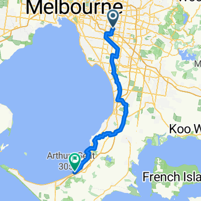
Arthurs Creek is a classic “rouler” ride taking in the hills of north east Melbourne. Consisting of two different loops this ride can be shortened, if needed. The first loop from Warrandyte passes Kangaroo Ground, Hurstbridge, Arthurs Creek & Panton Hill. The second loop around Panton Hill is via Watsons Creek & Smith’s Gully which includes the highest climb of the day; Clintons Rd. Although the climbs are not particular daunting rest assured that by days end you will know you have completed another gruelling 6am-er classic ride.
Ride Founder: Kevin "Murph" Murphy
- -:--
- Czas
- 109,7 km
- Dystans
- 812 m
- Przewyższenia
- 812 m
- Spadek
- ---
- Śr. Prędkość
- ---
- Maks. wysokość

Kontynuuj z Bikemap
Użyj, edytuj lub pobierz tę trasę rowerową
Chcesz przejechać trasę Arthurs Creek lub dostosować ją do swojej wycieczki? Oto, co możesz zrobić z tą trasą na Bikemap:
Darmowe funkcje
- Zapisz tę trasę jako ulubioną lub w kolekcji
- Skopiuj i zaplanuj swoją wersję tej trasy
- Podziel trasę na etapy, aby utworzyć kilkudniową wycieczkę
- Synchronizuj swoją trasę z Garminem lub Wahoo
Funkcje Premium
3 dni bezpłatnej wersji próbnej lub jednorazowa opłata. Dowiedz się więcej o Bikemap Premium.
- Nawiguj po tej trasie na iOS i Androidzie
- Eksportuj plik GPX / KML tej trasy
- Stwórz swój własny wydruk (wypróbuj za darmo)
- Pobierz tę trasę do nawigacji offline
Odkryj więcej funkcji Premium.
Uzyskaj Bikemap PremiumOd naszej społeczności
Ashwood: Inne popularne trasy rozpoczynające się tutaj
 Gruyere De Grande
- Dystans
- 109,3 km
- Przewyższenia
- 927 m
- Spadek
- 928 m
- Lokalizacja
- Ashwood, Wiktoria, Australia
 Sorrento
- Dystans
- 187,8 km
- Przewyższenia
- 386 m
- Spadek
- 386 m
- Lokalizacja
- Ashwood, Wiktoria, Australia
 Arthurs Seat
- Dystans
- 162,3 km
- Przewyższenia
- 618 m
- Spadek
- 618 m
- Lokalizacja
- Ashwood, Wiktoria, Australia
 The Drom
- Dystans
- 82,7 km
- Przewyższenia
- 532 m
- Spadek
- 633 m
- Lokalizacja
- Ashwood, Wiktoria, Australia
 Strengthies in the Nongs
- Dystans
- 95,2 km
- Przewyższenia
- 1285 m
- Spadek
- 1285 m
- Lokalizacja
- Ashwood, Wiktoria, Australia
 Mount Waverley to Federation Square
- Dystans
- 25,1 km
- Przewyższenia
- 133 m
- Spadek
- 238 m
- Lokalizacja
- Ashwood, Wiktoria, Australia
 Giro d'Italia
- Dystans
- 105,7 km
- Przewyższenia
- 1393 m
- Spadek
- 1393 m
- Lokalizacja
- Ashwood, Wiktoria, Australia
 Kinglake
- Dystans
- 110,1 km
- Przewyższenia
- 1007 m
- Spadek
- 1008 m
- Lokalizacja
- Ashwood, Wiktoria, Australia
Otwórz ją w aplikacji