

Mississauga (Celebration Square) Through Toronto Waterfront and and Back
Trasa rowerowa rozpoczynająca się w Mississauga, Ontario, Kanada.
Przegląd
O tej trasie
OVERVIEW: A round-trip that is mostly on trails and bike lanes. Very few of the route is on actual road - that is, the Downtown Toronto part. Feels like a nice adventure. Although the Queensway part may be quite boring, it adds some variety! However, there will be a lot of riders like you on the Waterfront Trail, so don't fret.
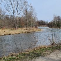
ROUTE DESCRIPTION: The route starts by skipping Port Credit and goes the edge of Mississauga next to the Etobicoke Creek. This is because that part is mostly in residential neighborhoods. Dixie's trails takes us to Marie Curtis Park (which is when we enter Etobicoke) then we connect to the Waterfront Trail. We'll take the Waterfront trail down to Downtown TO, going through places like St Lawrence Market, Eaton Centre, Nathan Philips and Yonge/Dundas Square, as well as around the entertainment district. Heading back, we will visit High Park and complete a loop around that park. Upon arriving to Mississauga, we'll finally take a glance at Port Credit's several parks, then after we'll take some trails and different roads back north to Celebration Square.
LENGTH: This route takes around 2 1/2 to 3 hours for more experienced cyclists, whereas 4 hours is more realistic.
I hope you enjoy this route! Feel free to visit anywhere you wish in Toronto. Feedback is appreciated!
- -:--
- Czas
- 83,7 km
- Dystans
- 585 m
- Przewyższenia
- 585 m
- Spadek
- ---
- Śr. Prędkość
- 165 m
- Maks. wysokość

Jakość trasy
Typy dróg i nawierzchnie na trasie
Typy dróg
Droga rowerowa
33,3 km
(40 %)
Spokojna droga
18,2 km
(22 %)
Powierzchnie
Utwardzona
72,8 km
(87 %)
Nieutwardzona
0,1 km
(<1 %)
Asfalt
69,1 km
(83 %)
Beton
3,2 km
(4 %)
Kontynuuj z Bikemap
Użyj, edytuj lub pobierz tę trasę rowerową
Chcesz przejechać trasę Mississauga (Celebration Square) Through Toronto Waterfront and and Back lub dostosować ją do swojej wycieczki? Oto, co możesz zrobić z tą trasą na Bikemap:
Darmowe funkcje
- Zapisz tę trasę jako ulubioną lub w kolekcji
- Skopiuj i zaplanuj swoją wersję tej trasy
- Podziel trasę na etapy, aby utworzyć kilkudniową wycieczkę
- Synchronizuj swoją trasę z Garminem lub Wahoo
Funkcje Premium
3 dni bezpłatnej wersji próbnej lub jednorazowa opłata. Dowiedz się więcej o Bikemap Premium.
- Nawiguj po tej trasie na iOS i Androidzie
- Eksportuj plik GPX / KML tej trasy
- Stwórz swój własny wydruk (wypróbuj za darmo)
- Pobierz tę trasę do nawigacji offline
Odkryj więcej funkcji Premium.
Uzyskaj Bikemap PremiumOd naszej społeczności
Mississauga: Inne popularne trasy rozpoczynające się tutaj
 Warmup Churchill to Brittania and back
- Dystans
- 23,8 km
- Przewyższenia
- 67 m
- Spadek
- 64 m
- Lokalizacja
- Mississauga, Ontario, Kanada
 Day2_Missiisauga to Niagara Falls
- Dystans
- 119,8 km
- Przewyższenia
- 385 m
- Spadek
- 354 m
- Lokalizacja
- Mississauga, Ontario, Kanada
 Riverwood-SawmillValley-Culham Loop
- Dystans
- 10,1 km
- Przewyższenia
- 90 m
- Spadek
- 93 m
- Lokalizacja
- Mississauga, Ontario, Kanada
 30k around the block
- Dystans
- 29,1 km
- Przewyższenia
- 124 m
- Spadek
- 127 m
- Lokalizacja
- Mississauga, Ontario, Kanada
 bike tour through Mississauga Rd
- Dystans
- 17,3 km
- Przewyższenia
- 116 m
- Spadek
- 116 m
- Lokalizacja
- Mississauga, Ontario, Kanada
 2689 Hollington Cres, Mississauga to 2652 Hollington Cres, Mississauga
- Dystans
- 16,2 km
- Przewyższenia
- 162 m
- Spadek
- 161 m
- Lokalizacja
- Mississauga, Ontario, Kanada
 Etobicoke-Lakeshore-Miss Road
- Dystans
- 40,5 km
- Przewyższenia
- 133 m
- Spadek
- 131 m
- Lokalizacja
- Mississauga, Ontario, Kanada
 Erindale route...long
- Dystans
- 29,6 km
- Przewyższenia
- 296 m
- Spadek
- 289 m
- Lokalizacja
- Mississauga, Ontario, Kanada
Otwórz ją w aplikacji