

Menorca: Alaior-Sant Climent-Llucmaçanes-Alaior
Trasa rowerowa rozpoczynająca się w Alaior, Balearic Islands, Spain.
Przegląd
O tej trasie
Ruta arqueològica: jaciment de Torre d'en Galmés, taula de Torrellisar Vell, poblat de So na Caçana, talaiot de Binicalaf, poblat de Biniparratxet Petit, poblat de Binissafullet, talaiot de Torelló, basílica paleocristiana de Torelló, jaciment de Talatí de Dalt, mil·liari romà d'Alcaidús i jaciment de Torralba d'en Salort
- -:--
- Czas
- 45,8 km
- Dystans
- 387 m
- Przewyższenia
- 386 m
- Spadek
- ---
- Śr. Prędkość
- 124 m
- Maks. wysokość

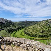
Zdjęcia trasy


Jakość trasy
Typy dróg i nawierzchnie na trasie
Typy dróg
Spokojna droga
22,6 km
(49 %)
Droga
13,4 km
(29 %)
Powierzchnie
Utwardzona
12,1 km
(27 %)
Nieutwardzona
2,4 km
(5 %)
Asfalt
11,7 km
(26 %)
Nieutwardzony (nieokreślony)
1,1 km
(2 %)
Najważniejsze punkty trasy
Punkty zainteresowania na trasie
Interesujące miejsce po 4,4 km
poblat talaiòtic Torre d'en Galmés
Interesujące miejsce po 12,1 km
taula de Torrellisar Vell
Interesujące miejsce po 13,4 km
poblat talaiòtic de So na Caçana
Interesujące miejsce po 16 km
talaiot de Binicalaf
Interesujące miejsce po 23,8 km
poblat talaiòtic de Biniparratxet Petit
Interesujące miejsce po 26 km
poblat talaiòtic de Binissafullet
Interesujące miejsce po 32,5 km
talaiot de Torelló
Interesujące miejsce po 32,9 km
basílica paleocristiana de Torelló
Interesujące miejsce po 35,1 km
poblat talaiòtic de Talatí de Dalt
Interesujące miejsce po 38,9 km
mil·liari romà d'Alcaidús
Interesujące miejsce po 41,6 km
taula de Torralba d'en Salort
Kontynuuj z Bikemap
Użyj, edytuj lub pobierz tę trasę rowerową
Chcesz przejechać trasę Menorca: Alaior-Sant Climent-Llucmaçanes-Alaior lub dostosować ją do swojej wycieczki? Oto, co możesz zrobić z tą trasą na Bikemap:
Darmowe funkcje
- Zapisz tę trasę jako ulubioną lub w kolekcji
- Skopiuj i zaplanuj swoją wersję tej trasy
- Synchronizuj swoją trasę z Garminem lub Wahoo
Funkcje Premium
3 dni bezpłatnej wersji próbnej lub jednorazowa opłata. Dowiedz się więcej o Bikemap Premium.
- Nawiguj po tej trasie na iOS i Androidzie
- Eksportuj plik GPX / KML tej trasy
- Stwórz swój własny wydruk (wypróbuj za darmo)
- Pobierz tę trasę do nawigacji offline
Odkryj więcej funkcji Premium.
Uzyskaj Bikemap PremiumOd naszej społeczności
Alaior: Inne popularne trasy rozpoczynające się tutaj
 Menorca: Alaior-cap de Favàritx-camí d'en Kane-Alaior
- Dystans
- 42,9 km
- Przewyższenia
- 433 m
- Spadek
- 434 m
- Lokalizacja
- Alaior, Balearic Islands, Spain
 Menorca, Inselumrundung Tag 4
- Dystans
- 65,5 km
- Przewyższenia
- 409 m
- Spadek
- 422 m
- Lokalizacja
- Alaior, Balearic Islands, Spain
 Sonntagstour Cala en Porter nach Alaior nach Son Bou und zurück Alaior
- Dystans
- 23,7 km
- Przewyższenia
- 252 m
- Spadek
- 266 m
- Lokalizacja
- Alaior, Balearic Islands, Spain
 Menorca: Alaior-Sant Climent-Llucmaçanes-Alaior
- Dystans
- 45,8 km
- Przewyższenia
- 387 m
- Spadek
- 386 m
- Lokalizacja
- Alaior, Balearic Islands, Spain
 MINORQUE / MTB - Cala en Porter - Mahon (bonne cyclabilité)
- Dystans
- 34,5 km
- Przewyższenia
- 222 m
- Spadek
- 235 m
- Lokalizacja
- Alaior, Balearic Islands, Spain
 Avinguda de la Verge del Toro 65, Alaior to Diseminado Poligono 11 128
- Dystans
- 15,7 km
- Przewyższenia
- 541 m
- Spadek
- 307 m
- Lokalizacja
- Alaior, Balearic Islands, Spain
 MINORQUE / Cami de Cavalls - BTT - Cala En Porter - Mahon
- Dystans
- 33,1 km
- Przewyższenia
- 302 m
- Spadek
- 294 m
- Lokalizacja
- Alaior, Balearic Islands, Spain
 Alaior Radfahren
- Dystans
- 0 km
- Przewyższenia
- 0 m
- Spadek
- 0 m
- Lokalizacja
- Alaior, Balearic Islands, Spain
Otwórz ją w aplikacji