

Albussac (Les Quatre Routes) - Circle to Brive-la-Gaillarde (Malemort)
Trasa rowerowa rozpoczynająca się w Beynat, Nouvelle-Aquitaine, Francja.
Przegląd
O tej trasie
To była naprawdę niesamowita przejażdżka. Kilka kilometrów po opuszczeniu Brive na drodze D141E3 zaczęły się grzmoty, błyskawice i bardzo intensywne opady deszczu. Przez około pół godziny schroniliśmy się pod zadaszonym wejściem do budynku w St-Hilaire-Peyroux. Potem, podczas deszczu, skręciliśmy nie tam, gdzie trzeba, i musieliśmy jechać trochę po drodze D1089, co nie było zbyt przyjemne... zwłaszcza w deszczu. Ta droga miała też kilka tuneli; na szczęście mieliśmy na rowerach tylne światła, bo przy gęstym zachmurzeniu i deszczu było dość ciemno. W końcu dotarliśmy do Cornil, gdzie mogliśmy wsiąść na D1, kierując się na wschód do Ste-Fortunade, a następnie na D940, co pozwoliło nam pojechać na południe z powrotem do naszego hotelu. Naszym pierwotnym celem było Tulle, gdzie planowaliśmy zrobić zakupy spożywcze i zabrać jedzenie z McDonald's na kolację. Ze względu na grzmoty, błyskawice i deszcz ominęliśmy Tulle... może jutro.
- 4 h 31 min
- Czas
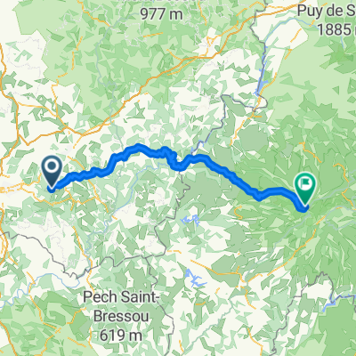
- 75,3 km
- Dystans
- 1422 m
- Przewyższenia
- 1422 m
- Spadek
- 16,7 km/h
- Śr. Prędkość
- 570 m
- Maks. wysokość

Zdjęcia trasy
 - Circle to Brive-la-Gaillarde (Malemort)”")
 - Circle to Brive-la-Gaillarde (Malemort)”")
 - Circle to Brive-la-Gaillarde (Malemort)”")
 - Circle to Brive-la-Gaillarde (Malemort)”")
 - Circle to Brive-la-Gaillarde (Malemort)”")
 - Circle to Brive-la-Gaillarde (Malemort)”")
 - Circle to Brive-la-Gaillarde (Malemort)”")
Jakość trasy
Typy dróg i nawierzchnie na trasie
Typy dróg
Droga
15,8 km
(21 %)
Spokojna droga
4,5 km
(6 %)
Powierzchnie
Utwardzona
30,9 km
(41 %)
Asfalt
30,9 km
(41 %)
Niezdefiniowany
44,4 km
(59 %)
Kontynuuj z Bikemap
Użyj, edytuj lub pobierz tę trasę rowerową
Chcesz przejechać trasę Albussac (Les Quatre Routes) - Circle to Brive-la-Gaillarde (Malemort) lub dostosować ją do swojej wycieczki? Oto, co możesz zrobić z tą trasą na Bikemap:
Darmowe funkcje
- Zapisz tę trasę jako ulubioną lub w kolekcji
- Skopiuj i zaplanuj swoją wersję tej trasy
- Synchronizuj swoją trasę z Garminem lub Wahoo
Funkcje Premium
3 dni bezpłatnej wersji próbnej lub jednorazowa opłata. Dowiedz się więcej o Bikemap Premium.
- Nawiguj po tej trasie na iOS i Androidzie
- Eksportuj plik GPX / KML tej trasy
- Stwórz swój własny wydruk (wypróbuj za darmo)
- Pobierz tę trasę do nawigacji offline
Odkryj więcej funkcji Premium.
Uzyskaj Bikemap PremiumOd naszej społeczności
Beynat: Inne popularne trasy rozpoczynające się tutaj
 puy mary 2
- Dystans
- 116,8 km
- Przewyższenia
- 1874 m
- Spadek
- 824 m
- Lokalizacja
- Beynat, Nouvelle-Aquitaine, Francja
 espagnagol
- Dystans
- 7,1 km
- Przewyższenia
- 135 m
- Spadek
- 135 m
- Lokalizacja
- Beynat, Nouvelle-Aquitaine, Francja
 Albussac (Les Quatre Routes) - Circle through Neuville
- Dystans
- 37,8 km
- Przewyższenia
- 686 m
- Spadek
- 686 m
- Lokalizacja
- Beynat, Nouvelle-Aquitaine, Francja
 Albussac (Les Quatre Routes) - Circle to Brive-la-Gaillarde (Malemort)
- Dystans
- 75,3 km
- Przewyższenia
- 1422 m
- Spadek
- 1422 m
- Lokalizacja
- Beynat, Nouvelle-Aquitaine, Francja
 Albussac (Les Quatre Routes) to Égletons
- Dystans
- 53,5 km
- Przewyższenia
- 978 m
- Spadek
- 889 m
- Lokalizacja
- Beynat, Nouvelle-Aquitaine, Francja
 Albussac (Les Quatre Routes) - Circle through Tulle
- Dystans
- 59,4 km
- Przewyższenia
- 1179 m
- Spadek
- 1180 m
- Lokalizacja
- Beynat, Nouvelle-Aquitaine, Francja
 Albussac (Les Quatre Routes) - Circle to Argentat and Barrage
- Dystans
- 63,9 km
- Przewyższenia
- 1701 m
- Spadek
- 1696 m
- Lokalizacja
- Beynat, Nouvelle-Aquitaine, Francja
 Palazinges - Barrage aigle
- Dystans
- 66,7 km
- Przewyższenia
- 508 m
- Spadek
- 764 m
- Lokalizacja
- Beynat, Nouvelle-Aquitaine, Francja
Otwórz ją w aplikacji