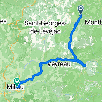


Tarnroute (Nr. 160) Ste. Enemie- Millau
- 55,4 km
- 318 m
- 436 m
- Chanac, Occitanie, Francja
Trasa rowerowa rozpoczynająca się w Chanac, Occitanie, Francja.
Przegląd
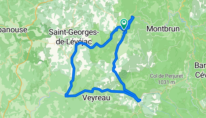
<span style="font-size: 12pt; font-family: Arial;">Another particularly wonderful route.<span> </span>After a slow climb of about 450 M above the Tarn River, we were directly above our hotel in St Chély-du-Tarn, looking down on it far below.</span>
<span style="font-size: 12pt; font-family: Arial;">At the Col was a large playful black dog that was idolizing my wife.<span> </span>After she was able to outrun him on the way down from the Col when I’d called him, I was left inching my way forward so as not to run into him if he bounded in front of me.<span> </span>Fortunately, at some point he lost interest and I was able to catch up.</span>
<span style="font-size: 12pt; font-family: Arial;">From the Col de Coperlac, we were on a plateau that kept us roughly between 800 M and 1000 M until we descended to Meyrueis.</span>
<span style="font-size: 12pt; font-family: Arial;">Getting into Meyrueis, we went by the hotel where we’d stayed the prior year and then headed down the Gorges de la Jonte.<span> </span>It was as beautiful and rugged as we remembered.</span>
<span style="font-size: 12pt; font-family: Arial;">We eventually arrived in Le Rozier, which is at the juncture of the Jonte and Tarn rivers.<span> </span>It’s a pleasant village that is particularly picturesque as you approach it.<span> </span>Just past Le Rozier as you start up the Gorges du Tarn, there was a very nice looking Best Western hotel, something that we don’t see often unless we’re in a relatively large city.<span> </span>Also, while in the Le Rozier area, we were in the Aveyron Department for a few kilometers before returning to the Lozère Department.</span>
<span style="font-size: 12pt; font-family: Arial;">Now that we’d finished riding downstream along the Jonte, we were riding upstream along the Tarn.<span> </span>While we’d descended quite a bit between Meyruies and Le Rozier, the ascent along the Tarn was much more gentle.</span>
<span style="font-size: 12pt; font-family: Arial;">Overall, a fantastic ride.</span>
Background:<br /><br /><br />My wife and I have been doing self-supported tours in Western Europe (a majority in France) since 1993. This series of rides covers our 2005 2 month route through parts of France. Our beginning and ending point is near Chaduri (south of Angoulême) where our friends have a farm with Gites and Chambres d'Hotes.<br /><br /><br />We rode our Dawes touring bicycles purchased in 1993 heavily loaded with 700Cx32 tires. All of our riding was on paved roads, mostly with very little traffic.<br /><br /><br />If any questions, feel free to email me at jeffkadet@netdiving.com<br /><br /><br />Jeff
utworzono 14 lat temu temu
Jakość trasy
Droga leśna
2,6 km
(3 %)
Spokojna droga
1,7 km
(2 %)
Utwardzona
82,6 km
(96 %)
Nieutwardzona
2,6 km
(3 %)
Asfalt
82,6 km
(96 %)
Żwir
1,7 km
(2 %)
Kontynuuj z Bikemap
Chcesz przejechać trasę Ride Day 29—10 Oct 2005—48210 St-Chely du Tarn/Sainte Énimie — Circle lub dostosować ją do swojej wycieczki? Oto, co możesz zrobić z tą trasą na Bikemap:
3 dni bezpłatnej wersji próbnej lub jednorazowa opłata. Dowiedz się więcej o Bikemap Premium.
Odkryj więcej funkcji Premium.
Uzyskaj Bikemap PremiumOd naszej społeczności
Otwórz ją w aplikacji