

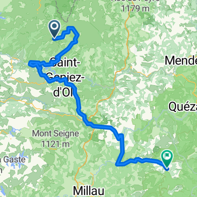
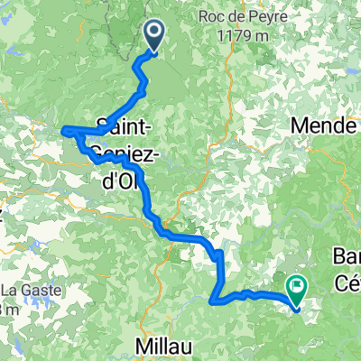
Ride Day 32—13 Oct 2005—48260 Recoules D'Aubrac (Nasbinals) to 15300 Murat
Trasa rowerowa rozpoczynająca się w Laguiole, Occitanie, Francja.
Przegląd
O tej trasie
W każdym życiu musi trochę popadać. Krótko po rozpoczęciu jazdy w chłodny poranek założyliśmy spodnie przeciwdeszczowe i ochraniacze na buty z powodu lekkiego deszczu. Chociaż nigdy nie padało naprawdę mocno, to było więcej niż lekko i trwało przez kilka godzin. Najtrudniejszą częścią był zjazd z około 1050 m wzdłuż dróg D13 i D989 do Chaudes-Aigues na około 750 m. Na szczęście podczas wspinaczki z powrotem na poziom powyżej 1000 m na północ od Chaudes-Aigues deszcz osłabł... i mogliśmy nawet zobaczyć nasze cienie, gdy byliśmy na D16. Nie spodziewaliśmy się tak miłego zakończenia dnia. Na koniec opuściliśmy departament Lozère i wjechaliśmy do departamentu Cantal tuż przed wjazdem do St Urcize. Oznaczało to również, że przeszliśmy z regionu Languedoc-Roussillon do regionu Auvergne. Świetne, mało uczęszczane drogi. Tło: Moja żona i ja od 1993 roku jeździmy na samodzielne wycieczki po Europie Zachodniej (głównie we Francji). Ta seria przejażdżek obejmuje naszą trasę z 2005 roku, dwumiesięczną podróż przez części Francji. Nasz początek i koniec znajduje się w pobliżu Chaduri (na południe od Angoulême), gdzie nasi przyjaciele mają gospodarstwo z gîtes i chambres d'hôtes. Jeździliśmy na naszych trekkingowych rowerach Dawes, kupionych w 1993 roku, mocno załadowanych oponami 700Cx32. Cała nasza jazda odbywała się po asfaltowych drogach, głównie o bardzo niskim natężeniu ruchu. W razie pytań proszę pisać na jeffkadet@netdiving.com Jeff
- -:--
- Czas
- 67,6 km
- Dystans
- 587 m
- Przewyższenia
- 757 m
- Spadek
- ---
- Śr. Prędkość
- ---
- Maks. wysokość

Kontynuuj z Bikemap
Użyj, edytuj lub pobierz tę trasę rowerową
Chcesz przejechać trasę Ride Day 32—13 Oct 2005—48260 Recoules D'Aubrac (Nasbinals) to 15300 Murat lub dostosować ją do swojej wycieczki? Oto, co możesz zrobić z tą trasą na Bikemap:
Darmowe funkcje
- Zapisz tę trasę jako ulubioną lub w kolekcji
- Skopiuj i zaplanuj swoją wersję tej trasy
- Synchronizuj swoją trasę z Garminem lub Wahoo
Funkcje Premium
3 dni bezpłatnej wersji próbnej lub jednorazowa opłata. Dowiedz się więcej o Bikemap Premium.
- Nawiguj po tej trasie na iOS i Androidzie
- Eksportuj plik GPX / KML tej trasy
- Stwórz swój własny wydruk (wypróbuj za darmo)
- Pobierz tę trasę do nawigacji offline
Odkryj więcej funkcji Premium.
Uzyskaj Bikemap PremiumOd naszej społeczności
Laguiole: Inne popularne trasy rozpoczynające się tutaj
 TAP J 1
- Dystans
- 78,4 km
- Przewyższenia
- 900 m
- Spadek
- 1474 m
- Lokalizacja
- Laguiole, Occitanie, Francja
 09-MassifCentral
- Dystans
- 60,8 km
- Przewyższenia
- 509 m
- Spadek
- 1057 m
- Lokalizacja
- Laguiole, Occitanie, Francja
 Nasbidaniel2
- Dystans
- 60,7 km
- Przewyższenia
- 627 m
- Spadek
- 627 m
- Lokalizacja
- Laguiole, Occitanie, Francja
 Ride Day 32—13 Oct 2005—48260 Recoules D'Aubrac (Nasbinals) to 15300 Murat
- Dystans
- 67,6 km
- Przewyższenia
- 587 m
- Spadek
- 757 m
- Lokalizacja
- Laguiole, Occitanie, Francja
 Route de Sainte-Urcize 21, Nasbinals nach Avenue Albert Thomas 23, Capdenac-Gare
- Dystans
- 114 km
- Przewyższenia
- 2345 m
- Spadek
- 3338 m
- Lokalizacja
- Laguiole, Occitanie, Francja
 Aveyron-Tag1--4-0719 Runde angepasst
- Dystans
- 142,3 km
- Przewyższenia
- 1759 m
- Spadek
- 1875 m
- Lokalizacja
- Laguiole, Occitanie, Francja
 Aveyron-Tag1--4-0719 Runde angepasst 2
- Dystans
- 138,5 km
- Przewyższenia
- 1438 m
- Spadek
- 1922 m
- Lokalizacja
- Laguiole, Occitanie, Francja
 étape 5
- Dystans
- 105 km
- Przewyższenia
- 1228 m
- Spadek
- 1265 m
- Lokalizacja
- Laguiole, Occitanie, Francja
Otwórz ją w aplikacji