

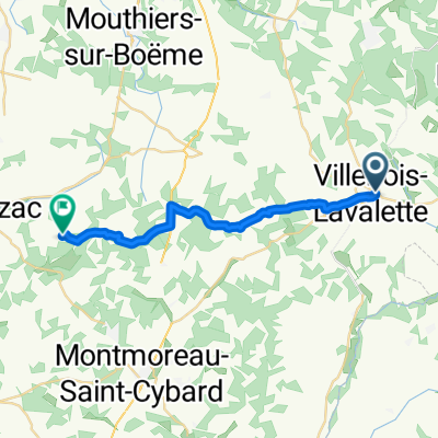
Ride Day 47—31 Oct 2005—16410 Maison Neuve (Vouzan) to 16250 Chadurie
Trasa rowerowa rozpoczynająca się w Dignac, Nouvelle-Aquitaine, Francja.
Przegląd
O tej trasie
A rainy end to a wonderful tour, but with sunshine appearing as we were on the homestretch to the farm of our friends at Les Vergers du Faure in Chadurie.
Background:My wife and I have been doing self-supported tours in Western Europe (a majority in France) since 1993. This series of rides covers our 2005 2 month route through parts of France. Our beginning and ending point is near Chadurie (south of Angoulême) where our friends have a farm with Gites and Chambres d'Hotes.We rode our Dawes touring bicycles purchased in 1993 heavily loaded with 700Cx32 tires. All of our riding was on paved roads, mostly with very little traffic.If any questions, feel free to email me at jeffkadet@netdiving.comJeff
- -:--
- Czas
- 31,9 km
- Dystans
- 303 m
- Przewyższenia
- 315 m
- Spadek
- ---
- Śr. Prędkość
- ---
- Maks. wysokość

Kontynuuj z Bikemap
Użyj, edytuj lub pobierz tę trasę rowerową
Chcesz przejechać trasę Ride Day 47—31 Oct 2005—16410 Maison Neuve (Vouzan) to 16250 Chadurie lub dostosować ją do swojej wycieczki? Oto, co możesz zrobić z tą trasą na Bikemap:
Darmowe funkcje
- Zapisz tę trasę jako ulubioną lub w kolekcji
- Skopiuj i zaplanuj swoją wersję tej trasy
- Synchronizuj swoją trasę z Garminem lub Wahoo
Funkcje Premium
3 dni bezpłatnej wersji próbnej lub jednorazowa opłata. Dowiedz się więcej o Bikemap Premium.
- Nawiguj po tej trasie na iOS i Androidzie
- Eksportuj plik GPX / KML tej trasy
- Stwórz swój własny wydruk (wypróbuj za darmo)
- Pobierz tę trasę do nawigacji offline
Odkryj więcej funkcji Premium.
Uzyskaj Bikemap PremiumOd naszej społeczności
Dignac: Inne popularne trasy rozpoczynające się tutaj
 Riberac 115
- Dystans
- 118 km
- Przewyższenia
- 617 m
- Spadek
- 616 m
- Lokalizacja
- Dignac, Nouvelle-Aquitaine, Francja
 Villebois-Bessines
- Dystans
- 139,3 km
- Przewyższenia
- 835 m
- Spadek
- 662 m
- Lokalizacja
- Dignac, Nouvelle-Aquitaine, Francja
 Under Lime Tree
- Dystans
- 44 km
- Przewyższenia
- 337 m
- Spadek
- 366 m
- Lokalizacja
- Dignac, Nouvelle-Aquitaine, Francja
 perign
- Dystans
- 19,9 km
- Przewyższenia
- 213 m
- Spadek
- 235 m
- Lokalizacja
- Dignac, Nouvelle-Aquitaine, Francja
 Chatonniere
- Dystans
- 77,6 km
- Przewyższenia
- 710 m
- Spadek
- 650 m
- Lokalizacja
- Dignac, Nouvelle-Aquitaine, Francja
 salle
salle- Dystans
- 30,3 km
- Przewyższenia
- 324 m
- Spadek
- 416 m
- Lokalizacja
- Dignac, Nouvelle-Aquitaine, Francja
 Ride Day 47—31 Oct 2005—16410 Maison Neuve (Vouzan) to 16250 Chadurie
- Dystans
- 31,9 km
- Przewyższenia
- 303 m
- Spadek
- 315 m
- Lokalizacja
- Dignac, Nouvelle-Aquitaine, Francja
 Ride Day 46—30 Oct 2005—16410 Maison Neuve (Vouzan) -- Circle
- Dystans
- 82,1 km
- Przewyższenia
- 536 m
- Spadek
- 536 m
- Lokalizacja
- Dignac, Nouvelle-Aquitaine, Francja
Otwórz ją w aplikacji