LePuy-Pamplona Etappe 11 Navarrenx Saint-Jean-Pied-de-Port
Trasa rowerowa rozpoczynająca się w Navarrenx, Aquitaine-Limousin-Poitou-Charentes, France.
Przegląd
O tej trasie
- -:--
- Czas
- 58,5 km
- Dystans
- 515 m
- Przewyższenia
- 480 m
- Spadek
- ---
- Śr. Prędkość
- ---
- Maks. wysokość
Najważniejsze punkty trasy
Punkty zainteresowania na trasie
Interesujące miejsce po 14,5 km
Interesujące miejsce po 19,1 km
Interesujące miejsce po 24,2 km
Benta
Interesujące miejsce po 32,6 km
Interesujące miejsce po 32,9 km
Interesujące miejsce po 36 km
Chapelle de Soyarza
Interesujące miejsce po 36,9 km
Interesujące miejsce po 40,3 km
Interesujące miejsce po 43,1 km
Interesujące miejsce po 43,7 km
Interesujące miejsce po 45,9 km
Interesujące miejsce po 47,7 km
Interesujące miejsce po 49,3 km
Interesujące miejsce po 49,9 km
Larreleborda
Interesujące miejsce po 52,9 km
Interesujące miejsce po 53,6 km
Chateau d'Apat
Kontynuuj z Bikemap
Użyj, edytuj lub pobierz tę trasę rowerową
Chcesz przejechać trasę LePuy-Pamplona Etappe 11 Navarrenx Saint-Jean-Pied-de-Port lub dostosować ją do swojej wycieczki? Oto, co możesz zrobić z tą trasą na Bikemap:
Darmowe funkcje
- Zapisz tę trasę jako ulubioną lub w kolekcji
- Skopiuj i zaplanuj swoją wersję tej trasy
- Synchronizuj swoją trasę z Garminem lub Wahoo
Funkcje Premium
3 dni bezpłatnej wersji próbnej lub jednorazowa opłata. Dowiedz się więcej o Bikemap Premium.
- Nawiguj po tej trasie na iOS i Androidzie
- Eksportuj plik GPX / KML tej trasy
- Stwórz swój własny wydruk (wypróbuj za darmo)
- Pobierz tę trasę do nawigacji offline
Odkryj więcej funkcji Premium.
Uzyskaj Bikemap PremiumOd naszej społeczności
Navarrenx: Inne popularne trasy rozpoczynające się tutaj
- CDP - L'Hôpital-Saint-Blaise - Mauléon-Licharre
- Dystans
- 15,4 km
- Przewyższenia
- 224 m
- Spadek
- 238 m
- Lokalizacja
- Navarrenx, Aquitaine-Limousin-Poitou-Charentes, France
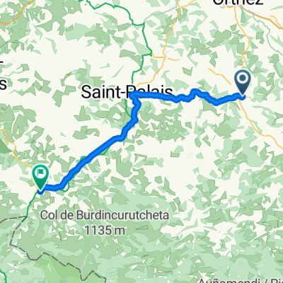
- De D847 1, Navarrenx à Place Charles de Gaulle 13, Saint-Jean-Pied-de-Port
- Dystans
- 61,9 km
- Przewyższenia
- 1234 m
- Spadek
- 1187 m
- Lokalizacja
- Navarrenx, Aquitaine-Limousin-Poitou-Charentes, France
- Navarrenx
- Dystans
- 11,1 km
- Przewyższenia
- 80 m
- Spadek
- 87 m
- Lokalizacja
- Navarrenx, Aquitaine-Limousin-Poitou-Charentes, France
- Navarrenx-Mauléon-Oloron-Navarrenx
- Dystans
- 80,7 km
- Przewyższenia
- 449 m
- Spadek
- 449 m
- Lokalizacja
- Navarrenx, Aquitaine-Limousin-Poitou-Charentes, France
- J.14 Navarrenx - Roncalles g.
- Dystans
- 90 km
- Przewyższenia
- 1560 m
- Spadek
- 791 m
- Lokalizacja
- Navarrenx, Aquitaine-Limousin-Poitou-Charentes, France
- SdC Tag7 Castetnau-Camblong nach St. Jean Pied de Port
- Dystans
- 56,3 km
- Przewyższenia
- 496 m
- Spadek
- 455 m
- Lokalizacja
- Navarrenx, Aquitaine-Limousin-Poitou-Charentes, France
- 15 Navarenx - Irun
- Dystans
- 108,1 km
- Przewyższenia
- 857 m
- Spadek
- 946 m
- Lokalizacja
- Navarrenx, Aquitaine-Limousin-Poitou-Charentes, France
- Navarrenx-Arrast_Moncayolle-Navarrenx
- Dystans
- 38,1 km
- Przewyższenia
- 363 m
- Spadek
- 363 m
- Lokalizacja
- Navarrenx, Aquitaine-Limousin-Poitou-Charentes, France
Otwórz ją w aplikacji