

Airport to Harshaw Road loop and back to airport
Trasa rowerowa rozpoczynająca się w Nogales, Arizona, USA.
Przegląd
O tej trasie
There are a couple of places to place a vehicle on this route to avoid having to ride the pavement back to the airport. This is a great ride, rugged in a few places andsome great climbs and downhills and well as some scenic detours. Bring plenty of water and snacks...it's a long ride.
- -:--
- Czas
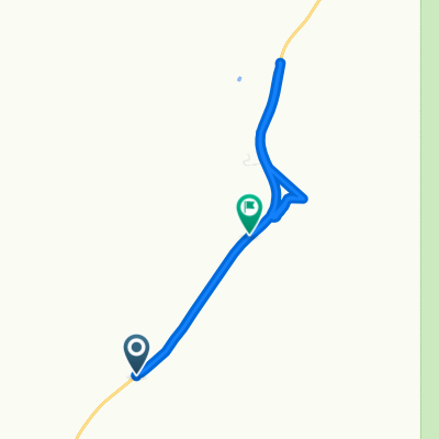
- 28,4 km
- Dystans
- 427 m
- Przewyższenia
- 430 m
- Spadek
- ---
- Śr. Prędkość
- ---
- Maks. wysokość
Najważniejsze punkty trasy
Punkty zainteresowania na trasie
Interesujące miejsce po 2,7 km
Paloma Canyon Turnoff
Interesujące miejsce po 2,9 km
Interesujące miejsce po 2,9 km
Gate...Please close the gate...
Interesujące miejsce po 3,1 km
Junction..Right goes to old corrals and water tank and dead ends there...nice diversion..
Interesujące miejsce po 4,7 km
Gate..Please close the gate..
Interesujące miejsce po 4,7 km
This road just goes up the hill to a cattle tank and dead ends...it's still a good ride and a rugged climb
Interesujące miejsce po 7,7 km
Old Corral...this is a good turnaround spot if you want to go back the way you came..from here the round trip is 9.5 miles....or continue..
Interesujące miejsce po 8,7 km
great road...comes out just south of the runway...the gate is probably locked however
Interesujące miejsce po 9 km
Great climb and beautiful view from top but is a dead end..although the view is worth the ride
Interesujące miejsce po 12,8 km
Gate..Please close the gate
Interesujące miejsce po 14,9 km
This is a great place to leave a vehicle if you want to end your ride here..otherwise it's on out to the Patagonia Hwy
Interesujące miejsce po 15,9 km
Back entrance to Kino Springs via The Village
Interesujące miejsce po 23,1 km
this also a good place to leave a vehicle if you want to end the ride here...otherwise..back to the airport
Kontynuuj z Bikemap
Użyj, edytuj lub pobierz tę trasę rowerową
Chcesz przejechać trasę Airport to Harshaw Road loop and back to airport lub dostosować ją do swojej wycieczki? Oto, co możesz zrobić z tą trasą na Bikemap:
Darmowe funkcje
- Zapisz tę trasę jako ulubioną lub w kolekcji
- Skopiuj i zaplanuj swoją wersję tej trasy
- Synchronizuj swoją trasę z Garminem lub Wahoo
Funkcje Premium
3 dni bezpłatnej wersji próbnej lub jednorazowa opłata. Dowiedz się więcej o Bikemap Premium.
- Nawiguj po tej trasie na iOS i Androidzie
- Eksportuj plik GPX / KML tej trasy
- Stwórz swój własny wydruk (wypróbuj za darmo)
- Pobierz tę trasę do nawigacji offline
Odkryj więcej funkcji Premium.
Uzyskaj Bikemap PremiumOd naszej społeczności
Nogales: Inne popularne trasy rozpoczynające się tutaj
 744–748 E Patagonia Hwy, Nogales to 900–958 E Patagonia Hwy, Nogales
- Dystans
- 7,9 km
- Przewyższenia
- 1279 m
- Spadek
- 1234 m
- Lokalizacja
- Nogales, Arizona, USA
 paloma canyon
- Dystans
- 14,9 km
- Przewyższenia
- 333 m
- Spadek
- 287 m
- Lokalizacja
- Nogales, Arizona, USA
 trecho yankee
- Dystans
- 3675,7 km
- Przewyższenia
- 9362 m
- Spadek
- 10 532 m
- Lokalizacja
- Nogales, Arizona, USA
 Airport to Harshaw Road loop and back to airport
- Dystans
- 28,4 km
- Przewyższenia
- 427 m
- Spadek
- 430 m
- Lokalizacja
- Nogales, Arizona, USA
 san2tume
- Dystans
- 828,7 km
- Przewyższenia
- 2759 m
- Spadek
- 1583 m
- Lokalizacja
- Nogales, Arizona, USA
Otwórz ją w aplikacji