- 25,8 km
- 66 m
- 154 m
- Wells Branch, Teksas, USA
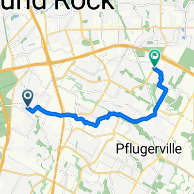
Wells Branch to Downtown Austin Commute
Trasa rowerowa rozpoczynająca się w Wells Branch, Teksas, USA.
Przegląd
O tej trasie
To najlepsza trasa, jaką znalazłem, żeby dotrzeć z Wells Branch do centrum. Korzystam z niej raz w tygodniu, a zazwyczaj zajmuje to 1,25 godziny. Potem biorę autobus 935 do domu.
Trasa na początku jest pagórkowata, ale zamienia się w łagodny zjazd im bliżej jesteś miasta.
Idź ulicą Metric do 183. Poruszaj się na wschód wzdłuż drogi/urządzeń 183 przez 0,25 mili. Przejdź pod 183 na skrzyżowaniu z Burnetem, wchodząc na parking Chili's. Idź na północ przez parking, wzdłuż 183, obok Tabu, BagPipes, aż do McCann Dr.
Zrób przyjemną jazdę w dół Shoal Creek do W38th Street. Podążaj ścieżkami Shoal Creek przez kilka bloków, aż Shoal Creek Blvd pojawi się znowu. Weź Shoal Creek Blvd/W31st do N Lamar Blvd.
Bierz N Lamar Blvd na południe (chodnik po zachodniej stronie). Na 15 ulicy znajdź ponownie ścieżkę Shoal Creek. Tym razem podążaj nią aż do 5 ulicy. Na 15 ulicy znajdują się schody, które możesz wykorzystać do wyjścia z szlaku Shoal Creek.
Możesz również wziąć ścieżkę Shoal Creek do 3 ulicy lub aż do jeziora Lady Bird.
- -:--
- Czas
- 25,8 km
- Dystans
- 66 m
- Przewyższenia
- 154 m
- Spadek
- ---
- Śr. Prędkość
- 246 m
- Maks. wysokość
utworzono 16 lat temu temu
Jakość trasy
Typy dróg i nawierzchnie na trasie
Typy dróg
Droga
7 km
(27 %)
Spokojna droga
2,8 km
(11 %)
Powierzchnie
Utwardzona
19,6 km
(76 %)
Asfalt
17,5 km
(68 %)
Beton
1,8 km
(7 %)
Kontynuuj z Bikemap
Użyj, edytuj lub pobierz tę trasę rowerową
Chcesz przejechać trasę Wells Branch to Downtown Austin Commute lub dostosować ją do swojej wycieczki? Oto, co możesz zrobić z tą trasą na Bikemap:
Darmowe funkcje
- Zapisz tę trasę jako ulubioną lub w kolekcji
- Skopiuj i zaplanuj swoją wersję tej trasy
- Synchronizuj swoją trasę z Garminem lub Wahoo
Funkcje Premium
3 dni bezpłatnej wersji próbnej lub jednorazowa opłata. Dowiedz się więcej o Bikemap Premium.
- Nawiguj po tej trasie na iOS i Androidzie
- Eksportuj plik GPX / KML tej trasy
- Stwórz swój własny wydruk (wypróbuj za darmo)
- Pobierz tę trasę do nawigacji offline
Odkryj więcej funkcji Premium.
Uzyskaj Bikemap PremiumOd naszej społeczności
Wells Branch: Inne popularne trasy rozpoczynające się tutaj
- Wells Branch to Downtown Austin Commute
- Wells Branch - Leander
- 46,2 km
- 202 m
- 163 m
- Wells Branch, Teksas, USA
- rock gym
- 11,5 km
- 38 m
- 72 m
- Wells Branch, Teksas, USA
- bike tour through Pflugerville
- 19,5 km
- 119 m
- 112 m
- Wells Branch, Teksas, USA
- Ruly Walnut 052617
- 10,5 km
- 78 m
- 79 m
- Wells Branch, Teksas, USA
- Walnut Creek 20190712
- 12,9 km
- 443 m
- 465 m
- Wells Branch, Teksas, USA
- Walnut Creek 20190705
- 13,8 km
- 65 m
- 65 m
- Wells Branch, Teksas, USA
- North Walnut Creek
- 5,8 km
- 42 m
- 14 m
- Wells Branch, Teksas, USA
Otwórz ją w aplikacji


