Mallorca
Mallorca Day 06 Colonia de Sant Pere to Port de Pollenca
Trasa rowerowa rozpoczynająca się w Artà, Comunitat Autònoma de les Illes Balears, Hiszpania.
Przegląd
O tej trasie
- 3 h 37 min
- Czas
- 54,9 km
- Dystans
- 576 m
- Przewyższenia
- 578 m
- Spadek
- 15,2 km/h
- Śr. Prędkość
- 134 m
- Maks. wysokość
Część

11 etapów
Zdjęcia trasy
Jakość trasy
Typy dróg i nawierzchnie na trasie
Typy dróg
Spokojna droga
22 km
(40 %)
Droga
8,2 km
(15 %)
Powierzchnie
Utwardzona
48,4 km
(88 %)
Asfalt
45,1 km
(82 %)
Nawierzchnia (nieokreślona)
1,6 km
(3 %)
Najważniejsze punkty trasy
Punkty zainteresowania na trasie
Interesujące miejsce po 11,4 km
Talayot Sa Cova de Sa Nineta is a construction from the Talayotic period, which spans from 1300 to 123 BC. It is believed that the construction dates back to 900 BC. It was restored at the end of the sixties, hence its stones are perfectly framed, since some are from modern times, placed to reinforce the structure. Like most square talayots, it has the door facing southeast. Recently, the Santa Margalida City Council has acquired the property where the square talayot is located, to create an interpretation center and to be able to carry out excavation work to bring more remains to light. The Consell de Mallorca participates in the cleaning work of the surrounding area, where important remains of a large town appear to be found. A must-visit place to recover our distant past.
Interesujące miejsce po 14,2 km
Es Figueral de Son Real
Interesujące miejsce po 14,6 km
Museu de Son Real Local history museum Small museum that explains the history of Finca Son Real and the surrounding area
Interesujące miejsce po 28,4 km
Embarcadero Ciudad Blanca Observation deck
Interesujące miejsce po 30,5 km
Port d'Alcúdia
Interesujące miejsce po 31,7 km
Roman theatre Teatre romà de Pol·lèntia
Interesujące miejsce po 31,8 km
Necròpoli de Can Fanals
Interesujące miejsce po 32,5 km
Ruines Romanes de Pollentia Excavation continues at this ~100 BCE site with ruins of a Roman forum, theater & residential area.
Interesujące miejsce po 32,5 km
Museu Monogràfic de Pol·lèntia Small museum in a 14th-century building with archaeological remains from Pollentia, an ancient Roman city.
Interesujące miejsce po 32,5 km
Església de Sant Jaume d'Alcúdia Grand, historic church with a small entrance fee to see ancient artifacts & art.
Interesujące miejsce po 32,5 km
Cova de Murades d'Alcudia A simple must do visit when in the area and if on a market day even better. Such a lovely surprise to see the remains or the original castle and town wall’s protected and preserved. It was fun walking the whole perimeter to see what was on offer.
Interesujące miejsce po 32,6 km
Carrer Major
Interesujące miejsce po 33,1 km
Mercat d'Alcúdia Sun and Tues mornings
Interesujące miejsce po 33,1 km
Porta del Moll
Interesujące miejsce po 36,9 km
La Victòria
Interesujące miejsce po 39,2 km
Ermita de la Victòria Absolutely worth the trip through the windy roads. If you’re on your bike be prepared for a lung busting climb. The view and a coffee at the top make up for it.
Interesujące miejsce po 45,6 km
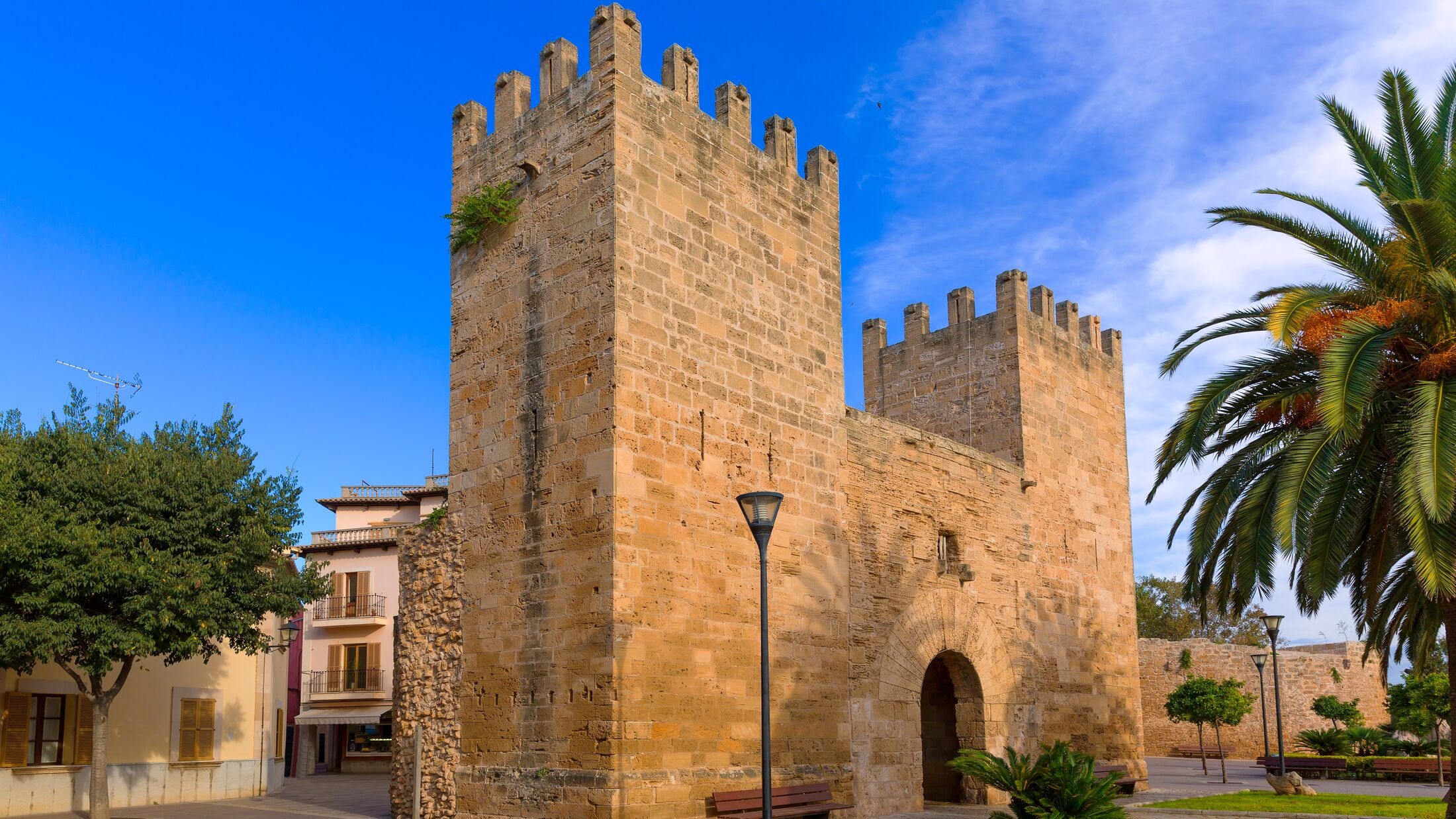
Medieval Wall of Alcúdia Muralla medieval d'Alcúdia
Nocleg po 54,9 km
Illa d'Or
Kontynuuj z Bikemap
Użyj, edytuj lub pobierz tę trasę rowerową
Chcesz przejechać trasę Mallorca Day 06 Colonia de Sant Pere to Port de Pollenca lub dostosować ją do swojej wycieczki? Oto, co możesz zrobić z tą trasą na Bikemap:
Darmowe funkcje
- Zapisz tę trasę jako ulubioną lub w kolekcji
- Skopiuj i zaplanuj swoją wersję tej trasy
- Synchronizuj swoją trasę z Garminem lub Wahoo
Funkcje Premium
3 dni bezpłatnej wersji próbnej lub jednorazowa opłata. Dowiedz się więcej o Bikemap Premium.
- Nawiguj po tej trasie na iOS i Androidzie
- Eksportuj plik GPX / KML tej trasy
- Stwórz swój własny wydruk (wypróbuj za darmo)
- Pobierz tę trasę do nawigacji offline
Odkryj więcej funkcji Premium.
Uzyskaj Bikemap PremiumOd naszej społeczności
Artà: Inne popularne trasy rozpoczynające się tutaj
 Mallorca Day 05 Arta to Colonia de Sant Pere
- Dystans
- 61,8 km
- Przewyższenia
- 1089 m
- Spadek
- 1221 m
- Lokalizacja
- Artà, Comunitat Autònoma de les Illes Balears, Hiszpania
 Mallorca a peu: sa talaia Moreia pel camí d'en Mondoi i el camí dels Presos
- Dystans
- 15,5 km
- Przewyższenia
- 526 m
- Spadek
- 525 m
- Lokalizacja
- Artà, Comunitat Autònoma de les Illes Balears, Hiszpania
 Mallorca Day 06 Colonia de Sant Pere to Port de Pollenca
- Dystans
- 54,9 km
- Przewyższenia
- 576 m
- Spadek
- 578 m
- Lokalizacja
- Artà, Comunitat Autònoma de les Illes Balears, Hiszpania
 Arta-Manacor-Port Christo-Art
- Dystans
- 63,6 km
- Przewyższenia
- 455 m
- Spadek
- 490 m
- Lokalizacja
- Artà, Comunitat Autònoma de les Illes Balears, Hiszpania
 Am Meer entlang
- Dystans
- 44,2 km
- Przewyższenia
- 578 m
- Spadek
- 702 m
- Lokalizacja
- Artà, Comunitat Autònoma de les Illes Balears, Hiszpania
 MTB Mallorca geführte MTB Tour durch www.Micobike.de in der Region Artá
- Dystans
- 28,7 km
- Przewyższenia
- 538 m
- Spadek
- 538 m
- Lokalizacja
- Artà, Comunitat Autònoma de les Illes Balears, Hiszpania
 SON CARRIO
- Dystans
- 39,2 km
- Przewyższenia
- 376 m
- Spadek
- 380 m
- Lokalizacja
- Artà, Comunitat Autònoma de les Illes Balears, Hiszpania
 Serra De Arta
- Dystans
- 33,3 km
- Przewyższenia
- 715 m
- Spadek
- 714 m
- Lokalizacja
- Artà, Comunitat Autònoma de les Illes Balears, Hiszpania
Otwórz ją w aplikacji


