Rhine Cycle Route, EuroVelo 15 - Andermatt to Basel
Trasa rowerowa rozpoczynająca się w Andermatt, Uri, Szwajcaria.
Przegląd
O tej trasie
Więcej o trasie rowerowej wzdłuż Renu:
https://www.cyclingthread.com/switzerland-and-rhine-cycle-route-one-of-most-beautiful-in-europe
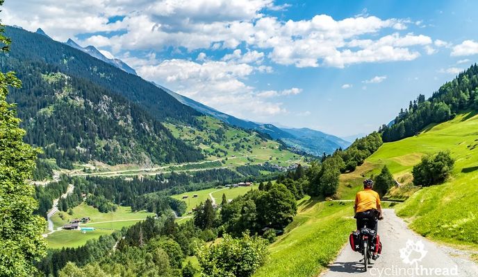
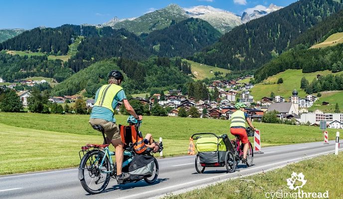
Trasa rowerowa wzdłuż Renu w Szwajcarii to pierwszy odcinek EuroVelo 15 i biegnie od Andermatt w Alpach do Bazylei – około 430 km. Zaczyna się w pobliżu źródła Renu na Przełęczy Oberalp i schodzi przez przełom Ruinaulta do Chur. Od Chur droga staje się bardziej płaska i podąża doliną Renu do Jeziora Bodeńskiego. Trasa kontynuuje dalej obok Schaffhausen i Stein am Rhein, wliczając Wodospady Renu, zanim dotrze do Bazylei. Rowerzyści przemierzają różnorodne krajobrazy – od alpejskich panoram po spokojne doliny rzeczne i historyczne miasta. Większość trasy prowadzi po utwardzonych drogach rowerowych, z kilkoma odcinkami szutrowymi i krótkimi fragmentami po cichych drogach. Łączy mocną infrastrukturę rowerową z bogatymi atrakcjami przyrodniczymi i kulturowymi.
- -:--
- Czas
- 492,2 km
- Dystans
- 6424 m
- Przewyższenia
- 7590 m
- Spadek
- ---
- Śr. Prędkość
- 2047 m
- Maks. wysokość
Zdjęcia trasy
Jakość trasy
Typy dróg i nawierzchnie na trasie
Typy dróg
Droga leśna
132,9 km
(27 %)
Spokojna droga
123,1 km
(25 %)
Powierzchnie
Utwardzona
398,7 km
(81 %)
Nieutwardzona
68,9 km
(14 %)
Asfalt
398,7 km
(81 %)
Żwir
54,1 km
(11 %)
Kontynuuj z Bikemap
Użyj, edytuj lub pobierz tę trasę rowerową
Chcesz przejechać trasę Rhine Cycle Route, EuroVelo 15 - Andermatt to Basel lub dostosować ją do swojej wycieczki? Oto, co możesz zrobić z tą trasą na Bikemap:
Darmowe funkcje
- Zapisz tę trasę jako ulubioną lub w kolekcji
- Skopiuj i zaplanuj swoją wersję tej trasy
- Podziel trasę na etapy, aby utworzyć kilkudniową wycieczkę
- Synchronizuj swoją trasę z Garminem lub Wahoo
Funkcje Premium
3 dni bezpłatnej wersji próbnej lub jednorazowa opłata. Dowiedz się więcej o Bikemap Premium.
- Nawiguj po tej trasie na iOS i Androidzie
- Eksportuj plik GPX / KML tej trasy
- Stwórz swój własny wydruk (wypróbuj za darmo)
- Pobierz tę trasę do nawigacji offline
Odkryj więcej funkcji Premium.
Uzyskaj Bikemap PremiumOd naszej społeczności
Andermatt: Inne popularne trasy rozpoczynające się tutaj
 Andermatt 3
- Dystans
- 158,9 km
- Przewyższenia
- 3905 m
- Spadek
- 3702 m
- Lokalizacja
- Andermatt, Uri, Szwajcaria
 NL The Rhine Cycle Route
- Dystans
- 1352,1 km
- Przewyższenia
- 88 m
- Spadek
- 1523 m
- Lokalizacja
- Andermatt, Uri, Szwajcaria
 Rheinradweg
- Dystans
- 1085,7 km
- Przewyższenia
- 107 m
- Spadek
- 1544 m
- Lokalizacja
- Andermatt, Uri, Szwajcaria
 VR01 Furkapass Belvedere-Brig.kml - VR01 Furkapass Belvedere-Brig.kml_VR01 Furkapass Belvedere-Brig
- Dystans
- 60,1 km
- Przewyższenia
- 852 m
- Spadek
- 2409 m
- Lokalizacja
- Andermatt, Uri, Szwajcaria
 giro dei tre passi susten grimsel furka
- Dystans
- 132,9 km
- Przewyższenia
- 3457 m
- Spadek
- 3601 m
- Lokalizacja
- Andermatt, Uri, Szwajcaria
 20.09.2010 Furka, Nufenen, Gotthard
- Dystans
- 98,5 km
- Przewyższenia
- 2959 m
- Spadek
- 2959 m
- Lokalizacja
- Andermatt, Uri, Szwajcaria
 Transalpine (7) Andermatt - Visp
- Dystans
- 89,5 km
- Przewyższenia
- 1685 m
- Spadek
- 2290 m
- Lokalizacja
- Andermatt, Uri, Szwajcaria
![[DAY 19] Göschenen - Ilanz](https://media.bikemap.net/routes/8561780/gallery/thumbs/af10c4bc-a85d-4013-8c11-c6c25ccc528a.jpeg.208x208_q80_crop.jpg) [DAY 19] Göschenen - Ilanz
[DAY 19] Göschenen - Ilanz- Dystans
- 68,1 km
- Przewyższenia
- 984 m
- Spadek
- 1380 m
- Lokalizacja
- Andermatt, Uri, Szwajcaria
Otwórz ją w aplikacji


