Central Lonsdale - Circle to Stanley Park
Trasa rowerowa rozpoczynająca się w North Vancouver, Kolumbia Brytyjska, Kanada.
Przegląd
O tej trasie
Dzisiejsza jazda przez części Vancouver Północnego i przez most Lions Gate do Stanley Park ponownie podkreśliła, jak wspaniałą robotę lokalność wykonała w tworzeniu doskonałej infrastruktury dla rowerów. Przejechaliśmy już przez trzy mosty, każdy z doskonałymi ścieżkami dla pieszych i rowerzystów. Stanley Park miał świetne drogi i ścieżki dla rowerzystów, dla tych, którzy chcą się wysilić i dla tych, którzy po prostu chcą jechać wolno. Przy wspaniałej pogodzie dzisiaj było mnóstwo ludzi na świeżym powietrzu, co skłoniło nas do pozostania głównie na drogach parkowych, a nie na ścieżkach rowerowych.
- 4 h 14 min
- Czas
- 31,1 km
- Dystans
- 627 m
- Przewyższenia
- 622 m
- Spadek
- 7,3 km/h
- Śr. Prędkość
- 128 m
- Maks. wysokość
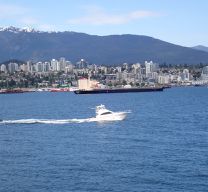
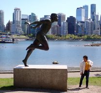
Zdjęcia trasy
Kontynuuj z Bikemap
Użyj, edytuj lub pobierz tę trasę rowerową
Chcesz przejechać trasę Central Lonsdale - Circle to Stanley Park lub dostosować ją do swojej wycieczki? Oto, co możesz zrobić z tą trasą na Bikemap:
Darmowe funkcje
- Zapisz tę trasę jako ulubioną lub w kolekcji
- Skopiuj i zaplanuj swoją wersję tej trasy
- Synchronizuj swoją trasę z Garminem lub Wahoo
Funkcje Premium
3 dni bezpłatnej wersji próbnej lub jednorazowa opłata. Dowiedz się więcej o Bikemap Premium.
- Nawiguj po tej trasie na iOS i Androidzie
- Eksportuj plik GPX / KML tej trasy
- Stwórz swój własny wydruk (wypróbuj za darmo)
- Pobierz tę trasę do nawigacji offline
Odkryj więcej funkcji Premium.
Uzyskaj Bikemap PremiumOd naszej społeczności
North Vancouver: Inne popularne trasy rozpoczynające się tutaj
 3518 Napier St, Vancouver to 3518 Napier St, Vancouver
- Dystans
- 43 km
- Przewyższenia
- 861 m
- Spadek
- 864 m
- Lokalizacja
- North Vancouver, Kolumbia Brytyjska, Kanada
 North Vancouver to Mission
- Dystans
- 79,9 km
- Przewyższenia
- 1057 m
- Spadek
- 1071 m
- Lokalizacja
- North Vancouver, Kolumbia Brytyjska, Kanada
 221 Lloyd Ave, North Vancouver to 221 Lloyd Ave, North Vancouver
- Dystans
- 13,5 km
- Przewyższenia
- 0 m
- Spadek
- 6 m
- Lokalizacja
- North Vancouver, Kolumbia Brytyjska, Kanada
 Mosquito Creek to Silva Bay, Gabriola Is., BC
- Dystans
- 49,4 km
- Przewyższenia
- 0 m
- Spadek
- 0 m
- Lokalizacja
- North Vancouver, Kolumbia Brytyjska, Kanada
 Seymour Valley Loop
- Dystans
- 46,9 km
- Przewyższenia
- 614 m
- Spadek
- 613 m
- Lokalizacja
- North Vancouver, Kolumbia Brytyjska, Kanada
 100km Poco
- Dystans
- 104,8 km
- Przewyższenia
- 289 m
- Spadek
- 289 m
- Lokalizacja
- North Vancouver, Kolumbia Brytyjska, Kanada
 Seymour Valley - East Trails and roads.
- Dystans
- 34,5 km
- Przewyższenia
- 448 m
- Spadek
- 448 m
- Lokalizacja
- North Vancouver, Kolumbia Brytyjska, Kanada
 Studio to Buntzen Lake
- Dystans
- 89,3 km
- Przewyższenia
- 877 m
- Spadek
- 879 m
- Lokalizacja
- North Vancouver, Kolumbia Brytyjska, Kanada
Otwórz ją w aplikacji


