Gap Trail Day 5
- 126,7 km
- 1380 m
- 1614 m
- Dunbar, Pensylwania, USA
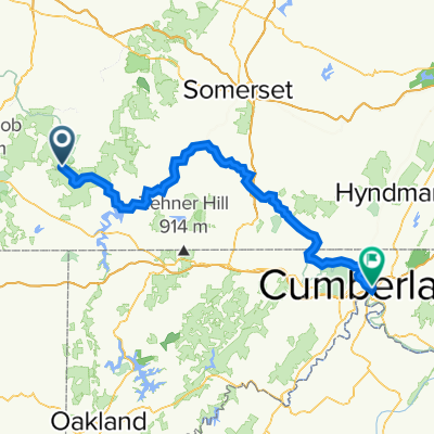
Turkey Foot Rd. is in bad shape; be cautious on descent.
Be aware of dump trucks on Jim Mountain Rd. (Rte. 653) between Normalville and just below the summit where there is a huge quarry.
There are stores in Ohiopyle and Confluence. Also, in Normalville but that requires climbing an additional steep ramp from the turnaround shown on the map.
Droga
44,9 km44 %Spokojna droga
26,6 km26 %Utwardzona
42,9 km(42 %)Asfalt
40,9 km40 %Nawierzchnia (nieokreślona)
2 km2 %Niezdefiniowany
59,2 km58 %3 dni bezpłatnej wersji próbnej lub jednorazowa opłata. Dowiedz się więcej o Bikemap Premium.
Odkryj więcej funkcji Premium.
Uzyskaj Bikemap PremiumOtwórz ją w aplikacji