St Margarets Way- Earlsferry to St Andrews
Trasa rowerowa rozpoczynająca się w Saint Monans, Szkocja, Zjednoczone Królestwo Wielkiej Brytanii.
Przegląd
O tej trasie
Striking north from Chapel Green and off the Fife Coastal Path, in the footsteps of early pilgrims heading to St Andrews, the Way continues along quiet roads and tracks until Largo Ward, where there is a strip of main road with a grass verge, past the famous Peat Inn, to Radernie, where it is signposted to Cameron Reservoir . This ancient pilgrim path is currently being restored but may be muddy in parts. After Cameron Reservoir the Way passes through Denhead and the welcoming Golf Club House at Craigtoun with a great view onto the spires of St Andrews, the long sandy beaches, and the North Sea before descending along the picturesque burn and forest track of Lumbo burn to St Andrews.
This is the 5th and final section of St Margaret’s Way, the great 100km pilgrimage trail from Edinburgh to St Andrews, part of the revival of the 1000 year old pilgrimage, The Way of St Andrews. (http://www.thewayofstandrews.com)
- -:--
- Czas
- 31,4 km
- Dystans
- 268 m
- Przewyższenia
- 252 m
- Spadek
- ---
- Śr. Prędkość
- ---
- Maks. wysokość
Kontynuuj z Bikemap
Użyj, edytuj lub pobierz tę trasę rowerową
Chcesz przejechać trasę St Margarets Way- Earlsferry to St Andrews lub dostosować ją do swojej wycieczki? Oto, co możesz zrobić z tą trasą na Bikemap:
Darmowe funkcje
- Zapisz tę trasę jako ulubioną lub w kolekcji
- Skopiuj i zaplanuj swoją wersję tej trasy
- Synchronizuj swoją trasę z Garminem lub Wahoo
Funkcje Premium
3 dni bezpłatnej wersji próbnej lub jednorazowa opłata. Dowiedz się więcej o Bikemap Premium.
- Nawiguj po tej trasie na iOS i Androidzie
- Eksportuj plik GPX / KML tej trasy
- Stwórz swój własny wydruk (wypróbuj za darmo)
- Pobierz tę trasę do nawigacji offline
Odkryj więcej funkcji Premium.
Uzyskaj Bikemap PremiumOd naszej społeczności
Saint Monans: Inne popularne trasy rozpoczynające się tutaj
- Route from Woodland Way, Kilconquhar, Leven
- Dystans
- 4,6 km
- Przewyższenia
- 20 m
- Spadek
- 42 m
- Lokalizacja
- Saint Monans, Szkocja, Zjednoczone Królestwo Wielkiej Brytanii
- Woodland Way, Kilconquhar, Leven to Woodland Way, Kilconquhar, Leven
- Dystans
- 14,6 km
- Przewyższenia
- 96 m
- Spadek
- 92 m
- Lokalizacja
- Saint Monans, Szkocja, Zjednoczone Królestwo Wielkiej Brytanii
- Coastal Path - never again
- Dystans
- 9,7 km
- Przewyższenia
- 67 m
- Spadek
- 67 m
- Lokalizacja
- Saint Monans, Szkocja, Zjednoczone Królestwo Wielkiej Brytanii
- The Toft 16, Elie to Tolbooth Wynd 1a, Crail
- Dystans
- 20 km
- Przewyższenia
- 170 m
- Spadek
- 141 m
- Lokalizacja
- Saint Monans, Szkocja, Zjednoczone Królestwo Wielkiej Brytanii
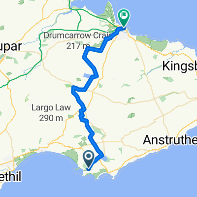
- Route from 25 Station Road, Anstruther
- Dystans
- 13,6 km
- Przewyższenia
- 298 m
- Spadek
- 46 m
- Lokalizacja
- Saint Monans, Szkocja, Zjednoczone Królestwo Wielkiej Brytanii
- St Margaret's Elbow- via Crail and Fife Ness to St Andrews
- Dystans
- 37,4 km
- Przewyższenia
- 174 m
- Spadek
- 159 m
- Lokalizacja
- Saint Monans, Szkocja, Zjednoczone Królestwo Wielkiej Brytanii
- Woodland Way, Kilconquhar2, Leven to Woodland Way, Kilconquhar, Leven
- Dystans
- 12,2 km
- Przewyższenia
- 116 m
- Spadek
- 110 m
- Lokalizacja
- Saint Monans, Szkocja, Zjednoczone Królestwo Wielkiej Brytanii
- Kellie Castle - St Andrews - Crail - Pittenweem
- Dystans
- 51,6 km
- Przewyższenia
- 316 m
- Spadek
- 305 m
- Lokalizacja
- Saint Monans, Szkocja, Zjednoczone Królestwo Wielkiej Brytanii
Otwórz ją w aplikacji