

FR1-06_Nancy - Thaon-les-Vosges_72,2km 230hm
Trasa rowerowa rozpoczynająca się w Maxéville, Grand Est, Francja.
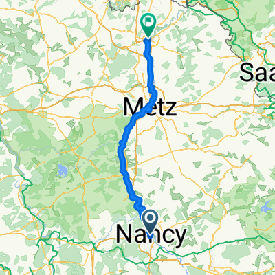
Przegląd
O tej trasie
- 4 h 28 min
- Czas
- 71,8 km
- Dystans
- 273 m
- Przewyższenia
- 163 m
- Spadek
- 16,1 km/h
- Śr. Prędkość
- 317 m
- Maks. wysokość

Jakość trasy
Typy dróg i nawierzchnie na trasie
Typy dróg
Ścieżka
43,9 km
(61 %)
Droga dojazdowa
14,7 km
(20 %)
Powierzchnie
Utwardzona
68,1 km
(95 %)
Asfalt
66,8 km
(93 %)
Beton
1,1 km
(2 %)
Najważniejsze punkty trasy
Punkty zainteresowania na trasie
Interesujące miejsce po 0,4 km
Porte Désilles Die Porte Désilles (oder Mémorial Désilles ) ist ein Gedenktor in der französischen Stadt Nancy . Es befindet sich am Place du Luxembourg, an der nördlichen Verlängerung des Cours Léopold und der Esplanade du Souvenir-Français, an der Kreuzung der Rue Désilles, der Rue de Metz und der Rue de la Craffe. Es wurde zwischen 1782 und 1784 nach Plänen des Architekten Didier-Joseph-François Mélin auf Initiative des Comte de Stainville , Oberbefehlshaber von Lothringen, erbaut. Es sollte die Aussicht am Ende des Cours Léopold abschließen und den Blick auf die Route de Metz freigeben sowie den im amerikanischen Unabhängigkeitskrieg gefallenen Bürgern von Nancy ein Denkmal setzen. Sein Name war zunächst Porte Saint-Louis, dann Porte Stainville und nahm schließlich seinen heutigen Namen in Erinnerung an André Désilles und seinen Tod in der Nancy-Affäre an. Es wurde am 15. Januar 1925 unter Denkmalschutz gestellt.
Interesujące miejsce po 0,5 km
WC
Interesujące miejsce po 1 km
Little Niam Sandwich 17 Rue de Serre, 54000 Nancy
Interesujące miejsce po 1,1 km
Pomme de Pain - La maison du sandwich 57 Rue Saint-Jean, 54000 Nancy
Serwis rowerowy po 1,1 km
Interesujące miejsce po 1,1 km
Green Bagel Café Nancy 11 Rue de la Visitation, 54000 Nancy
Interesujące miejsce po 1,3 km
Place Carnot mit dem Obelisk
Interesujące miejsce po 1,7 km
Basilique Saint-Epvre - Basilique du Sacré-Cœur de Nancy Die Basilika Saint-Epvre (Aussprache [sɛ̃.t‿ɛvʁ]) ist eine römisch-katholische Kirche in Nancy in Frankreich. Die Kirche im Bistum Nancy-Toul ist dem heiligen Aper, Bischof von Toul, gewidmet, dessen Reliquien in einem Schrein auf dem Hochaltar aufbewahrt werden, und trägt den Titel einer Basilica minor und eines Monument historique.
Interesujące miejsce po 1,8 km
Torhaus des Herzogenpalastes
Interesujące miejsce po 1,8 km
Schöner Brunnen
Serwis rowerowy po 1,8 km
Interesujące miejsce po 2 km
Parc de la Pépinière Ein toller Park mit vielen historischen Gebäuden, und sehr schönen Bäumen und großen Wiesen sehr schön angelegt.
Interesujące miejsce po 2 km
Mozart Kiosk
Serwis rowerowy po 2,1 km
Interesujące miejsce po 2,1 km
Rosarium
Interesujące miejsce po 2,1 km
WC
Serwis rowerowy po 2,1 km
Interesujące miejsce po 2,2 km
WC
Interesujące miejsce po 3 km
WC
Interesujące miejsce po 3 km
Porte Sainte-Catherine 15 m hoch und 60 m breit. Teil der alten Stadtmauer.
Interesujące miejsce po 3 km
WC
Interesujące miejsce po 3 km
WC
Serwis rowerowy po 3 km
Interesujące miejsce po 3,5 km
Food'Lab Nancy u.a. Sandwiches 61 Av. du XX Corps, 54000 Nancy
Interesujące miejsce po 3,5 km
WC
Interesujące miejsce po 3,6 km
WC
Interesujące miejsce po 4 km
WC
Interesujące miejsce po 4,7 km
WC
Serwis rowerowy po 5,5 km
Interesujące miejsce po 5,7 km
La Tomblainoise
Serwis rowerowy po 7 km
Interesujące miejsce po 10,3 km
EZEL KEBAB TACOS BURGER 13 Rue du Général Patton, 54410 Laneuveville-devant-Nancy
Interesujące miejsce po 16,5 km
Bistro La Parenthèse u.a. Sandwich 30 Rue du Ruisseau d'Urpont, 54710 Fléville-devant-Nancy
Interesujące miejsce po 21 km
Elektrizitätswerk "Turbinen" des Verbindungskanals Elektrizitätswerk "Turbinen" des Verbindungskanals
Interesujące miejsce po 26,4 km
Vielleicht Badestelle
Interesujące miejsce po 29,7 km
Le Menils St. Michel Charakteristisches Landhaus am Kanal.
Interesujące miejsce po 34,5 km
Notre-Dame-en-son-Assomption
Interesujące miejsce po 39,9 km
Chez Pascalou et Valoule kiosque à burgers - Wirtsgarten Rue de la Moselle, 54290 Bayon
Interesujące miejsce po 43,9 km
Plage de Bainville-Aux-Miroirs
Interesujące miejsce po 53,2 km
Port de Charmes
Interesujące miejsce po 53,2 km
Charmes Pizza 5 Rue Marcel Goulette, 88130 Charmes
Interesujące miejsce po 53,2 km
Boulangerie Bécherand 9 Rue Marcel Goulette, 88130 Charmes
Interesujące miejsce po 53,3 km
WC
Woda pitna po 53,6 km
Interesujące miejsce po 58,1 km
Boulangerie pâtisserie chocolaterie Bécherand 4 Rue d'Alsace, 88450 Vincey
Interesujące miejsce po 63,9 km
Borne du Serment de Koufra The Capture of Kufra (French: Prise de Koufra, Italian: Cufra) was part of the Allied Western Desert Campaign during the Second World War. Kufra is a group of oases in the Kufra District of south-eastern Cyrenaica in the Libyan Desert. In 1940, it was part of the colony of Italian Libya Libia Italiana, which was part of Africa Settentrionale Italiana (ASI), which had been established in 1934. With some early assistance from the British Long Range Desert Group, Kufra was besieged from 31 January to 1 March 1941 by Free French forces which forced the surrender of the Italian and Libyan garrison.
Interesujące miejsce po 64,4 km
Alte Fabrik am Kanal Die Gebäude aus Backstein wirken wie ein Lost Place, in jedem Fall aber ein geschlossenes Ensemble direkt am Canal: beeindruckend!
Interesujące miejsce po 69,5 km
Badestrand?
Interesujące miejsce po 70,9 km
Franky Pizza 35 Rue de Lorraine, 88150 Thaon-les-Vosges
Interesujące miejsce po 71,4 km
ZONE KEBAB 15 Av. des Fusillés, 88150 Thaon-les-Vosges
Kontynuuj z Bikemap
Użyj, edytuj lub pobierz tę trasę rowerową
Chcesz przejechać trasę FR1-06_Nancy - Thaon-les-Vosges_72,2km 230hm lub dostosować ją do swojej wycieczki? Oto, co możesz zrobić z tą trasą na Bikemap:
Darmowe funkcje
- Zapisz tę trasę jako ulubioną lub w kolekcji
- Skopiuj i zaplanuj swoją wersję tej trasy
- Synchronizuj swoją trasę z Garminem lub Wahoo
Funkcje Premium
3 dni bezpłatnej wersji próbnej lub jednorazowa opłata. Dowiedz się więcej o Bikemap Premium.
- Nawiguj po tej trasie na iOS i Androidzie
- Eksportuj plik GPX / KML tej trasy
- Stwórz swój własny wydruk (wypróbuj za darmo)
- Pobierz tę trasę do nawigacji offline
Odkryj więcej funkcji Premium.
Uzyskaj Bikemap PremiumOd naszej społeczności
Maxéville: Inne popularne trasy rozpoczynające się tutaj
 Maxéville - Diedenhofen
- Dystans
- 99,2 km
- Przewyższenia
- 145 m
- Spadek
- 184 m
- Lokalizacja
- Maxéville, Grand Est, Francja
 Nancy Liverdun Pont à Mousson Nancy
- Dystans
- 72,1 km
- Przewyższenia
- 274 m
- Spadek
- 273 m
- Lokalizacja
- Maxéville, Grand Est, Francja
 Nancy Liverdun Dieulouard Custine Nancy
- Dystans
- 59,9 km
- Przewyższenia
- 251 m
- Spadek
- 252 m
- Lokalizacja
- Maxéville, Grand Est, Francja
 Nancy to Épinal
- Dystans
- 78,6 km
- Przewyższenia
- 329 m
- Spadek
- 209 m
- Lokalizacja
- Maxéville, Grand Est, Francja
 Lengthy ride through Nancy
- Dystans
- 46,1 km
- Przewyższenia
- 190 m
- Spadek
- 190 m
- Lokalizacja
- Maxéville, Grand Est, Francja
 FR1-06_Nancy - Thaon-les-Vosges_72,2km 230hm
- Dystans
- 71,8 km
- Przewyższenia
- 273 m
- Spadek
- 163 m
- Lokalizacja
- Maxéville, Grand Est, Francja
 nancy- verdun
- Dystans
- 137,3 km
- Przewyższenia
- 326 m
- Spadek
- 338 m
- Lokalizacja
- Maxéville, Grand Est, Francja
 Nancy Chaligny Champigneules Nancy
- Dystans
- 49,3 km
- Przewyższenia
- 286 m
- Spadek
- 287 m
- Lokalizacja
- Maxéville, Grand Est, Francja
Otwórz ją w aplikacji