VASCO-NAVARRO LANDA
Trasa rowerowa rozpoczynająca się w Vitoria, Euskal Autonomia Erkidegoa, Hiszpania.
Przegląd
O tej trasie
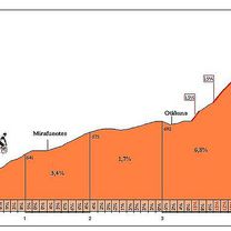
Jako punkt odniesienia bierzemy Zielony Szlak Vasco-Navarro, ale tym razem punktem startu jest parking przy kompleksie sportowym Gamarra. Trasa o długości 29 kilometrów zaprowadzi nas do Parku Prowincjonalnego Landa oraz jego nadbrzeżnych plaż. Landa oferuje malowniczy krajobraz złożony ze zielonych, dobrze utrzymanych i rozległych łąk, na których rosną samotne, pięknie wyglądające dęby lub jesiony oraz lasy sosnowe przeplatające się z nimi, co pozwala znaleźć słoneczne i zacienione miejsca na brzegu zbiornika wodnego. Mamy więc do czynienia z idealnym miejscem do spędzania wolnego czasu w kontakcie z naturą i na świeżym powietrzu. Z Landy, biegnąc wzdłuż zbiornika Ullibarri-Gamboa i ciesząc się spektakularnymi widokami, wrócimy do punktu startowego.
- -:--
- Czas
- 29,5 km
- Dystans
- 203 m
- Przewyższenia
- 203 m
- Spadek
- ---
- Śr. Prędkość
- 582 m
- Maks. wysokość
Zdjęcia trasy
Jakość trasy
Typy dróg i nawierzchnie na trasie
Typy dróg
Droga rowerowa
12,4 km
(42 %)
Ścieżka
8 km
(27 %)
Powierzchnie
Utwardzona
4,4 km
(15 %)
Nieutwardzona
16,8 km
(57 %)
Nieutwardzony (nieokreślony)
11,2 km
(38 %)
Ziemia
5,6 km
(19 %)
Kontynuuj z Bikemap
Użyj, edytuj lub pobierz tę trasę rowerową
Chcesz przejechać trasę VASCO-NAVARRO LANDA lub dostosować ją do swojej wycieczki? Oto, co możesz zrobić z tą trasą na Bikemap:
Darmowe funkcje
- Zapisz tę trasę jako ulubioną lub w kolekcji
- Skopiuj i zaplanuj swoją wersję tej trasy
- Synchronizuj swoją trasę z Garminem lub Wahoo
Funkcje Premium
3 dni bezpłatnej wersji próbnej lub jednorazowa opłata. Dowiedz się więcej o Bikemap Premium.
- Nawiguj po tej trasie na iOS i Androidzie
- Eksportuj plik GPX / KML tej trasy
- Stwórz swój własny wydruk (wypróbuj za darmo)
- Pobierz tę trasę do nawigacji offline
Odkryj więcej funkcji Premium.
Uzyskaj Bikemap PremiumOd naszej społeczności
Vitoria: Inne popularne trasy rozpoczynające się tutaj
 1ª Etapa Euskadi-Murcia 2015
- Dystans
- 200,2 km
- Przewyższenia
- 2192 m
- Spadek
- 1666 m
- Lokalizacja
- Vitoria, Euskal Autonomia Erkidegoa, Hiszpania
 Vitoria- Santuario de Codes- Camping de la Rioja
- Dystans
- 131,6 km
- Przewyższenia
- 1356 m
- Spadek
- 1367 m
- Lokalizacja
- Vitoria, Euskal Autonomia Erkidegoa, Hiszpania
 VASCO-NAVARRO LANDA
- Dystans
- 29,5 km
- Przewyższenia
- 203 m
- Spadek
- 203 m
- Lokalizacja
- Vitoria, Euskal Autonomia Erkidegoa, Hiszpania
 en la ruta
- Dystans
- 41,8 km
- Przewyższenia
- 408 m
- Spadek
- 415 m
- Lokalizacja
- Vitoria, Euskal Autonomia Erkidegoa, Hiszpania
 en la ruta
- Dystans
- 27 km
- Przewyższenia
- 333 m
- Spadek
- 336 m
- Lokalizacja
- Vitoria, Euskal Autonomia Erkidegoa, Hiszpania
 Tour Pays Basque J5
- Dystans
- 62,3 km
- Przewyższenia
- 1309 m
- Spadek
- 1852 m
- Lokalizacja
- Vitoria, Euskal Autonomia Erkidegoa, Hiszpania
 VASCO NAVARRO ESTIBALIZ
- Dystans
- 14,2 km
- Przewyższenia
- 747 m
- Spadek
- 270 m
- Lokalizacja
- Vitoria, Euskal Autonomia Erkidegoa, Hiszpania
 GREAT CYCLE TOURIST ROUTE OF THE LLANADA ALAVESA
- Dystans
- 118,6 km
- Przewyższenia
- 1033 m
- Spadek
- 1034 m
- Lokalizacja
- Vitoria, Euskal Autonomia Erkidegoa, Hiszpania
Otwórz ją w aplikacji


