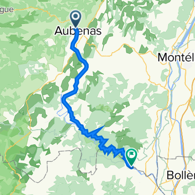
Parcours autour d'Aubenas
Trasa rowerowa rozpoczynająca się w Aubenas, Owernia-Rodan-Alpy, Francja.
Przegląd
O tej trasie
26 przełęczy wokół Aubenas dla uzyskania BERTHA, Wyjątkowego Brevetu dla Tytanicznego i Homeryckiego Rowerzysty Ardèche.
- -:--
- Czas
- 165,6 km
- Dystans
- 2266 m
- Przewyższenia
- 2266 m
- Spadek
- ---
- Śr. Prędkość
- ---
- Maks. wysokość
Jakość trasy
Typy dróg i nawierzchnie na trasie
Typy dróg
Droga
79,5 km
(48 %)
Spokojna droga
19,9 km
(12 %)
Powierzchnie
Utwardzona
66,2 km
(40 %)
Asfalt
62,9 km
(38 %)
Nawierzchnia (nieokreślona)
3,3 km
(2 %)
Niezdefiniowany
99,4 km
(60 %)
Najważniejsze punkty trasy
Punkty zainteresowania na trasie
Interesujące miejsce po 6,6 km
Col d'Autuche 327m
Interesujące miejsce po 10,2 km
Col de Vals 402m
Interesujące miejsce po 13,3 km
Col de Montagnac 558m
Interesujące miejsce po 20,2 km
Col de Conchis 694m
Interesujące miejsce po 21,4 km
Col de Genestelle 648m
Interesujące miejsce po 31,8 km
Col d'Aizac 642m
Interesujące miejsce po 38,1 km
Col de Juvinas 718m
Interesujące miejsce po 46,4 km
Col de Moucheyre 858m
Interesujące miejsce po 66,6 km
Col du Pranlet 1363m
Interesujące miejsce po 75,3 km
Col de Mezilhac 1119m
Interesujące miejsce po 81,5 km
Col des Quatre Vios 1149m
Interesujące miejsce po 88,3 km
Col de Miraud 986m
Interesujące miejsce po 89,5 km
Malpas 1074m
Interesujące miejsce po 94,1 km
Col de la Fayolle 877m
Interesujące miejsce po 95,3 km
Goulet de Peyrille 832m
Interesujące miejsce po 99,5 km
Col de Sarrasset 825m
Interesujące miejsce po 103,5 km
Col des Pierres de Faux 793m
Interesujące miejsce po 107,7 km
Col de l'Arénier 682m
Interesujące miejsce po 109,8 km
Col de l'Escrinet 787m
Interesujące miejsce po 114,4 km
Coulet de la Souliere 834m
Interesujące miejsce po 118,6 km
Col du Benas 795m
Interesujące miejsce po 123,8 km
Col de Fontenelle 703m
Interesujące miejsce po 125 km
Col Saint Martin 723m
Interesujące miejsce po 140,3 km
Pas de Vendrias 635m
Interesujące miejsce po 152,5 km
Col de Valaurie
Interesujące miejsce po 155 km
Col d'Auriolles
Kontynuuj z Bikemap
Użyj, edytuj lub pobierz tę trasę rowerową
Chcesz przejechać trasę Parcours autour d'Aubenas lub dostosować ją do swojej wycieczki? Oto, co możesz zrobić z tą trasą na Bikemap:
Darmowe funkcje
- Zapisz tę trasę jako ulubioną lub w kolekcji
- Skopiuj i zaplanuj swoją wersję tej trasy
- Podziel trasę na etapy, aby utworzyć kilkudniową wycieczkę
- Synchronizuj swoją trasę z Garminem lub Wahoo
Funkcje Premium
3 dni bezpłatnej wersji próbnej lub jednorazowa opłata. Dowiedz się więcej o Bikemap Premium.
- Nawiguj po tej trasie na iOS i Androidzie
- Eksportuj plik GPX / KML tej trasy
- Stwórz swój własny wydruk (wypróbuj za darmo)
- Pobierz tę trasę do nawigacji offline
Odkryj więcej funkcji Premium.
Uzyskaj Bikemap PremiumOd naszej społeczności
Aubenas: Inne popularne trasy rozpoczynające się tutaj
 Cévennes V3
- Dystans
- 482,7 km
- Przewyższenia
- 5608 m
- Spadek
- 5610 m
- Lokalizacja
- Aubenas, Owernia-Rodan-Alpy, Francja
 2010.1 Aubenas-Saint-Martin-d'Ardèche
- Dystans
- 70,2 km
- Przewyższenia
- 1153 m
- Spadek
- 1366 m
- Lokalizacja
- Aubenas, Owernia-Rodan-Alpy, Francja
 Aubenas-Chassiers
- Dystans
- 18,1 km
- Przewyższenia
- 432 m
- Spadek
- 406 m
- Lokalizacja
- Aubenas, Owernia-Rodan-Alpy, Francja
 Aubenas - Montpellier: 12h
- Dystans
- 153 km
- Przewyższenia
- 616 m
- Spadek
- 880 m
- Lokalizacja
- Aubenas, Owernia-Rodan-Alpy, Francja
 2010.0 für 2023 Languedoc: Ardèche-Camarque
- Dystans
- 818,1 km
- Przewyższenia
- 8238 m
- Spadek
- 8485 m
- Lokalizacja
- Aubenas, Owernia-Rodan-Alpy, Francja
 2023 Ardèche Aubenas-Stes Maries de la Mer
- Dystans
- 748,1 km
- Przewyższenia
- 7646 m
- Spadek
- 7962 m
- Lokalizacja
- Aubenas, Owernia-Rodan-Alpy, Francja
 Raid 707 - Section 6
- Dystans
- 100,9 km
- Przewyższenia
- 841 m
- Spadek
- 944 m
- Lokalizacja
- Aubenas, Owernia-Rodan-Alpy, Francja
 Parcours autour d'Aubenas
- Dystans
- 165,6 km
- Przewyższenia
- 2266 m
- Spadek
- 2266 m
- Lokalizacja
- Aubenas, Owernia-Rodan-Alpy, Francja
Otwórz ją w aplikacji

