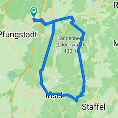
Stadttour Darmstadt
Trasa rowerowa rozpoczynająca się w Pfungstadt, Hesja, Niemcy.
Przegląd
O tej trasie
- -:--
- Czas
- 17,1 km
- Dystans
- 89 m
- Przewyższenia
- 35 m
- Spadek
- ---
- Śr. Prędkość
- 165 m
- Maks. wysokość
Jakość trasy
Typy dróg i nawierzchnie na trasie
Typy dróg
Spokojna droga
6 km
(35 %)
Droga leśna
3,9 km
(23 %)
Powierzchnie
Utwardzona
8,7 km
(51 %)
Nieutwardzona
4,5 km
(26 %)
Asfalt
8,7 km
(51 %)
Żwir
4,1 km
(24 %)
Najważniejsze punkty trasy
Punkty zainteresowania na trasie
Interesujące miejsce po 5,6 km
Straßenbahn bis hier?
Interesujące miejsce po 5,6 km
Hochhaus h_da
Interesujące miejsce po 5,9 km
Alt-Bessungen
Interesujące miejsce po 6,3 km
Orangerie
Interesujące miejsce po 7,3 km
Kuppelkirche
Interesujące miejsce po 7,8 km
Luisenplatz
Interesujące miejsce po 7,9 km
Centralstation, Carree
Interesujące miejsce po 8,3 km
Schloß
Interesujące miejsce po 8,7 km
Herrngarten-Café
Interesujące miejsce po 9 km
Prinz-Georgs-Garten
Interesujące miejsce po 9,6 km
Hundertwasserhaus
Interesujące miejsce po 9,7 km
Martinsviertel
Interesujące miejsce po 10,9 km
Mathildenhöhe
Interesujące miejsce po 12,1 km
Rosenhöhe
Interesujące miejsce po 12,6 km
Oberfeld
Interesujące miejsce po 13,3 km
Hofgut Oberfeld
Interesujące miejsce po 15,6 km
Grosser Woog
Interesujące miejsce po 16,8 km
Alte Stadtmauer
Interesujące miejsce po 17,1 km
Biergarten
Kontynuuj z Bikemap
Użyj, edytuj lub pobierz tę trasę rowerową
Chcesz przejechać trasę Stadttour Darmstadt lub dostosować ją do swojej wycieczki? Oto, co możesz zrobić z tą trasą na Bikemap:
Darmowe funkcje
- Zapisz tę trasę jako ulubioną lub w kolekcji
- Skopiuj i zaplanuj swoją wersję tej trasy
- Synchronizuj swoją trasę z Garminem lub Wahoo
Funkcje Premium
3 dni bezpłatnej wersji próbnej lub jednorazowa opłata. Dowiedz się więcej o Bikemap Premium.
- Nawiguj po tej trasie na iOS i Androidzie
- Eksportuj plik GPX / KML tej trasy
- Stwórz swój własny wydruk (wypróbuj za darmo)
- Pobierz tę trasę do nawigacji offline
Odkryj więcej funkcji Premium.
Uzyskaj Bikemap PremiumOd naszej społeczności
Pfungstadt: Inne popularne trasy rozpoczynające się tutaj
 Feierabendtour zum Kühkopf
- Dystans
- 31,8 km
- Przewyższenia
- 52 m
- Spadek
- 63 m
- Lokalizacja
- Pfungstadt, Hesja, Niemcy
 Eberstadt-Hambach-Neunkirchner Höhe
- Dystans
- 69,5 km
- Przewyższenia
- 1030 m
- Spadek
- 927 m
- Lokalizacja
- Pfungstadt, Hesja, Niemcy
 Tour 4 - Stettbachtal von oben
- Dystans
- 25,7 km
- Przewyższenia
- 291 m
- Spadek
- 294 m
- Lokalizacja
- Pfungstadt, Hesja, Niemcy
 Rund um den Frankenstein 28,520
- Dystans
- 29,7 km
- Przewyższenia
- 689 m
- Spadek
- 580 m
- Lokalizacja
- Pfungstadt, Hesja, Niemcy
 Eberstadt - Bensheim - Pfungstadt
- Dystans
- 41 km
- Przewyższenia
- 74 m
- Spadek
- 74 m
- Lokalizacja
- Pfungstadt, Hesja, Niemcy
 2012_Pfungstadt - Frankenstein - Heiligenberg - Steigerts - Hutzelstraße - Col de Ober-Beerbach - Steigerts - Pfungstadt
- Dystans
- 49,9 km
- Przewyższenia
- 850 m
- Spadek
- 850 m
- Lokalizacja
- Pfungstadt, Hesja, Niemcy
 Burg Frankenstein
- Dystans
- 11,7 km
- Przewyższenia
- 466 m
- Spadek
- 466 m
- Lokalizacja
- Pfungstadt, Hesja, Niemcy
 Darmstadt Eberstadt - Odenwald (Frankenstein/Melibocus)
- Dystans
- 63,3 km
- Przewyższenia
- 965 m
- Spadek
- 965 m
- Lokalizacja
- Pfungstadt, Hesja, Niemcy
Otwórz ją w aplikacji

