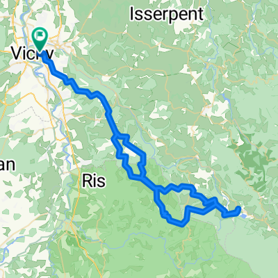
Vichy - Le Donjon
- 40,5 km
- 603 m
- 385 m
- Vichy, Owernia-Rodan-Alpy, Francja
Trasa rowerowa rozpoczynająca się w Vichy, Owernia-Rodan-Alpy, Francja.
Przegląd
Mimo prognozy deszczu, wyruszyliśmy pod przeważnie niebieskim niebem. Niewiele później mijaliśmy poważnie ciemne chmury, słysząc regularny odgłos odległych grzmotów. Będąc około siedem lub osiem mil od naszego celu (Etap w Thiers), mieliśmy nadzieję, że nie zostaniemy zaskoczeni deszczem.
Żegnaj nadziejo... zostaliśmy obrzuceni gradem (dzięki kaskom nie był to większy problem, choć było trochę głośno) i całkowicie przemokliśmy, gdy gwałtowna ulewa nie ustawała przez te pozostałe siedem lub osiem mil. Na szczęście pani w Etap była uprzejma i nakazała nam wprowadzić nasze ociekające rowery przez hol do tylnego pomieszczenia.
Tło:
Ja i moja żona podróżujemy na własną rękę po Europie Zachodniej (głównie po Francji) od 1993 roku. Ta seria opisuje naszą trasę z 2009 roku, trwającą 4,5 miesiąca, przez części Francji, Niemiec, Austrii, Szwajcarii, a następnie z powrotem do Francji. Nasz punkt startu i końca to okolice Chadurie (na południe od Angouleme), gdzie nasi przyjaciele mają farmę z Gites i Chambres d'Hotes.
Jeździliśmy naszymi rowerami turystycznymi Dawes zakupionymi w 1993 roku, mocno załadowanymi, z oponami 700Cx32. Cała nasza jazda odbywała się po wyasfaltowanych drogach, przeważnie z bardzo małym ruchem. Prawie jedyne nieutwardzone odcinki to niektóre ścieżki rowerowe w Niemczech i Austrii. Niestety nie było to najlepsze, ponieważ Helen wielokrotnie upadała na nieutwardzonych ścieżkach. Na szczęście bez poważnych urazów.
W razie pytań, proszę śmiało pisać na jeffkadet@netdiving.com
Jeff
utworzono 13 lat temu temu
Jakość trasy
Droga
14,3 km
35 %
Spokojna droga
3,7 km
9 %
Utwardzona
25,8 km
(63 %)
Nieutwardzona
0,8 km
(2 %)
Asfalt
25,8 km
63 %
Nieutwardzony (nieokreślony)
0,8 km
2 %
Niezdefiniowany
14,3 km
35 %
Kontynuuj z Bikemap
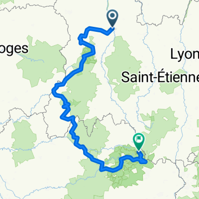
Chcesz przejechać trasę 2009 Euro Tour -- Ride Day 6 — 26 June 2009 — 03200 Vichy to 63300 Thiers lub dostosować ją do swojej wycieczki? Oto, co możesz zrobić z tą trasą na Bikemap:
3 dni bezpłatnej wersji próbnej lub jednorazowa opłata. Dowiedz się więcej o Bikemap Premium.
Odkryj więcej funkcji Premium.
Uzyskaj Bikemap PremiumOd naszej społeczności
Otwórz ją w aplikacji