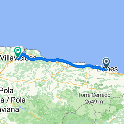
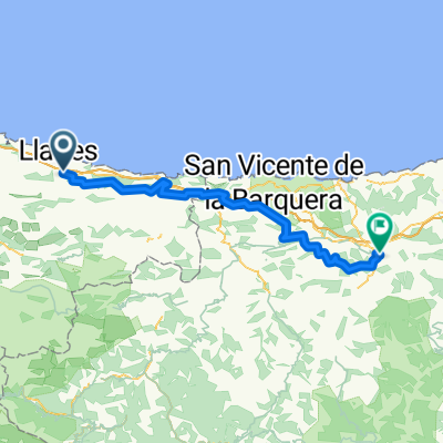
Llanes - Cartes
- 87,1 km
- 2652 m
- 2507 m
- Llanes, Asturia, Hiszpania
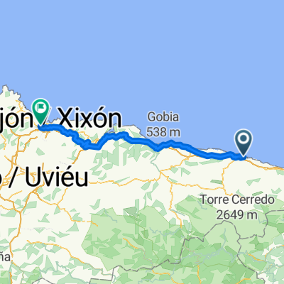
Santander - Gijon
Trasa rowerowa rozpoczynająca się w Llanes, Asturia, Hiszpania.
Przegląd
Dzień wyróżniający się przejazdem obok pięknych plaż, dość zatłoczonych latem, zanim trasa skręca w głąb lądu i jedzie się przez bardziej wiejskie tereny. Dość długi dzień.
utworzono 1 rok temu temu
Część

7 etapów
Jakość trasy
Droga leśna
13,7 km
(44 %)
Spokojna droga
8,7 km
(28 %)
Utwardzona
15,9 km
(51 %)
Nieutwardzona
12,1 km
(39 %)
Asfalt
10,3 km
(33 %)
Żwir
7,5 km
(24 %)
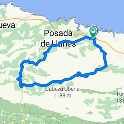
Najważniejsze punkty trasy

The Monestario y Iglesia de San Salvador has a hsitory stretching back to the 11th century. what is seen today is from the 17th century when the church and other monastic buildings were rebuilt. In 1633, a college of philosophy was established there, giving it some renown. In 1679, the reconstruction of the church began due to its poor state of conservation. The monastery's demise occurred during the 19th century, first with its occupation during the Peninsular Wa and in 1835 it was secularized. Its library was transferred to the University of Oviedo, where it was burned in 1934. After passing into private hands, it was acquired by the Jesuits in 1919, who still maintain ownership. Despite later destructions and reforms, some medieval elements of the former monastic establishment remain, including a notable square-plan bell tower and the church's portal, with a slightly pointed zigzag arch.

The Iglesia de Nuéstra Señora de los Dolores is the Parish Church of Barro.To the rear is the cemetery, which borders the Barro estuary. The Church was built at the end of the eighteenth century.

The Monestario de San Antolín de Bedón was built at the mouth of the river Bedón, close to the sea and the coast. Its year of construction is unknown, as the first information we have is from the 12th century. The only surviving evidence is the church, which corresponds to an advanced Romanesque style, in transition to Gothic, a style that can be seen in the use of the pointed arch.

The Playa Gulpiyuri is a flooded sinkhole with an inland beach around 100 m from the sea. It is the shortest beach in the world

The Iglesia de San Mamés dates from the 16th century it was restored in the 18th century, and expanded in the 20th. It served as a pilgrim hostel in ancient times.

Fuente de los Peregrinos is in front of the Church and separated from it by a green carpet, there is the Pilgrim Fountain that serves as a stop and rest for pilgrims who since ancient times make the Camino de Santiago along the coast. It dates back to the 15th centur

The Iglesia de Santa María Magdalena was built in the early 20th century on the remains of an old mediaeval church. It was almost completely destroyed during the Spanish Civil War in 1936 but was subsequently rebuilt. The architectural features of interest include the two towers on its main facade, between which stands an image of Christ, and the dome over the transept.

The Capilla de Santa Ana is located in the street of the same name in Ribadesella. The temple, renovated in 1995, stands out for having housed the headquarters of The Sea Guild, which disappeared in 1846.

Monte Corbero or La Atalaya is called the summit of the promontory that rises above the town of Ribadesella, on the right bank of the estuary that forms at its mouth the Sella.

Playa de Santa Marina is located in the town centre. A big stretch of sand that runs alongside the town. The Sella river flows out onto this beach and every year hundreds of people participate in a competition canoeing down the Sella. The beach is surrounded by a promenade and by pretty villas and estates, formerly the summer residences of Ribadesella and also locals that live there all year round.

The Ermita de La Guía is located at the top of Mount Corberu, at the end of a stone path that begins from the port. The temple was built in the 16th century, under a proto-renaissance style, at the request of the Guild of the Sea From the church, there are magnificent views over the town and the mouth of the river.
Kontynuuj z Bikemap
Chcesz przejechać trasę 04 Day 4, Llanes - Ribadesella lub dostosować ją do swojej wycieczki? Oto, co możesz zrobić z tą trasą na Bikemap:
3 dni bezpłatnej wersji próbnej lub jednorazowa opłata. Dowiedz się więcej o Bikemap Premium.
Odkryj więcej funkcji Premium.
Uzyskaj Bikemap PremiumOd naszej społeczności
Otwórz ją w aplikacji