Austin - Circle to Bee Cave
Trasa rowerowa rozpoczynająca się w Rollingwood, Teksas, USA.
Przegląd
O tej trasie
To był wymagający okrąg z wieloma wzniesieniami i zjazdami. Niektóre z początkowych podjazdów po przekroczeniu rzeki Kolorado w kierunku West Lake Hills były strasznie strome.
Ta część West Lake Hills trasy, aż do skrętu w Bee Cave Road, była jedyną drogą o niskim natężeniu ruchu. Praktycznie cała reszta przejazdu wzdłuż Bee Cave Road/FM2244 i West Highway 71 była z dość dużym ruchem. Chociaż było głośno, nie stanowiło to problemu, ponieważ przez prawie 98% czasu były doskonałe szerokie pobocza. Było nawet kilka widoków, które można było określić jako malownicze wzdłuż West Highway 71.
Zbliżając się do centrum Austin, trasa zawiera oddzielną ścieżkę rowerową, która znacznie ułatwiła i umożliwiła bezpieczny powrót do miasta.
- 2 h 23 min
- Czas
- 44,6 km
- Dystans
- 562 m
- Przewyższenia
- 564 m
- Spadek
- 18,7 km/h
- Śr. Prędkość
- 315 m
- Maks. wysokość
Zdjęcia trasy
Jakość trasy
Typy dróg i nawierzchnie na trasie
Typy dróg
Droga
5,8 km
(13 %)
Droga dojazdowa
4,5 km
(10 %)
Powierzchnie
Utwardzona
39,7 km
(89 %)
Asfalt
33,5 km
(75 %)
Beton
5,8 km
(13 %)
Kontynuuj z Bikemap
Użyj, edytuj lub pobierz tę trasę rowerową
Chcesz przejechać trasę Austin - Circle to Bee Cave lub dostosować ją do swojej wycieczki? Oto, co możesz zrobić z tą trasą na Bikemap:
Darmowe funkcje
- Zapisz tę trasę jako ulubioną lub w kolekcji
- Skopiuj i zaplanuj swoją wersję tej trasy
- Synchronizuj swoją trasę z Garminem lub Wahoo
Funkcje Premium
3 dni bezpłatnej wersji próbnej lub jednorazowa opłata. Dowiedz się więcej o Bikemap Premium.
- Nawiguj po tej trasie na iOS i Androidzie
- Eksportuj plik GPX / KML tej trasy
- Stwórz swój własny wydruk (wypróbuj za darmo)
- Pobierz tę trasę do nawigacji offline
Odkryj więcej funkcji Premium.
Uzyskaj Bikemap PremiumOd naszej społeczności
Rollingwood: Inne popularne trasy rozpoczynające się tutaj
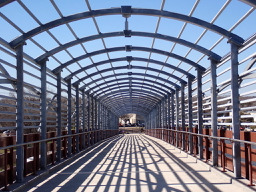 Austin - Circle Southeast to Richard Moya Park
- Dystans
- 47,2 km
- Przewyższenia
- 288 m
- Spadek
- 288 m
- Lokalizacja
- Rollingwood, Teksas, USA
 Buda loop - 37 mi
- Dystans
- 60,2 km
- Przewyższenia
- 212 m
- Spadek
- 213 m
- Lokalizacja
- Rollingwood, Teksas, USA
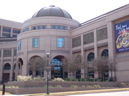 Austin - Circle to Northeast
- Dystans
- 36,4 km
- Przewyższenia
- 270 m
- Spadek
- 276 m
- Lokalizacja
- Rollingwood, Teksas, USA
 Austin - Circle to Bee Cave
- Dystans
- 44,6 km
- Przewyższenia
- 562 m
- Spadek
- 564 m
- Lokalizacja
- Rollingwood, Teksas, USA
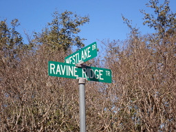 Austin - Circle to Steiner Ranch
- Dystans
- 56,1 km
- Przewyższenia
- 757 m
- Spadek
- 758 m
- Lokalizacja
- Rollingwood, Teksas, USA
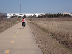 Austin to Giddings
- Dystans
- 113,7 km
- Przewyższenia
- 492 m
- Spadek
- 529 m
- Lokalizacja
- Rollingwood, Teksas, USA
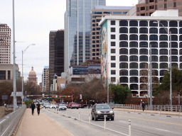 Austin - Circle to McKinney Falls State Park
- Dystans
- 40,3 km
- Przewyższenia
- 360 m
- Spadek
- 355 m
- Lokalizacja
- Rollingwood, Teksas, USA
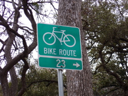 Austin - Circle to North Via Camp Mabry, Bike Rt 23, and Shoal Creek Blvd
- Dystans
- 39,5 km
- Przewyższenia
- 515 m
- Spadek
- 513 m
- Lokalizacja
- Rollingwood, Teksas, USA
Otwórz ją w aplikacji


