

FR2
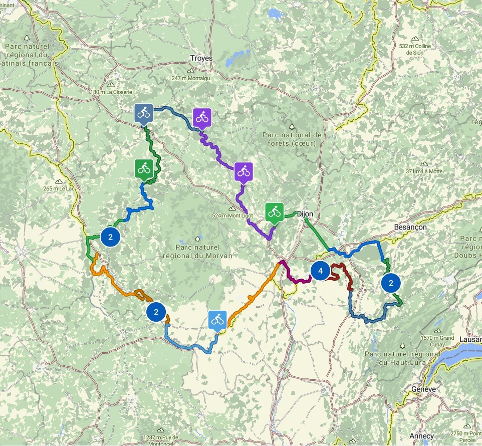
FR2-01_Palinges_Bourbon-Lancy_72,5km 290hm
Trasa rowerowa rozpoczynająca się w Palinges, Burgundia-Franche-Comté, Francja.
Przegląd
O tej trasie
- 4 h 27 min
- Czas
- 71,8 km
- Dystans
- 310 m
- Przewyższenia
- 298 m
- Spadek
- 16,1 km/h
- Śr. Prędkość
- 292 m
- Maks. wysokość

Część
16 etapów
Jakość trasy
Typy dróg i nawierzchnie na trasie
Typy dróg
Ścieżka
40,2 km
(56 %)
Spokojna droga
15,8 km
(22 %)
Powierzchnie
Utwardzona
48,1 km
(67 %)
Nieutwardzona
0,7 km
(1 %)
Asfalt
43,8 km
(61 %)
Nawierzchnia (nieokreślona)
4,3 km
(6 %)
Najważniejsze punkty trasy
Punkty zainteresowania na trasie
Interesujące miejsce po 0,4 km
Lac de Palinges
Interesujące miejsce po 0,5 km
Bank
Interesujące miejsce po 0,6 km
Badestrand
Interesujące miejsce po 0,6 km
Toilette
Interesujące miejsce po 1,7 km
Église Notre-Dame de l'Assomption
Woda pitna po 1,7 km
Boulangerie Pellenard
Interesujące miejsce po 1,8 km
Toilette
Interesujące miejsce po 4,3 km
Château de Digoine
Interesujące miejsce po 8,5 km
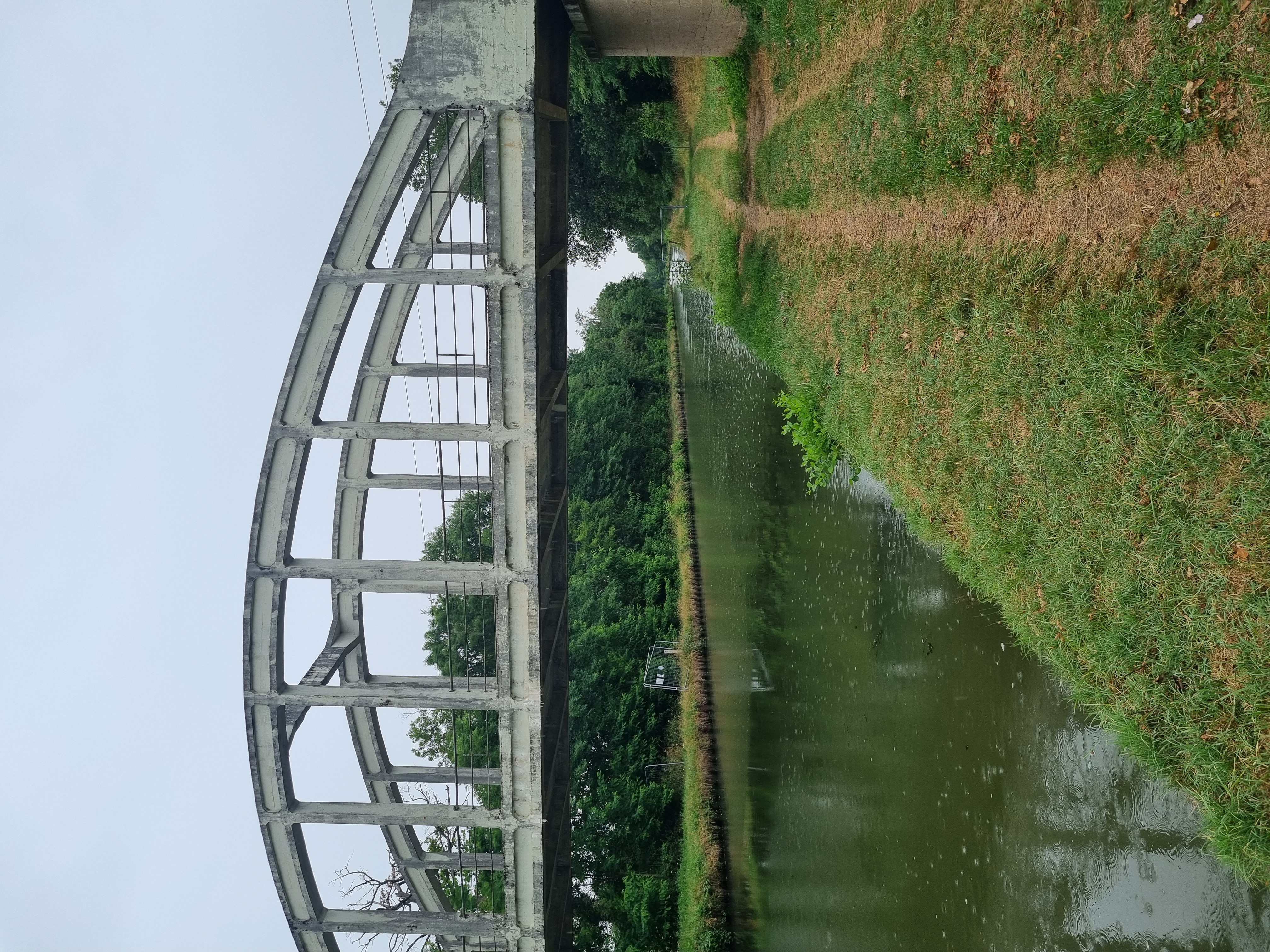
Canal du Centre
Interesujące miejsce po 13,6 km
Église Saint-Jean-Baptiste
Interesujące miejsce po 13,6 km
Bank
Interesujące miejsce po 13,7 km
Toilette
Interesujące miejsce po 17,2 km
Rastplätze
Interesujące miejsce po 17,2 km
Basilika Sacré-Coeur in Paray-le-Monial - Die Basilika von Paray-le-Monial, eine Kluniazenserstätte, ist eines der schönsten Beispiele für die romanische Kunst in Burgund. Sie gilt als "verkleinertes Modell" der Abtei von Cluny
Interesujące miejsce po 18,9 km
Bank
Interesujące miejsce po 20,4 km
Rastplätze und Bänke
Interesujące miejsce po 20,4 km
Park du Moulin Liron
Interesujące miejsce po 20,9 km
Toilette
Interesujące miejsce po 20,9 km
Bank
Interesujące miejsce po 21,6 km
Toilette
Zdjęcie po 21,7 km
Basilique du Sacré-Cœur (heiliges Herz) - spätromanische Basilika und ehemalige Prioratskirche - Sacré-Cœur wird von Kunsthistorikern als die bekannteste Cluny III- Nachfolgerin und als eine der berühmtesten Kirchen Burgunds eingestuft - Ihre Ähnlichkeiten zu Cluny III, aber in kleinerem Maßstab, führte häufig zu ihrem Beinamen „Klein-Cluny“ oder „Taschenausgabe“ von Cluny III
Interesujące miejsce po 21,7 km
Toilette
Interesujące miejsce po 21,7 km
Jardin Saint-Hugues
Zdjęcie po 21,8 km
Chapelle du monastère de la Visitation
Zdjęcie po 22 km
Chapelle Saint-Claude-la-Colombière - Es ist eine prächtige Kapelle mit wunderschönen Mosaiken und Buntglasfenstern
Interesujące miejsce po 22,3 km
Toilette
Zdjęcie po 22,3 km
Ancienne église paroissiale Saint-Nicolas - Tour Saint-Nicolas
Interesujące miejsce po 22,3 km
Bänke
Woda pitna po 22,4 km
Marie Blachère Boulangerie Sandwicherie Tarterie
Interesujące miejsce po 22,5 km
Bank
Interesujące miejsce po 22,5 km
Toilette
Interesujące miejsce po 22,5 km
Bänke
Interesujące miejsce po 23,3 km
Toiletten
Interesujące miejsce po 23,3 km
Bank
Serwis rowerowy po 23,4 km
Cycles Kaikinger
Serwis rowerowy po 23,6 km
JMV Cycles
Woda pitna po 24,4 km
La Panif'
Interesujące miejsce po 25,8 km
Zwischen "Canal du Centre" und "La Bourbince"
Interesujące miejsce po 33,2 km
Pont-Levis über den Arroux
Interesujące miejsce po 34,1 km
Rastplatz
Interesujące miejsce po 34,1 km
Stadt Digoin
Interesujące miejsce po 34,2 km
Bänke
Interesujące miejsce po 35,8 km
Toilette
Serwis rowerowy po 36,4 km
Cycles Dujardin
Interesujące miejsce po 36,6 km
Kanalbrücke von Digoin Hier überquert der "Canal du Centre" die "La Loire" und wird zum "Canal latéral à la Loire" - Der Loire-Seitenkanal ist 196 Kilometer lang und ermöglicht zusammen mit anderen Bauwerken die Verbindung von Rhône und Seine und damit vom Mittelmeer zum Atlantik. Dadurch sind die drei größten Flüsse Frankreichs miteinander verbunden.
Interesujące miejsce po 36,9 km
Bank
Interesujące miejsce po 45 km
Toilette
Interesujące miejsce po 45,1 km
Rastplätze und Bänke
Interesujące miejsce po 46,7 km
Rastplätze
Interesujące miejsce po 48,1 km
Rastplatz
Interesujące miejsce po 48,1 km
Toilette
Interesujące miejsce po 48,1 km
Rastplätze
Interesujące miejsce po 52,5 km
Rastplätze
Interesujące miejsce po 53 km
Strand am See Pierrefitte sur Loire
Interesujące miejsce po 59 km
Bei Diou verlassen wir den Loire-Seitenkanal und folgen jetzt der Loire
Interesujące miejsce po 60,2 km
Evtl. Badeplatz an der Loire
Interesujące miejsce po 60,6 km
Toilette
Interesujące miejsce po 60,6 km
Badeplatz am Port von Diou - Schöner Platz mit Schatten. Ausstiegsstelle für Kanus kann auch als Einstieg zum Baden genutzt werden. Strömung beachten!
Interesujące miejsce po 60,6 km
Evtl. Badeplatz (vielleicht auch gegenüber an der anderen Flußseite)
Interesujące miejsce po 60,6 km
Toilette
Interesujące miejsce po 60,6 km
Toilette
Interesujące miejsce po 60,6 km
Toilette
Interesujące miejsce po 60,6 km
Rastplatz
Interesujące miejsce po 62,2 km
Rastplatz / Unterschlupf
Interesujące miejsce po 64 km
Toilette mit Rastplatz
Zdjęcie po 64 km
Schloss Saint Aubin / Loire
Interesujące miejsce po 64,5 km
Schloss Saint Aubin / Loire
Interesujące miejsce po 66,7 km
Bank
Interesujące miejsce po 67,5 km
Bank
Interesujące miejsce po 68 km
Rastplatz
Interesujące miejsce po 69,4 km
Toilette
Interesujące miejsce po 69,5 km
Toilette
Interesujące miejsce po 69,8 km
Bank
Interesujące miejsce po 70 km
Bänke
Interesujące miejsce po 70,2 km
Bänke
Interesujące miejsce po 70,3 km
Toilette
Interesujące miejsce po 70,3 km
Bänke
Interesujące miejsce po 70,4 km
Plan d’eau du Breuil
Interesujące miejsce po 71,2 km
Toilette
Interesujące miejsce po 71,3 km
Parc Puzenat
Interesujące miejsce po 71,5 km
Toilette
Interesujące miejsce po 71,6 km
Château Puzenat
Interesujące miejsce po 71,7 km
Interesujące miejsce po 71,8 km
Bänke
Nocleg po 71,8 km
Hôtel La Tourelle du Beffroi
Interesujące miejsce po 71,8 km
Toilette
Serwis rowerowy po 71,8 km
Lancy’clette - Atelier d’insertion professionnelle
Kontynuuj z Bikemap
Użyj, edytuj lub pobierz tę trasę rowerową
Chcesz przejechać trasę FR2-01_Palinges_Bourbon-Lancy_72,5km 290hm lub dostosować ją do swojej wycieczki? Oto, co możesz zrobić z tą trasą na Bikemap:
Darmowe funkcje
- Zapisz tę trasę jako ulubioną lub w kolekcji
- Skopiuj i zaplanuj swoją wersję tej trasy
- Synchronizuj swoją trasę z Garminem lub Wahoo
Funkcje Premium
3 dni bezpłatnej wersji próbnej lub jednorazowa opłata. Dowiedz się więcej o Bikemap Premium.
- Nawiguj po tej trasie na iOS i Androidzie
- Eksportuj plik GPX / KML tej trasy
- Stwórz swój własny wydruk (wypróbuj za darmo)
- Pobierz tę trasę do nawigacji offline
Odkryj więcej funkcji Premium.
Uzyskaj Bikemap PremiumOd naszej społeczności
Palinges: Inne popularne trasy rozpoczynające się tutaj
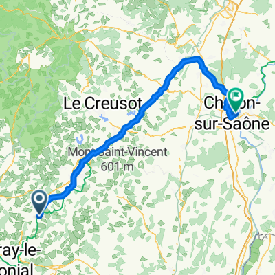
 Ziua a 5-a: Palinges - Chalon sur Saone
- Dystans
- 98,6 km
- Przewyższenia
- 421 m
- Spadek
- 505 m
- Lokalizacja
- Palinges, Burgundia-Franche-Comté, Francja
 10 Palinges to Chalon-sur-Saône 90
- Dystans
- 90 km
- Przewyższenia
- 201 m
- Spadek
- 298 m
- Lokalizacja
- Palinges, Burgundia-Franche-Comté, Francja
 Etappe 33: Pallinges - Crissey
- Dystans
- 99,6 km
- Przewyższenia
- 478 m
- Spadek
- 574 m
- Lokalizacja
- Palinges, Burgundia-Franche-Comté, Francja
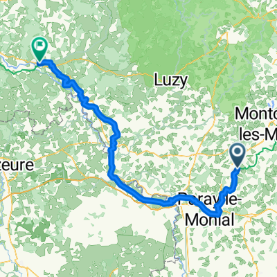
 20200724 Day 8a - Palinges à Vitry-en-Charollais
- Dystans
- 27,6 km
- Przewyższenia
- 217 m
- Spadek
- 246 m
- Lokalizacja
- Palinges, Burgundia-Franche-Comté, Francja
 palinges-camp du breuil bourbon lancy tandem 2017
- Dystans
- 61,9 km
- Przewyższenia
- 67 m
- Spadek
- 90 m
- Lokalizacja
- Palinges, Burgundia-Franche-Comté, Francja
 Palinges - Decize
- Dystans
- 112 km
- Przewyższenia
- 422 m
- Spadek
- 492 m
- Lokalizacja
- Palinges, Burgundia-Franche-Comté, Francja
 Rue des 2 Églises, Saint-Vincent-Bragny nach Avenue du Général de Gaulle, Digoin
- Dystans
- 14,3 km
- Przewyższenia
- 102 m
- Spadek
- 133 m
- Lokalizacja
- Palinges, Burgundia-Franche-Comté, Francja
 Route du plan d'eau to La Prise
- Dystans
- 99,9 km
- Przewyższenia
- 185 m
- Spadek
- 273 m
- Lokalizacja
- Palinges, Burgundia-Franche-Comté, Francja
Otwórz ją w aplikacji