- 64 km
- 717 m
- 717 m
- Elizabeth, State of South Australia, Australia
Star Cycles - Sandy Creek - hillier rd
Trasa rowerowa rozpoczynająca się w Elizabeth, State of South Australia, Australia.
Przegląd
O tej trasie
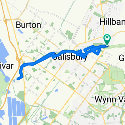
Opuszczając Star Cycles, kierujemy się na Peachey Rd i jedziemy w kierunku Petherton Rd, gdzie skręcamy w lewo. Skręcamy w prawo na Andrews Rd, którą jedziemy aż do Angle Vale Rd, gdzie skręcamy w prawo. To prowadzi nas do Gawler przez Jack Cooper Dr i Ryde St. Następnie na Murray St skręcamy w prawo na Lyndoch Rd i jedziemy szlakiem Doliny Barossy do Sandy Creek. Skręcamy w prawo przy hotelu, co prowadzi nas na Williamstown Rd, gdzie ponownie skręcamy w prawo na Davies Rd. W prawo na Balmoral Rd i jedziemy z powrotem na High St w Gawler, aby uniknąć ponownie Murray St. W prawo z High St w Ayers St, a następnie w lewo przez Dead Mans Pass do First Av, która prowadzi nas przez krótki odcinek Main North Rd. W prawo w Barnet Rd, gdzie zatrzymujemy się na przerwę w Sunrise Bakery lub Jaspers. Po kawie i napojach wracamy Barnet Rd, Para Rd, Farrow St i z powrotem na Jack Cooper Dr. W prawo na Hillier Rd do Wingate Rd, gdzie skręcamy w lewo, a potem w prawo na Angle Vale Rd do SOB. Podążamy SOB do Peterton Rd, którą potem wracamy do punktu startu.
- -:--
- Czas
- 59,8 km
- Dystans
- 196 m
- Przewyższenia
- 196 m
- Spadek
- ---
- Śr. Prędkość
- ---
- Maks. wysokość
utworzono 13 lat temu temu
Jakość trasy
Typy dróg i nawierzchnie na trasie
Typy dróg
Droga
18,5 km
(31 %)
Spokojna droga
13,7 km
(23 %)
Powierzchnie
Utwardzona
49,6 km
(83 %)
Asfalt
49,6 km
(83 %)
Niezdefiniowany
10,2 km
(17 %)
Najważniejsze punkty trasy
Punkty zainteresowania na trasie
Interesujące miejsce po 39,5 km
sunshine bakery
Kontynuuj z Bikemap
Użyj, edytuj lub pobierz tę trasę rowerową
Chcesz przejechać trasę Star Cycles - Sandy Creek - hillier rd lub dostosować ją do swojej wycieczki? Oto, co możesz zrobić z tą trasą na Bikemap:
Darmowe funkcje
- Zapisz tę trasę jako ulubioną lub w kolekcji
- Skopiuj i zaplanuj swoją wersję tej trasy
- Synchronizuj swoją trasę z Garminem lub Wahoo
Funkcje Premium
3 dni bezpłatnej wersji próbnej lub jednorazowa opłata. Dowiedz się więcej o Bikemap Premium.
- Nawiguj po tej trasie na iOS i Androidzie
- Eksportuj plik GPX / KML tej trasy
- Stwórz swój własny wydruk (wypróbuj za darmo)
- Pobierz tę trasę do nawigacji offline
Odkryj więcej funkcji Premium.
Uzyskaj Bikemap PremiumOd naszej społeczności
Elizabeth: Inne popularne trasy rozpoczynające się tutaj
- Star Cycles Inglewood-COP-Kersbrook
- Star Cycles - Sandy Creek - hillier rd
- 59,8 km
- 196 m
- 196 m
- Elizabeth, State of South Australia, Australia
- Steady ride in Salisbury Heights
- 31,8 km
- 117 m
- 117 m
- Elizabeth, State of South Australia, Australia
- Elizabeth - Nuriootpa
- 134,8 km
- 960 m
- 722 m
- Elizabeth, State of South Australia, Australia
- Angaston to Handorf
- 234,1 km
- 1334 m
- 1333 m
- Elizabeth, State of South Australia, Australia
- Yorktown Road 32, Elizabeth East to McCormack Crescent 50, Salisbury North
- 20,9 km
- 255 m
- 285 m
- Elizabeth, State of South Australia, Australia
- Easy ride in Hillbank quickie
- 5,2 km
- 52 m
- 52 m
- Elizabeth, State of South Australia, Australia
- Elizabeth East to Hilton South Australia
- 30,5 km
- 48 m
- 91 m
- Elizabeth, State of South Australia, Australia
Otwórz ją w aplikacji


