
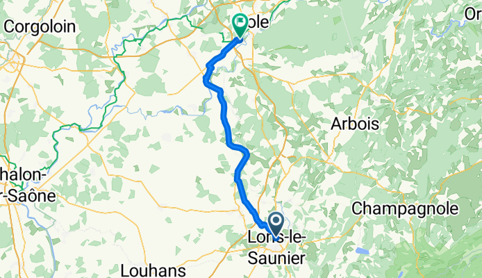
2009 Euro Tour -- Ride Day 11 — 4 July 2009 — 39000 Lons-le-Saunier to 39100 Choisey (Dôle)
Trasa rowerowa rozpoczynająca się w Lons-le-Saunier, Burgundia-Franche-Comté, Francja.
Przegląd
O tej trasie
Znaczna część dzisiejszej jazdy była płaska, a krajobrazy, a szczególnie wioski (np. Ruffeey), były bardzo piękne. Wszystkie drogi były doskonałe, z wyjątkiem dwóch „czerwonych” dróg, na których musieliśmy jechać przez krótki czas na początku i na końcu naszej jazdy. W tym nowym obszarze zobaczyliśmy kilka pięknych pól słoneczników i zwróciliśmy uwagę na różnice w architekturze kościołów. Wiele z nich miało wieże z geometrycznymi wzorami.Tło:Moja żona i ja organizujemy wycieczki w Europie Zachodniej (częściowo we Francji) od 1993 roku. Ta seria jazd obejmuje naszą 4,5-miesięczną trasę z 2009 roku przez części Francji, Niemiec, Austrii, Szwajcarii, a potem znów do Francji. Naszym punktem początkowym i końcowym jest obszar w pobliżu Chadurie (na południe od Angoulême), gdzie nasi przyjaciele mają farmę z Gites i Chambres d'Hotes.Jeździliśmy naszymi rowerami turystycznymi Dawes kupionymi w 1993 roku, mocno załadowanymi oponami 700Cx32. Cała nasza jazda odbywała się po asfaltowych drogach, przeważnie z bardzo małym ruchem. Właściwie jedynymi nieutwardzonymi odcinkami były kilka ścieżek rowerowych w Niemczech i Austrii. Niestety, nie było to tak wspaniałe, ponieważ Helen wielokrotnie upadła na nieutwardzonych ścieżkach. Na szczęście jednak nie było poważnych obrażeń.Jeśli masz jakieś pytania, nie wahaj się napisać do mnie na jeffkadet@netdiving.com.Jeff.
- -:--
- Czas
- 55 km
- Dystans
- 109 m
- Przewyższenia
- 196 m
- Spadek
- ---
- Śr. Prędkość
- ---
- Maks. wysokość

Jakość trasy
Typy dróg i nawierzchnie na trasie
Typy dróg
Droga
16 km
(29 %)
Droga leśna
8,8 km
(16 %)
Powierzchnie
Utwardzona
44,6 km
(81 %)
Nieutwardzona
2,8 km
(5 %)
Asfalt
44,6 km
(81 %)
Żwir
2,2 km
(4 %)
Kontynuuj z Bikemap
Użyj, edytuj lub pobierz tę trasę rowerową
Chcesz przejechać trasę 2009 Euro Tour -- Ride Day 11 — 4 July 2009 — 39000 Lons-le-Saunier to 39100 Choisey (Dôle) lub dostosować ją do swojej wycieczki? Oto, co możesz zrobić z tą trasą na Bikemap:
Darmowe funkcje
- Zapisz tę trasę jako ulubioną lub w kolekcji
- Skopiuj i zaplanuj swoją wersję tej trasy
- Synchronizuj swoją trasę z Garminem lub Wahoo
Funkcje Premium
3 dni bezpłatnej wersji próbnej lub jednorazowa opłata. Dowiedz się więcej o Bikemap Premium.
- Nawiguj po tej trasie na iOS i Androidzie
- Eksportuj plik GPX / KML tej trasy
- Stwórz swój własny wydruk (wypróbuj za darmo)
- Pobierz tę trasę do nawigacji offline
Odkryj więcej funkcji Premium.
Uzyskaj Bikemap PremiumOd naszej społeczności
Lons-le-Saunier: Inne popularne trasy rozpoczynające się tutaj
 Moiron-Chalain-Baumes
- Dystans
- 100,8 km
- Przewyższenia
- 1668 m
- Spadek
- 1668 m
- Lokalizacja
- Lons-le-Saunier, Burgundia-Franche-Comté, Francja
 Moiron - Bletterans
- Dystans
- 110,2 km
- Przewyższenia
- 1030 m
- Spadek
- 1028 m
- Lokalizacja
- Lons-le-Saunier, Burgundia-Franche-Comté, Francja
 rouler
- Dystans
- 26,9 km
- Przewyższenia
- 499 m
- Spadek
- 505 m
- Lokalizacja
- Lons-le-Saunier, Burgundia-Franche-Comté, Francja
 Lons - Chevillard en 2 jours (plus réaliste)
- Dystans
- 83,1 km
- Przewyższenia
- 1183 m
- Spadek
- 624 m
- Lokalizacja
- Lons-le-Saunier, Burgundia-Franche-Comté, Francja
 Lac d'Ilay & Cascades
- Dystans
- 92,1 km
- Przewyższenia
- 792 m
- Spadek
- 793 m
- Lokalizacja
- Lons-le-Saunier, Burgundia-Franche-Comté, Francja
 DUJURAAFREIBOURG
- Dystans
- 355,5 km
- Przewyższenia
- 2076 m
- Spadek
- 2082 m
- Lokalizacja
- Lons-le-Saunier, Burgundia-Franche-Comté, Francja
 One day ride
- Dystans
- 70,6 km
- Przewyższenia
- 243 m
- Spadek
- 273 m
- Lokalizacja
- Lons-le-Saunier, Burgundia-Franche-Comté, Francja
 2009 Euro Tour -- Ride Day 11 — 4 July 2009 — 39000 Lons-le-Saunier to 39100 Choisey (Dôle)
- Dystans
- 55 km
- Przewyższenia
- 109 m
- Spadek
- 196 m
- Lokalizacja
- Lons-le-Saunier, Burgundia-Franche-Comté, Francja
Otwórz ją w aplikacji