

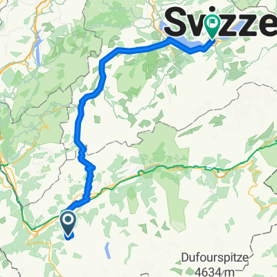
Aigle - Croix de Coeur
Trasa rowerowa rozpoczynająca się w Verbier, Valais, Szwajcaria.
Przegląd
O tej trasie
- -:--
- Czas
- 189,4 km
- Dystans
- 3932 m
- Przewyższenia
- 5451 m
- Spadek
- ---
- Śr. Prędkość
- ---
- Maks. wysokość

Najważniejsze punkty trasy
Punkty zainteresowania na trasie
Interesujące miejsce po 3 km
Croix de Coeur
Interesujące miejsce po 72,3 km
Col de Champex
Interesujące miejsce po 84,7 km
Col de la Forclaz
Interesujące miejsce po 126,9 km
Col de la Croix
Interesujące miejsce po 134,7 km
Col du Sanetsch
Interesujące miejsce po 151,3 km
Col des Mosses
Interesujące miejsce po 166,4 km
Col de Jaman
Interesujące miejsce po 172,7 km
Col de l`Aiguillon
Interesujące miejsce po 173,3 km
Mont Tendre
Interesujące miejsce po 173,3 km
Col du Marchairuz
Kontynuuj z Bikemap
Użyj, edytuj lub pobierz tę trasę rowerową
Chcesz przejechać trasę Aigle - Croix de Coeur lub dostosować ją do swojej wycieczki? Oto, co możesz zrobić z tą trasą na Bikemap:
Darmowe funkcje
- Zapisz tę trasę jako ulubioną lub w kolekcji
- Skopiuj i zaplanuj swoją wersję tej trasy
- Podziel trasę na etapy, aby utworzyć kilkudniową wycieczkę
- Synchronizuj swoją trasę z Garminem lub Wahoo
Funkcje Premium
3 dni bezpłatnej wersji próbnej lub jednorazowa opłata. Dowiedz się więcej o Bikemap Premium.
- Nawiguj po tej trasie na iOS i Androidzie
- Eksportuj plik GPX / KML tej trasy
- Stwórz swój własny wydruk (wypróbuj za darmo)
- Pobierz tę trasę do nawigacji offline
Odkryj więcej funkcji Premium.
Uzyskaj Bikemap PremiumOd naszej społeczności
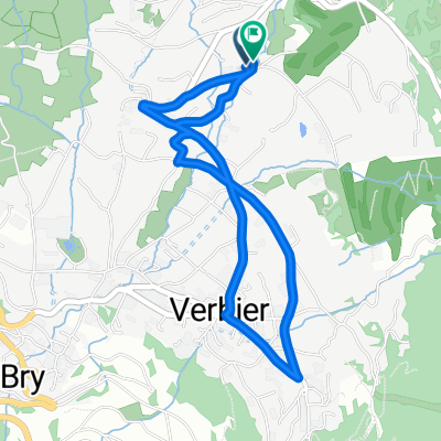
Verbier: Inne popularne trasy rozpoczynające się tutaj
 Aigle - Croix de Coeur
- Dystans
- 189,4 km
- Przewyższenia
- 3932 m
- Spadek
- 5451 m
- Lokalizacja
- Verbier, Valais, Szwajcaria
 De Rue de Ransou 72, Bagnes à Rue de Ransou 72, Bagnes
- Dystans
- 132 km
- Przewyższenia
- 2810 m
- Spadek
- 2812 m
- Lokalizacja
- Verbier, Valais, Szwajcaria
 Verbier -Megeve
- Dystans
- 105,1 km
- Przewyższenia
- 1843 m
- Spadek
- 2163 m
- Lokalizacja
- Verbier, Valais, Szwajcaria
 Verbier Early summer route
- Dystans
- 15,9 km
- Przewyższenia
- 945 m
- Spadek
- 945 m
- Lokalizacja
- Verbier, Valais, Szwajcaria
 V2V - D1
- Dystans
- 152,1 km
- Przewyższenia
- 2637 m
- Spadek
- 3557 m
- Lokalizacja
- Verbier, Valais, Szwajcaria
 Grand Raid Verbier - Grimentz 2009
- Dystans
- 114,4 km
- Przewyższenia
- 3947 m
- Spadek
- 3853 m
- Lokalizacja
- Verbier, Valais, Szwajcaria
 Verbier to the Chanrion Hut
- Dystans
- 73,4 km
- Przewyższenia
- 2319 m
- Spadek
- 2319 m
- Lokalizacja
- Verbier, Valais, Szwajcaria
 testrunde 2 Verbier
- Dystans
- 3,8 km
- Przewyższenia
- 123 m
- Spadek
- 120 m
- Lokalizacja
- Verbier, Valais, Szwajcaria
Otwórz ją w aplikacji